Bajaur District
Bajaur District (Pashto: باجوړ ولسوالۍ, Urdu: ضِلع باجوڑ) is a district in Malakand Division of Khyber Pakhtunkhwa province in Pakistan. Until 2018, it was an agency of the Federally Administered Tribal Areas, then during restructuring that merged FATA with Khyber Pakhtunkhwa, it became a district. According to the 2017 census, the population of the district is 1,093,684. It borders Afghanistan's Kunar Province with a 52 km border. The headquarters of the agency administration is located in the town of Khaar.[5]
Bajaur
باجوړ | |
|---|---|
District | |
 | |
 | |
| Coordinates: 34°41′N 71°30′E | |
| Country | |
| Province | |
| Administration HQ | Khaar |
| Government | |
| • DC | Muhamad Fayaz khan sherpou (DMG/PAS Officer) |
| • Assistant Commissioner | Fazal ur Rahim (PMS Officer) |
| • The Commandant Bajaur Scouts | Colonel Salman khalid |
| Area | |
| • Total | 1,290 km2 (500 sq mi) |
| Population (2017)[3] | |
| • Total | 1,093,684 |
| • Density | 850/km2 (2,200/sq mi) |
| Demonym(s) | Bajauri |
| Time zone | UTC+5 (PST) |
| • Summer (DST) | UTC+6 (PDT) |
| Main language | Pashto (99.5%)[4] |
| Number of Tehsils | 7 |
Geography
Bajaur is about 45 miles (72 km) long by 20 miles (32 km) broad. It lies at a high elevation to the east of the Kunar Valley of Afghanistan and Pakistan, from which it is separated by a continuous line of rugged frontier hills, forming a barrier that is easily passable at one or two points. The old road from Kabul to Pakistan ran through the barrier before the Khyber Pass was adopted as the main route. Nawagai is the chief town of Bajour; the Khan of Nawagai was previously under British protection for the purpose of safeguarding of the Chitral road.[6]
To the south of Bajaur District is the wild mountain district of the Mohmand District. To the east, beyond the Panjkora River, are the hills of Swat District, dominated by another Pashtun group. To the north is an intervening watershed between Bajaur and the small tehsil of Dir. It is over this watershed and through the valley of Dir, that the new road from Malakand and the Punjab runs to Chitral.
An interesting feature in the topography is a mountain spur from the Kunar range.
The drainage of Bajaur flows eastwards, starting from the eastern slopes of the dividing ridge, which overlooks the Kunar and terminating in the Panjkora river, so that the district lies on a slope tilting gradually downwards from the Kunar ridge to the Panjkora.
Jandol, one of the northern valleys of Bajour, has ceased to be of political importance since the 19th century, when a previous chief, Umra Khan, failed to appropriate himself Bajour, Dir and a great part of the Kunar valley. It was the active hostility between the amir of Kabul (who claimed sovereignty of the same districts) and Umra Khan that led, firstly to the demarcation agreement of 1893 which fixed the boundary of Afghanistan in Kunar; and, secondly, to the invasion of Chitral by Umra Khan (who was no party to the boundary settlement), and the siege of the Chitral fort in 1895.[6]
Subdivision
Bajaur district is currently subdivided into seven Tehsils or Sub-divisions[7]
2. Barang
3. Khar
4. Mamund
5. Nawagai
6. Salarzai
7. Utmankhel
Tribes
Bajaur is inhabited almost exclusively by Tarkani (Tarkalani) Pashtuns, and there are their main sub-tribes in Bajaur: Utmankhel, Tarkalanri (Mamund, Kakazai, Wur and Salarzai) as well as a small population of Safis. The Utmankhel are at the southeast of Bajaur, while Mamund are at the southwest, and the Tarkani are at the north of Bajaur. Its border with Afghanistan's Kunar province makes it of strategic importance to Pakistan and the region. Gujar are also present.
History
Ancient history
The area was the site of the ancient Scythian kingdom of Apraca from the 1st century BCE to the 1st century CE, and a stronghold of the Aspasioi, a western branch of the Ashvakas (q.v) of the Sanskrit texts who had earlier offered stubborn resistance to the Macedonian invader Alexander the Great in 326 BCE. The whole region came under Kushan control after the conquests of Kujula Kadphises during the first century CE.[8][9]
Alexander the Great
Alexander turned south from Aornus and continued march towards the Indus, but the greatest surprise during the march came when he neared the town of Nysa (former name of Bajaur). The local people and even the flora seemed strangely out of place in these mountains. The Nysains placed their dead in cedar coffin in the trees - some of which Alexander accidentally set on fire - and made wine from grapes, unlike other tribes in the area.[10] The Acuphis, the chief man of the city, who has been sent to them along with other thirty leaders, begged him not to harm their towns as they were descendants of settlers that the god Dionysus placed their generation before. Their prolific ivy, a plant sacred to Dionysus that nowhere else in the mountain, was proof they were the people blessed by god. Then they were only commanded to give him 300 cavalry, after which he restored their freedom and allow them to live under their own laws, having made acuphis governor of the city. Alexander took his son and grandson as hostages. He sacrificed there to Bacchus under this god’s others name of Dionysus.[11]
Bajaur casket
The Bajaur casket, also called the Indravarma reliquary, year 63, or sometimes referred to as the Avaca inscription, is an ancient reliquary from the area of Bajaur in ancient Gandhara, in the present-day Federally Administered Tribal Areas of Pakistan. It is dated to around 5-6 CE. It proves the involvement of the Scythian kings of the Apraca, in particular King Indravarman, in Buddhism. The casket is made of schist.
Babur's attack on Bajaur
In 1518, Babur had invested and conquered the fortress of Bajaur, The Gabar-Kot from Sultan Mir Haider Ali Gabari the Jahangirian Sultan and gone on to conquer Bhera on the river Jhelum, a little beyond the salt ranges. Babur claimed these areas as his own, because they had been part of Taimur's empire. Hence, "picturing as our own the countries once occupied by the Turks",[12] he ordered that "there was to be no overrunning or plundering [of the countryside]".[12] It may be noted that this applied to areas which did not offer resistance, because earlier, at Bajaur, where the Pashtun tribesmen had resisted, he had ordered a general massacare, with their women and children being made captive.[12]
Babur justifies this massacre by saying, "the Bajauris were rebels and at enmity with the people of Islam, and as, by heathenish and hostile customs prevailing in their midst, the very name of Islam was rooted out...".[13]
As the Bajauris were rebels and inimical to the people of Islam, the men were subjected to a general massacre and their wives and children were made captive. At a guess, more than 3,000 men met their death. We entered the fort and inspected it. On the walls, in houses, streets and alleys, the dead lay, in what numbers! Those walking around had to jump over the corpses.[14][lower-alpha 1]
Recent decades
During the Soviet invasion in the 1980s, the area was a critical staging ground for Afghan and local mujahideen to organise and conduct raids. It still hosts a large population of Afghan refugees sympathetic to Gulbuddin Hekmatyar, a mujahideen leader ideologically close to the Arab militants. Today, the United States believes militants based in Bajaur launch frequent attacks on American and Afghan troops in Afghanistan.}
In 2001 to 2007, a person named Marvan was in a truck (Datsun), in Loi sum checkpoint, they inquired of him that who is he? On that, he jumped from the truck, run away and started firing. The militants were trying to capture him, after 5–6 miles running, firing, they encountered him. Local people were saying that a great Mujahid was martyred, fragrant smell was coming from his blood. After his death, a breakout of Talibanization occurred. then the government were shifted from military to Taliban in this area. this change was slowly and gradually, Taliban target the checkpoints, firstly from peripheral areas and then in central areas. Then they targeted the schools, government servants, retired soldiers, all those people who had some relation with government. They made their own rules, Like no one will shave, wearing caps etc. An aerial attack, executed by the United States targeting Ayman al-Zawahiri, took place in a village in Bajaur Agency on January 13, 2006, killing 18 people.[15] Al-Zawahiri was not found among the dead and the incident led to severe outrage in the area. On October 30, 2006, 80 people were killed in Bajaur when Pakistani forces attacked a religious school they said was being used as a militant training camp.[16] There are many unconfirmed reports that the October attack was also carried out by the United States or NATO forces, but was claimed by Islamabad over fears of widespread protest similar to those after the US bombing in January 2006.[17] Maulana Liaqat, the head of the seminary, was killed in the attack. Liaqat was a senior leader of the pro-Taliban movement Tanzim Nifaz Shariat Mohammadi (TNSM), that spearheaded a violent Islamic movement in Bajaur and the neighbouring Malakand areas in 1994. The TNSM had led some 5,000 men from the Pakistani areas of Dir, Swat and Bajaur across the Mamond border into Afghanistan in October 2001, to fight US-led troops. In what is thought to be a reprisal for the October strike in Bajaur, in November, a suicide bomber killed dozens in an attack on an army training school in Khyber-Pakhtunkhwa.[18]
Loi sum is on a strategic location, road come from four sides, (khar, Nawagi, Tangai and Inzari), so approach was easy from Charmang and Ambar. That was the reason that this area was affected mostly. A military offensive by the military of Pakistan (FC and Leaves) was launched in early 8 August 2008 to retake the border crossing near the town of Loi-Sum, 12 km from khar[19] from militants loyal to Tehrik-e-Taliban, the so-called Pakistani Taliban.[20] In the two weeks following the initial battle, government forces pulled back to Khar and initiated aerial bombing and artillery barrages on presumed militant positions, which reportedly has all but depopulated Bajaur and parts of neighbouring Mohmand Agency, with an estimated 300,000 fleeing their homes.[20] The estimate of casualties ran into the hundreds.[20] The offensive was launched in the wake of Prime Minister Yousuf Raza Gilani's visit to Washington in late July, and is believed by some to be in response to U.S. demands that Pakistan prevent the FATA being used as a safe haven by insurgents fighting American and NATO troops in Afghanistan.[20] However, the offensive was decided by the military, not the civilian government.[21] The bloody bombing of Pakistan Ordnance Factories in Wah on August 21, 2008, came according to Maulvi Omar, a spokesman for the Pakistani Taliban, as a response to the Bajaur offensive.[22][23] after a few weeks, the Pak army came to battlefield. In an initial way toward the Loi sum Taliban did not resist and let them to come to middle position, when they reach to Rashakai, (3–4 km from Loi sum) Talaiban started to attack them but the Army was far stronger than their expectation. For several weeks they stayed in Rashakai, then 1st attempt Army come to loi sum, stay for whole day and come back to Rashakai, In 2nd attempt was the same, and 3rd attempt they come to loi sum and took the control of the area. Army continues there journey, control the main road of Bajaur from Khar to Nawagi, and the peripheral areas were still in the hold of Taliban. After nine months of vigorous clashes between government security forces and Taliban, military forces have finally claimed to have forced militants out of Bajaur Agency, and advanced towards strongholds of Taliban in the region. According to figures provided by the Government of Pakistan, 1,600 militants were killed and more than 2,000 injured, while some 150 civilians also died and about 2,000 were injured in the fighting. The military operation forced more than 300,000 people to flee their homes and take shelter in IDP camps in settled districts of the province. To date, more than 180,000 IDPs have returned to their homes in Bajaur Agency, facing widespread destruction to their lives, livelihoods and massive unemployment.
Now there were main issues to peripheral area, this situation occurred especially in Inzari and Ghwandu. In the middle of Loi sum and Inzari a checkpoint was made in KhatiKhwar, which was exposed from every side, and easily approachable because from every side there's a great (Kayia). There was not a single day they were not attached, but the checkpoint was made in best way, according to captains, “we made this checkpoint in a way that even a super power country can’t push us backward from this point”
In August, 2012, the Pakistani Army de-notified Bajaur as conflict zone.[24]
Education
In Bajaur total no of school registered with Malakand board are 106.[25] 55 out 106 are privet. The number of government colleges are only 5.
| Title | Total Numbers | Boys/Girls | Gov/Private |
| Schools | 106 | 94/12 | 51/55 |
| Colleges | 9 | 8/1 | 5/4 |
Education Rank
In district school education rank of Pakistan, the position of is going downward, according to the Alif Ailaan ranking, the rank of Bajaur in 2014,[26] 2015[27] and 2016[28] is the following
| Rank/Position | District/Agency | Province/Territory | Education Score | Enrolment score | Learning score | Retention score | Gender Parity score |
| 47(2014) | Bajaur | Khyber Pakhtunkhwa | 74.10 | 75.00 | 94.77 | 80.57 | 46.08 |
| 99(2015) | Bajaur | Khyber Pakhtunkhwa | 57.43 | 59.59 | 34.32 | 63.25 | 72.56 |
| 131(2016) | Bajaur | Khyber Pakhtunkhwa | 42.42 | 52.80 | 36.57 | 20.00 | 60.32 |
Tourism
Bajaur is located near swat and District Dir, so the climates of these districts are comparatively same.
Koh-i-Mor
Koh-i-Mor is the highest peak in Bajaur. It is also called three peak mountain. Its top is covered with white sheet of snow about 5–7 months of the year and clouds touching its head. The peak of Koh-i-Mor is visible from the Peshawar valley when there is no clouds.
It was here, at the foot of the mountain, that Alexander the Great founded the ancient city of Nysa and the Nysaean colony, traditionally said to have been founded by Dionysus. The Koh-i-Mor has been identified as the Meros of Arrian's history—the three-peaked mountain from which the god issued
You can climb to top by three ways; 1. Khar side 2. Barang side 3. Ambar side. On each way there is roads to less than midpoint.
On Khar Side; It is situated in North Khar about 17 km on road drive. 7 km to base and 10 km base to Tower (TV tower is present) Trekking From the tower to peak of khoh-i-mor is about 6 to 7 km trekking of about 5–6 hrs, the way is tough and narrow, but the scenery is changing after half a mile, 1st the track is less steep and slowly the steepness increases as you go up then there is a broad head about a mile, here Muddy lake made by locals for storage of rain water, and again the steepest like bottleneck and then the summit point.
People are living in koh-i-mor up-to the bottleneck. These people have simple houses with only a single room, there is no extra boundary wall. Rooms are made like caves in mountain. Majority of them are formers and shepherds.
Chenarran (platane Orientalis)
At the base of Koh-i-Mor a lot of chenar trees along with spring. Locals people are coming here and enjoy the nature, making their own cooking, some have load speakers, music, etc. majority people come along with their families.
Gabar Chenna
It is situated in Tehsil Salarzai, it has snowy water, people are come from all over the Bajaur and DIR to enjoy it especially in Ramadan and Eids. It is a historically spring, once here was a undefeated king ....
Charmang Hill
Like koh-i-Mor the charmang hills are reach of forest and beauty. The hole area is cover with Pines tree the views are awesome.4 –6 months it is covered with white sheet of snow.
Economy
Agriculture
Bajaur is a semi-independent in agriculture field, The soil is fertile but the no proper irrigation system. Harvest Crops; People grow wheat, maze and rices in some areas. All the crops is mainly dependent on rain. Vegetable and Fruits; The different types of vegetables are growing in Bajaur. Potato, tomato, onion, lady fingers, spinach, and orange parsimon, etc
Marble
Marbles are found in various regions, mainly in Inzari and Nawagai. There are different types of marble supper white, Badle etc. In the local areas are marble factories, cut to into different sizes of the base of demand, and supply to all over the country and even abroad.
Marble factory
The marble cutting factories are found in Shaikh kali and Umary. The supply to the factories of marble mainly from the local mountains and they also bring the marble from ambar and Zairat. These different types and variety of marble then supply all over the country
Nephrite
Nephrite (jade) is the precious stone, Rs 3000–5000 per kg. The mines are found in Inzari and some area in Utmankhail tehsil. It exports mainly to China, The Chinese thought so too, and for thousands of years, nephrite articles had a special value and signature and skilled artisans carved increasingly intricate designs. Maybe because it was so rare in China, yet useful for its toughness, nephrite became the status symbol of the rulers, considered imperial stone.
Olive And Olive Oil
The KPK government has started olive production projects in the Bajaur district. Previously, many wild olive trees are present in the area having no such importance. They use agricultural techniques to convert these wild trees into more farmer friendly and productive plants. With new projects of planting olive trees on more than 150000 acres of land, the Bajaur district will be the olive hub of Pakistan. Moreover, the district administration has installed olive oil extraction machine for locals. this machine started producing olive oil this year. More than 200 kg of oil has been extracted which is just a beginning. In coming years you will see huge transformation. These projects will change the fate and economical status of the district. The locals will have more new employment opportunities cause reduction in unemployment in the tribal area.
See also
- Bajaur Campaign
- Damadola airstrike of January 13, 2006
- Chenagai airstrike of October 30, 2006
- Bajaur offensive
- Kakazai
- Salarzai
Notes
- Thomas Holdich writing in 1911 in Encyclopædia Britannica (11th ed.) stated that "The Gazetteers and Reports of the Indian government contain nearly all the modern information available about Bajour. The autobiography of Baber (by Leyden and Erskine) gives interesting details about the country in the 16th century. For the connexion between the Kafirs and the ancient Nysaeans of Swat, see R. G. S. Journal, vol. vii., 1896" (Holdich 1911).
- Khan, Masood (2007-08-07). "Taliban-jirga talks fail in Bajaur Agency". Daily Times. Lahore, Pakistan. Retrieved 2008-09-01.
- Historical and administrative profile of the Bajaur Agency (.fata.gov.pk)
- "DISTRICT AND TEHSIL LEVEL POPULATION SUMMARY WITH REGION BREAKUP [PDF]" (PDF). www.pbscensus.gov.pk. 2018-01-03. Archived from the original (PDF) on 2018-03-26. Retrieved 2018-03-25.
- PCO 1998, p. 18.
- "Bajaur". www.globalsecurity.org. Retrieved 2020-09-22.
- Holdich 1911.
- (PDF). 2018-03-26 https://web.archive.org/web/20180326141456/http://www.pbscensus.gov.pk/sites/default/files/bwpsr/fata/BAJAUR_SUMMARY.pdf. Archived from the original (PDF) on 2018-03-26. Retrieved 2020-10-15. Missing or empty
|title=(help) - Hill, John E. (2015-03-18). "Appendix G". Through the Jade Gate - China to Rome'. II (2nd ed.). pp. 65–75.
- Yu, Taishan (1998). A Study of Saka History. Sino-Platonic Papers No. 80. Philadelphia, PA, USA: Dept. of Asian and Middle Eastern Studies, University of Pennsylvania. p. 160.
- Romm, James S.; Mensch, Pamela (2005-03-11). Alexander The Great: Selections from Arrian, Diodorus, Plutarch, and Quintus Curtius. Hackett Publishing. ISBN 978-1-60384-333-1.
- Ussher, James (2003-10-01). The Annals of the World. New Leaf Publishing Group. ISBN 978-1-61458-255-7.
- Chandra, p. 22.
- Chandra, p. 23.
- Babur, p. 207.
- "Pakistani elders killed in blast". BBC News. London, UK. 2007-02-05.
- Khan, M. Ilyas (2006-10-30). "'Shock and awe' on Afghan border". BBC News. London, UK.
- "Pakistan's Tribal Areas". New York, NY, USA: Council on Foreign Relations. 2007-10-26. Archived from the original on 2009-05-30. Retrieved 2018-04-09.
- "Suicide bomber attacks policemen". BBC News. London, UK. 2006-11-17.
- Khan, Hasbanullah (AFP) (August 8, 2008). "Bajaur battle kills 10 troops, 25 militants". Daily Times. Lahore, Pakistan. Archived from the original on 2008-10-07. Retrieved 2008-08-24.
- Cogan, James (August 23, 2008). "Military offensive displaces 300,000 in north-west Pakistan". Oak Park, MI, USA: World Socialist Web Site. Retrieved 2008-08-24.
- Sappenfield, Mark (2008-09-24). "U.S. and Pakistan: different wars on terror". The Christian Science Monitor. Boston, MA, USA.
- Anthony, Augustine (2008-08-21). "Blasts near Pakistan arms plant kill 59". London, UK: Reuters. Retrieved 2008-08-21.
- "Pakistan: 100 die in 'Taliban' suicide bombings". CNN International. 2008-08-21. Retrieved 2008-08-21.
- Ali, Zulfiqar (2012-08-06). "South Waziristan operation: Only Sararogha cleared in three years". Dawn. Karachi, Pakistan: Pakistan Herald Publications.
- https://bisemalakand.edu.pk/institution-corner/institution-corner. Missing or empty
|title=(help) - (PDF) http://aserpakistan.org/document/learning_resources/2015/Alif_Ailaan_District_Ranking_Report/DIstrict_Ranking_Report_2015.pdf. Missing or empty
|title=(help) - (PDF) http://aserpakistan.org/document/learning_resources/2014/Alif%20Ailaan%20District%20Ranking%20Report/AlifAilaan%20District%20Education%20Ranking%202014%20-%20Draft%20Report.pdf. Missing or empty
|title=(help) - (PDF) https://d3n8a8pro7vhmx.cloudfront.net/alifailaan/pages/537/attachments/original/1474368820/Pakistan_District_Education_Rankings_2016_Full_Report.pdf?1474368820. Missing or empty
|title=(help)
References
- Babur, Zahir Uddin Muhammad, Babur-Nama: Journal of Emperor Babur, Penguin
- Chandra, Satish, Medieval India (Part two), pp. 22–23
- Profiles of Pakistan's Seven Tribal Agencies
- 1998 Census report of Bajaur Agency. Census publication. 137. Islamabad: Population Census Organization, Statistics Division, Government of Pakistan. 2001.
- Attribution
 This article incorporates text from a publication now in the public domain: Holdich, Thomas Hungerford (1911). "Bajour". In Chisholm, Hugh (ed.). Encyclopædia Britannica. 3 (11th ed.). Cambridge University Press. p. 226.
Provincial capital: Peshawar | ||
| Divisions | Districts | 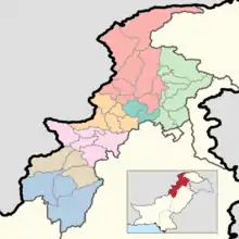 |
| Bannu | ||
| Dera Ismail Khan | ||
| Hazara | ||
| Kohat | ||
| Malakand | ||
| Mardan | ||
| Peshawar | ||