Jhelum
Jhelum /ˈdʒeɪləm/ (Urdu: جِہلم, Punjabi: جہلم) is a city on the right bank of the Jhelum River, in the district of Jhelum in the north of Punjab province, Pakistan. It is the 44th largest city of Pakistan by population. Jhelum is known for providing many soldiers to the British Army before independence,[4] and later to the Pakistan armed forces – due to which it is also known as City of Soldiers or Land of Martyrs and Warriors.[5][6]
Jhelum
جِہلم | |
|---|---|
City | |
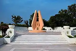    Clockwise from top: Major Akram Shaheed Memorial, Tareekh-e-Jhelum book cover, Cantonment Square, CMH Mosque and Zamir Jaffri Cricket Stadium | |
| Nickname(s): | |
 Map of Jhelum City | |
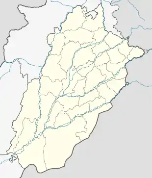 Jhelum Location within Pakistan  Jhelum Jhelum (Pakistan) | |
| Coordinates: 32°56′33″N 73°43′32″E[1] | |
| Country | |
| Province | |
| Division | Rawalpindi |
| District | Jhelum |
| Union Councils | 7 |
| Government | |
| • Chairman MC | Khan Sher Bahadur Kaira (PMLN) |
| Area | |
| • City | 22.5 km2 (8.7 sq mi) |
| Elevation | 233 m (768 ft) |
| Population | |
| • City | 190,425 |
| • Rank | 44th, Pakistan |
| • Density | 8,500/km2 (22,000/sq mi) |
| • Demonym | Jhelumi |
| Languages | |
| • Official | Punjabi, Urdu |
| Time zone | UTC+5 (PKT) |
| Postal code | 49600 |
| Dialling code | 0544 |
Jhelum is a few miles upstream from the site of the ancient Battle of the Hydaspes between the armies of Alexander and King Porus. A city called Bucephala was founded nearby to commemorate the death of Alexander's horse, Bucephalus. Other notable sites nearby include the 16th-century Rohtas Fort, the Tilla Jogian complex of ancient temples, and the 16th-century Grand Trunk Road which passes through the city. According to the 2017 census of Pakistan, the population of Jhelum was 190,425.[3] The name of the city is derived from the words Jal (pure water) and Ham (snow), as the water that flows through the river originates in the Himalayas.[7] There are a number of industries in and around Jhelum city, including a tobacco factory, wood, marble, glass and flour mills.[8]
Etymology
Anjum Sultan Shahbaz recorded some stories of the name Jhelum in his book Tareekh-e-Jhelum as:[9]
Many writers have different opinions about the name of Jhelum. One suggestion is that in ancient days Jhelumabad was known as Jalham. The word Jhelum is reportedly derived from the words Jal (pure water) and Ham (snow). The name thus refers to the waters of a river (flowing besides the city) which have their origins in the snow-capped Himalayas.[10]
However, some writers believe that when "Dara-e-Azam" reached a certain place on the river bank after winning many battles, he fixed his flag at that place and called it "Ja-e-Alam" which means "Place of the Flag". With the passage of time it became Jhelum from "Ja-e-Alam".
According to tradition, Saeed Bin Abi Waqas, brother of Saad Bin Abi Waqas, was sent to China to preach Islam, during his journey he arrived at the city of Jhelum, he saw the reflection of a city in the river and said "هذا جهيلم" (this is Jheelum), which means "City besides the river, in full moonlight".
Ahmed Shah Abdali also used "Jheelum" in place of Jhelum and "Harian" for Kharian in his diary.
History
Ancient
The Rajput, Gujjars, Jats and Ahirs,[11][12][13] who now hold the Salt Range and its northern plateau respectively, appear to have been the earliest inhabitants of Jhelum.[14] The next major point in the history of the district was the Battle of the Hydaspes between Alexander and the local ruler, . Abisares (or Abhisara;[15] in Greek Αβισαρης), called Embisarus (Eμ Oβισαρoς) by Diodorus,[16] was an Indian people king of abhira[17] descent beyond the river Hydaspes, whose territory lay in the mountains, sent embassies to Alexander both before and after the conquest of Porus in 326 BC, although inclined to espouse the side of the latter. Alexander not only allowed him to retain his kingdom, but increased it, and on his death appointed his son as his successor. The Gakhars appear to represent an early wave of conquerors from the west, and who still inhabit a large tract in the mountain north to tilla range. Gakhars were the dominant race during the early Muslim era and they long continued to retain their independence, both in Jhelum itself and in the neighbouring district of Rawalpindi.[14]
Medieval
In 997 CE, Sultan Mahmud Ghaznavi, took over the Ghaznavid dynasty empire established by his father, Sultan Sebuktegin. In 1005 he conquered the Shahis in Kabul and followed it by the conquests of Punjab region including Jhelum. The Delhi Sultanate and later Mughal Empire ruled the region. The Punjab region became predominantly Muslim due to missionary Sufi saints whose dargahs dot the landscape of Punjab region.
The Mughals were Persianized Turks who claimed descent from both Timur and Genghis Khan and strengthened the Persianate culture of Muslim India. Being very few in number,main families of Mughal Barlas, the descent of Ameer-i- Taimoor settled in Mong Rasool and afterward scattered to village chak Nazar, Shamaspur, Aima Afghana, khardiyala, Chak sikander, Malhar Muglain, Mota Garbi, Bimber, they adopted a policy of converting the local jats and Gakhars mandatory as recorded in the Baburnama.[18] Thus it is credited to the Mughals, who were largely responsible for the conversion of the jatts to Islam.[19]
With the collapse of the Mughal Empire after the death of Aurangzeb, the Durrani empire had occupied the plains but were quickly ousted by the Sikhs.
Later periods
After the decline of the Mughal Empire, the Sikh invaded and occupied Jhelum District. In 1849 Jhelum passed with the rest of the Sikh territories to the British. In 1857 the 14th Native Infantry stationed at Jhelum town mutinied, and displayed a vigorous defence against a force sent from Rawalpindi to disarm them, but decamped for the night following the action, with the main body being subsequently arrested by the Kashmiri authorities, into whose territory they had escaped.
British Raj
During British rule, Jhelum was connected by the North-Western Railway to other cities in the Indian Empire, 1,367 miles from Calcutta, 1,413 from Bombay, and 849 from Karachi. The population according to the 1901 census of India was 14,951.[20]
According to the Imperial Gazetteer of India:
The present town is of modern origin, the old town, which may have been the Bucephala of Alexander having been, on the left or opposite bank of the river. Under Sikh rule the place was quite unimportant, being mainly occupied by a settlement of boatmen, and at the time of annexation contained about 500 houses. It was then chosen as the site of a cantonment and as the headquarters of the civil administration. For some years it was the seat of the Commissioner of the Division, but in 1859 his headquarters were transferred to Rawalpindi. Under British rule, Jhelum has steadily advanced in prosperity; and is the entrepôt for most of the trade of the District, though, since the completion of the Sind-Sāgar branch of the North-Western Railway; the salt trade no longer passes through it. It is an important timber dépôt, the timber from the Kashmir forests which is floated down the river being collected here. A good deal of boat-building is carried on. The cantonment, which is 3 miles from the civil station, contains the church and post office. The normal strength of the garrison is one Native cavalry and four Native infantry regiments. The municipality was founded in 1867. During the ten years ending 1902–3 the receipts averaged Rs. 32,100, and the expenditure Rs, 31,900. Receipts and expenditure from cantonment funds in the same period averaged Rs. 31,900 and Rs. 6,100 respectively. The chief income of the municipality in 1903-4 was Rs. 34,200 chiefly from octroi; and the expenditure was Rs. 41,000. The town has two Anglo vernacular schools, a municipal high school, and a middle school maintained by the American Presbyterian Mission. Besides the civil hospital, the mission also maintains a hospital.[20]
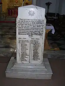
During the Mutiny of 1857, 35 British soldiers of the Regular 24th Regiment of Foot were killed at the Battle of Jhelum by mutineers from the Honourable East India Companies 14th Bengal Native Infantry (roughly 500 of the soldiers mutinied with roughly 100 of the Sikh soldiers remaining loyal). Among the dead was Captain Francis Spring, the eldest son of Colonel William Spring.[21] A lectern inside St. John's Church Jhelum shows the names of those 35 soldiers. St. John's Church is located in the Jhelum Cantonment, Pakistan beside the river Jhelum. It was built in 1860 and remains a landmark in the city. It was built as a Protestant church, and was in use throughout the British period. For the past forty years it has been closed to the public and in poor condition, however it has since been renovated and reopened and is now maintained.
The British soldier William Connolly won a Victoria Cross for his bravery during this battle. Mirza Dildar Baig, also known as Khaki Shah, took part in the mutiny at Jhelum and was later celebrated by Indian Nationalists. He was captured and arrested with the remaining mutineers by authorities in Kashmir and later hanged near the river Jhelum. His grave is in a shrine in Jhelum Dildarnagar, and a small town in Uttar Pradesh is also named after him.
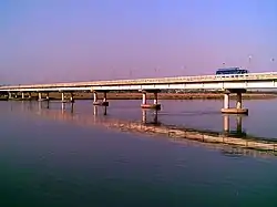
The railway bridge on the river Jhelum was built in 1873 by the British engineer William St. John Galwey. He also made the great Empress Bridge over the river Sutlej.
Independence
The predominantly Muslim population supported Muslim League and Pakistan Movement. After the independence of Pakistan in 1947, the minority Hindus and Sikhs migrated to India while Muslim refugees from India settled down in the Jhelum District.
Administration
As well as being district capital, Jhelum city is also the headquarters of Jhelum Tehsil, the city of Jhelum is administratively subdivided into seven union councils:[22] Jhelum-I, Jhelum-II, Jhelum-III, Jhelum-IV, Jhelum-V, Jhelum-VI and Jhelum-VII.
Demography
| Jhelum city population | |||
|---|---|---|---|
| Census | Pop. | %± | |
| 1961 | 52,685 | ||
| 1972 | 70,157 | 33.2% | |
| 1981 | 106,462 | 51.7% | |
| 1998 | 145,847 | 37.0% | |
| Est. 2009 | 188,803 | ||
| Source:[23] | |||
The population of the Jhelum city is about 188,800 (2012)[24] and it is the 32nd largest city of Pakistan with respect to population. Total area of city is about 22 km2 (8.5 sq mi). Population density is 261/km. Population growth rate is 1.51[25] which is very low as compared to other urban areas of Pakistan. The majority of the population i.e. 98.47 percent is Muslim. Among the minorities Christians are in the majority sharing 1.36 percent in the district.
The Gakhars, Janjua, Gujjars, Panhwar, Arain, Mughals, Gondals, Awan, Syed, Jat, Kashmiri, Kayani and Khokhar are among the tribes residing here.
The literacy rate of Jhelum is among the highest in Pakistan. At 79%, it is only lower than that of Islamabad and neighbouring Rawalpindi.[26] Somewhat higher than the literacy in Punjab province (58 percent).[26] The literacy rate has remarkably increased from 38.9 percent in 1981. The rate is much higher in the urban areas for both males and females. 84% of the population have electricity and 96% have access to water.[27] Human Development Index of Jhelum is 0.770, which is highest in Pakistan after Karachi.
City
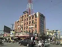
During the past few years, the city has experienced rapid expansion and it has now become a vibrant economic and cultural center. The old city has narrow streets and crowded bazaars.
The main market area of Jhelum is centred around Shandar Chowk, GTS Chowk, and Muhammadi Chowk, and includes Main Bazaar, Naya Bazaar, Raja Bazaar, Kinari Bazaar, Sarafa Bazaar, Chowk-Ehl-e-Hadith and Soldier Arcade. Some of the main roads of Jhelum City are Civil Line, Railway Road, Old GT Road, Kucheri Road, Iqbal Road and Rohtas Road. A cantonment was built during the British rule, which has now been upgraded into a strong garrison, with an infantry division commanded by a major general.
Geography and climate
Lying at 32°56′ North latitude and 73°44′ East longitude, Jhelum is located a 1-hour and 30 minutes drive from the Capital of Pakistan Islamabad, and 3 hours drive from the heart of Punjab Lahore. Jhelum is linked with these cities through the National Highway N-5. Several cities are within 1 to 2 hours drive including Gujrat (home to fan manufacturing),[28] Gujranwala,[29] Chakwal and Mirpur, Azad Kashmir.
Jhelum has a monsoon-influenced humid subtropical climate (Köppen climate classification Cwa) and is extremely hot and humid in summer, and cold and generally dry in winter. The maximum recorded temperature in the pre-monsoon season of April to June is 49.2 °C (120.6 °F), whereas in winter the minimum temperature recorded is −0.6 °C (30.9 °F).[30] Average annual rainfall is about 850 millimetres (33 in) which is much below the required quantity given the extremely high evaporation levels. Nevertheless, in the rainy season water torrents flow from the north to Jhelum River very rapidly and cause damage to the crops, bridges, roads. This is responsible for the soil erosion in the district.[31]
Over the years, global climate change has affected Jhelum as well as any other place on Earth and below comparison charts from Weatherbase and NOAA show the difference in rainfall between 1990 and 2015:
| Climate data for Jhelum, Pakistan | |||||||||||||
|---|---|---|---|---|---|---|---|---|---|---|---|---|---|
| Month | Jan | Feb | Mar | Apr | May | Jun | Jul | Aug | Sep | Oct | Nov | Dec | Year |
| Average high °C (°F) | 19 (66) |
21 (69) |
27 (80) |
33 (91) |
38 (100) |
40 (104) |
36 (96) |
34 (93) |
34 (93) |
33 (91) |
27 (80) |
21 (69) |
30 (86) |
| Average low °C (°F) | 4 (39) |
7 (44) |
12 (53) |
17 (62) |
22 (71) |
26 (78) |
26 (78) |
25 (77) |
23 (73) |
16 (60) |
9 (48) |
5 (41) |
16 (60) |
| Average precipitation mm (inches) | 35 (1.4) |
46 (1.8) |
45 (1.8) |
32 (1.2) |
27 (1) |
51 (2) |
223 (8.8) |
225 (8.9) |
79 (3.1) |
18 (0.7) |
12 (0.5) |
25 (1) |
81.8 (32.2) |
| Source: Weatherbase 2015[32] | |||||||||||||
| Climate data for Jhelum, Punjab | |||||||||||||
|---|---|---|---|---|---|---|---|---|---|---|---|---|---|
| Month | Jan | Feb | Mar | Apr | May | Jun | Jul | Aug | Sep | Oct | Nov | Dec | Year |
| Record high °C (°F) | 26.1 (79.0) |
30.7 (87.3) |
36.7 (98.1) |
43.3 (109.9) |
49.2 (120.6) |
49.0 (120.2) |
47.0 (116.6) |
42.2 (108.0) |
40.6 (105.1) |
37.8 (100.0) |
35.0 (95.0) |
27.8 (82.0) |
49.2 (120.6) |
| Average high °C (°F) | 19.7 (67.5) |
21.6 (70.9) |
26.6 (79.9) |
33.0 (91.4) |
38.1 (100.6) |
40.5 (104.9) |
35.9 (96.6) |
34.5 (94.1) |
35.0 (95.0) |
33.1 (91.6) |
27.6 (81.7) |
21.5 (70.7) |
30.6 (87.1) |
| Daily mean °C (°F) | 12.3 (54.1) |
14.7 (58.5) |
19.5 (67.1) |
25.4 (77.7) |
30.1 (86.2) |
33.2 (91.8) |
30.9 (87.6) |
29.9 (85.8) |
29.0 (84.2) |
24.9 (76.8) |
18.7 (65.7) |
13.6 (56.5) |
23.5 (74.3) |
| Average low °C (°F) | 5.0 (41.0) |
7.7 (45.9) |
12.5 (54.5) |
17.7 (63.9) |
22.0 (71.6) |
25.8 (78.4) |
25.8 (78.4) |
25.3 (77.5) |
23.0 (73.4) |
16.6 (61.9) |
9.9 (49.8) |
5.7 (42.3) |
16.4 (61.5) |
| Record low °C (°F) | −0.6 (30.9) |
0.0 (32.0) |
4.0 (39.2) |
8.6 (47.5) |
13.0 (55.4) |
18.0 (64.4) |
19.4 (66.9) |
19.4 (66.9) |
15.0 (59.0) |
8.9 (48.0) |
1.1 (34.0) |
0.0 (32.0) |
−0.6 (30.9) |
| Average rainfall mm (inches) | 33.8 (1.33) |
50.0 (1.97) |
60.5 (2.38) |
36.6 (1.44) |
31.8 (1.25) |
51.9 (2.04) |
237.3 (9.34) |
221.2 (8.71) |
77.7 (3.06) |
12.2 (0.48) |
9.9 (0.39) |
30.4 (1.20) |
853.3 (33.59) |
| Mean monthly sunshine hours | 212.8 | 202.9 | 225.3 | 256.8 | 312.7 | 284.7 | 247.0 | 243.6 | 257.0 | 287.5 | 251.9 | 215.3 | 2,997.5 |
| Source: NOAA (1961–1990)[30] | |||||||||||||
Major floods
The biggest floods in Jhelum in recent years were in 1992. Jhelum city and surrounding areas were almost completely submerged under flood waters.[33]
Important sites

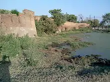
Rohtas Fort is a garrison fort built by the great Afghan king Sher Shah Suri. This fort is about 4 km in circumference. Qila Rohtas is situated in a gorge approximately 18 km NW of Jhelum and 7 km from Dina.
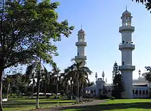
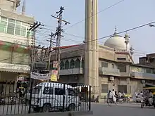
The old city has a labyrinth of narrow streets and bazaars. Opposite the CMH Jhelum Cantt is located the CMH Masjid Jhelum mosque.
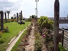
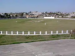
Located in the cantonment area is the St. John's Church Jhelum which was built in 1860. There was a local stadium near Gul Afshan Colony which was changed to a cricket stadium named Zamir Jaffri Cricket Stadium. Altaf Park which was constructed in 1994–95 is in a very close proximity of Cricket Stadium. Nearly 100 m from Shandar Chowk, in the center of city, is Major Akram Shaheed Memorial Park. Major Muhammad Akram Memorial Library is also present in this park. This is also a site of a parade which takes place every year on 6 September at the occasion of Defence Day.

Lehri Nature Park is located 10 kilometers away from G. T. Road between Jhelum and Islamabad, it is 30 kilometers from Jhelum and 90 kilometers from Islamabad in the hilly Pothohar region.
The Mangla Dam is located on the Jhelum River about 30 km (19 mi) from Jhelum, it is the twelfth largest dam in the world. It was constructed in 1967 across the Jhelum River. There is the Mangla View Resort[34] that is the first planned resort development in Pakistan to offer residences, villas, townhouses, hotels, serviced apartments and retail outlets. The resort is located on a 340-acre (1.4 km2) site on the Mangla Dam area.
Rasul Barrage is located on the Jhelum River about 30 km downstream from Jhelum. Two major water canals originate at the Rasul barrage, Rasul-Qadirabad link canal which is also called Lower-Jhelum link canal and Rasul-Shahpur branch canal. The area around the Rasul Barrage lake is also a picnic spot.
Travel and tourism
Local
Auto Rickshaws are a common mode of transport for short routes within the city. Many of the new rickshaws in the city use Compressed natural gas (CNG) instead of the petrol engines as CNG is environmentally clean and cheaper than petrol. Rickshaws are another important mode of transportation. The older horse drawn tongas are now defunct although some can still be privately commissioned. Taxis and privately commissioned small passenger carrying vans are available.
National
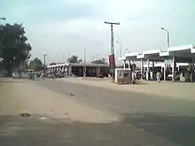
Daewoo Express Bus Service and other bus services operate from the city to the entire country.[35] There is a regular bus/Hiace service available running from early hours of the morning to late in the night. Daily routes include Rawalpindi, Islamabad, Lahore, Gujrat, Gujranwala, Sialkot, Mandi Bahauddin, Sargodha, Chakwal, Mirpur and Faisalabad.
Regular bus and van services are available within Jhelum District. It includes important towns and villages such as: buses from Jhelum to Pind Dadan Khan, Dina, Sohawa, Lilla, Nakka Khurd, Chakri Rajgan Khalaspur, Pind Sawika, Bair Faqiran- Green Hills Village) Nagyal, Sanghoi, Mangla Cantt, Nara, Domeli, Darapur, Jalalpur Sharif and many more, while vans go from Jhelum to Sanghoi, Wagh, Dina, Kharian, Sarai Alamgir, Chak Jamal, Chak Doulat, Mughalabad, Boken, Dhanyala and many other destinations as well as Baragowah.
Railway
The Jhelum Railway Station was built in 1928 during British rule before the independence of Pakistan. It was connected by the North-Western Railway to other cities in the Indian empire. Jhelum is on main line of Pakistan Railways, and linked to whole country through Railway line across Pakistan. Many of the railway lines and bridges were designed and constructed by engineers during the British time and after independence in railway workshop Jhelum.
Air
The nearest international airport is the Islamabad International Airport, which is approximately 110 km by road from Jhelum. The Sialkot International Airport, is approximately 100 km by road from Jhelum. A small airport called Gurha Salim Airport is situated 13 km (8 mi)[36] from the city centre. It is not being used by any commercial airlines, but only for military purposes.[37][38]
Telecommunication
3G & 4G Internet Service is available in this city since September 2014. The PTCL provides the main network of landline telephone with minority shares of few other operators like WorldCall. All major mobile phone companies operating in Pakistan provide service in Jhelum. Broadband internet access is available from DSL, EVDO to state of the art WiMAX technology from many ISPs, WiMax and WiFi operators like PTCL EVO,[39] Wateen, Mobilink, WorldCall, and LinkdotNet. WorldCall has laid its fiberoptics throughout the city of Jhelum for future project of FTTH with Triple Play service.[40] In August 2008 PTCL has launched its IPTV service named PTCL Smart TV in Jhelum. Jhelum has its own ISP Jhelum Networks which is a semi-public organisation working for the development of telecommunication and internet services throughout Jhelum. The company started its services in 2011 and now covering more than 200sq/km area. Jhelum Networks provides WiFi and cable internet services throughout the district. Different cellular networks also provide 3G internet in city Jhelum.
Sports
Located within the city is a golf course called the River-View Golf Club,[41] where national golf tournaments are held regularly.
There is a cricket and football stadium, Zamir Jaffri Cricket Stadium, where district level tournaments are held. In October 2008, Pakistan Cricket Board upgraded this stadium for regional events.[42]
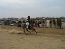
Besides the mainstream sports like football, cricket, hockey, and squash, a lot of other sports are also played in the rural areas around the city. These include tent pegging, volleyball, stone-lifting beeni and kabaddi. Thousands of people flock to these local grand sporting events as keenly as the average sports fan anywhere in the world.
These events are usually sponsored by the UK and foreign based Pakistani diaspora.
Education
Jhelum has six degree colleges for women, six degree colleges for men, six co-education colleges, six commerce colleges, one law college, numerous higher secondary schools and over 150 high schools. It also has a campus Of Punjab University,s Punjab University Jhelum Campus, near Rathiyan and Satellite Town Jhelum.[43]
Higher and technical education
In technical education there are three technical colleges, Government Institute of Technology (Chak Daulat), Government Vocational Institute for Women (Civil Lines Jhelum) and Government Technical Training Institute.[44]
Air School System is an independent education system that follows National Curriculum in accordance with Federal Ministry of Education and is registered as a Private Limited Company under the Companies Ordinance 1984. Air Foundation School System carries a trademark under the Ordinance 2001/Act 1940, Government of Pakistan. AFSS is ISO 9001 – 2000 certified by Moody International.
Universities
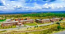
The University of the Punjab has established a campus in Jhelum offering programs related to business, commerce, law, and computer science. The new undergraduate and postgraduate degree programs are due to commence soon. The literacy rate of Jhelum is high in comparison to other cities of the Punjab. 65 kanals of land was allocated to establish this campus by Government of Punjab.[45]
Jhelum also has two sub-campuses of the Virtual University of Pakistan, Virtual University Campus at Civil Lines opposite city Church, and a private virtual campus, Wings Institute of Learning.[46] Virtual University of Pakistan inaugurated its own Campus in Jhelum in March 2012; VU Jhelum Campus is located in the middle of the city.
Hospitals
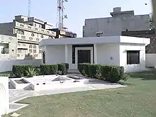
Jhelum has some of the largest hospitals[47] in the area which include the hospital in the cantonment area of the city managed by the Pakistan Army or sub organisations.[48] One such hospital is the Combined Military Hospital Jhelum.
Major industries

Some of the major industries are:[49]
- Pakistan Chipboard (Pvt) Ltd
- Pakistan Tobacco Company
Gallery
 Map of Tehsil Jhelum
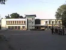
- A fort in Jhelum City
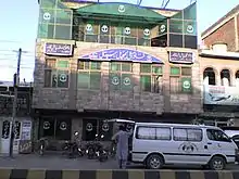
 Stylo and Hush Puppies, Civil Line
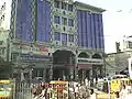 Saleem center, Civil Lines
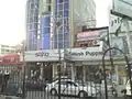
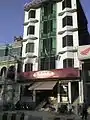 Ladi's mart, MM#3
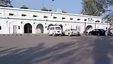
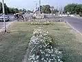 Cantonment Square, Jhelum
 Mahfooz Plaza, Kazim Kamal Road
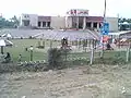 KFC Jhelum Cantt
 View of a match
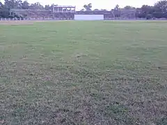 Zamir Jaffri Cricket Stadium
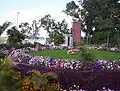 Tulip lawn Jhelum
 Kazim Kamal Park
 Tulip hotel
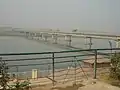 Jhelum River at Jhelum City
See also
- Inder Kumar Gujral, thirteenth Prime Minister of India
- Military College Jhelum
- Rabia Qari, the first female Muslim barrister in South Asia
- Rawalpindi
- Rawalpindi Division
- Potohar plateau
- List of colleges in Jhelum
References
- "Location of Jhelum – Falling Rain Genomics". Fallingrain.com. Retrieved 25 January 2013.
- "Weatherbase: Historical Weather for Jhelum, Pakistan". Weatherbase. 2008.
- "Pakistan: Provinces and Major Cities – Population Statistics, Maps, Charts, Weather and Web Information". www.citypopulation.de.
- John Pike. "Dominated Recruitment". Globalsecurity.org. Retrieved 25 January 2013.
- Shoaib, Syed (17 June 2009). "City of Soldiers". BBC News. Retrieved 25 January 2013.
- "AAJ NEWS Report (City of martyrs and warriors)". Youtube.com. 10 February 2009. Retrieved 25 January 2013.
- The District Jhelum
- "Tehsil Municipal Administration Jhelum – Industries of Jhelum". Tmajhelum.com. Archived from the original on 11 May 2013. Retrieved 25 January 2013.
- Shahbaz, Anjum Sultan (September 2003). Tareekh-e-Jhelum. history of Jhelum (2nd ed.). Book Corner, Main Bazar, Jhelum. p. 92.
- The District Jhelum Archived 15 April 2009 at the Wayback Machine
- Kapoor, Subodh (2002). Encyclopaedia of Ancient Indian Geography – Subodh Kapoor. ISBN 9788177552980. Retrieved 25 January 2013.
- Kapoor, Subodh (16 July 2017). Encyclopaedia of Ancient Indian Geography. Cosmo Publications. ISBN 9788177552980 – via Google Books.
- Arrian, Anabasis Alexandri, v. 8, 20, 29; Curtius Rufus, Historiae Alexandri Magni, viii. 12–14, ix. 1, x. 1
- "Jhelum District Imperial Gazetteer of India, v. 14, p. 152". Dsal.uchicago.edu. Retrieved 25 January 2013.
- Chisholm, Hugh (1910). "Alexander III (Alexander the Great)". Encyclopædia Britannica Eleventh Edition. 1.
- Diodorus, Bibliotheca, xvii. 90
- Enthoven, Reginald Edward (1990). The Tribes and Castes of Bombay: Ill – Reginald E. Enthoven. ISBN 9788120606302. Retrieved 25 January 2013.
- "Biography of Abdur Rahim Khankhana". Archived from the original on 17 January 2006. Retrieved 28 October 2006.
- ^ a b c Robert L. Canfield, Turko-Persia in historical perspective, Cambridge University Press, 1991. pg 20: "The Mughals – Persianized Turks who invaded from Central Asia and claimed descent from both Timur and Genghis – strengthened the Persianate culture of Muslim India."
- "Imperial Gazetteer of India, v. 14, p. 159-160". Dsal.uchicago.edu. Retrieved 25 January 2013.
- The London Gazette, 19 May 1858 http://www.london-gazette.co.uk/issues/22141/pages/2492/page.pdf
- "Tehsils & Unions in the District of Jhelum – Government of Pakistan". Nrb.gov.pk. Archived from the original on 9 February 2012. Retrieved 2013-01-25.
- World-Gazetteer.com. "Jhelum City". Archived from the original on 18 July 2011. Retrieved 19 September 2010.
- "Archived copy". Archived from the original on 18 July 2011. Retrieved 19 September 2010.CS1 maint: archived copy as title (link)
- "Population growth rate". World-gazetteer.com. Archived from the original on 17 October 2013. Retrieved 25 January 2013.
- "Archived copy" (PDF). Archived from the original (PDF) on 13 November 2010. Retrieved 28 September 2010.CS1 maint: archived copy as title (link)
- "District Profile". Dawn.com. Archived from the original on 29 August 2008. Retrieved 25 January 2013.
- "University of Gujrat". Uog.edu.pk. 3 March 2012. Retrieved 25 January 2013.
- Gujranwala Business Center Archived 11 January 2009 at the Wayback Machine
- "Jhelum Climate Normals 1961–1990". National Oceanic and Atmospheric Administration. Retrieved 16 January 2012.
- "Jhelum, Pakistan Travel Weather Averages (Weatherbase)". Weatherbase.
- "Weatherbase: Historical Weather for Jhelum, Pakistan". Weatherbase. 2015. Retrieved 13 October 2015.
- http://precis.metoffice.com/Useful_Links/Publications/Sajjad.pdf
- Mangla View Resort Archived 6 January 2009 at the Wayback Machine
- Daewoo Express Bus Service Archived 21 May 2014 at the Wayback Machine
- "Wikimapia – Let's describe the whole world!". wikimapia.org.
- "Air Force Question Thread".
- "eyeball-series.org". eyeball-series.org.
- PTCL EVO Archived 11 July 2010 at the Wayback Machine
- LinkdotNET Archived 28 February 2010 at the Wayback Machine
- "Wikimapia – Let's describe the whole world!". www.wikimapia.org.
- Jang News report(District Cricket Stadium, Jhelum) Archived 30 September 2008 at the Wayback Machine
- School Directory of PUNJAB (Jhelum) Archived 11 August 2011 at the Wayback Machine
- Technical education in Jhelum
- Punjab University NewsLetter Archived 30 December 2008 at the Wayback Machine
- "Virtual University of Pakistan". www.vu.edu.pk.
- "Program Areas – CPDI".
- Medical facilities in Jhelum
- "TMA Jhelum (Industries)". Archived from the original on 11 May 2013.
External links
- Jhelum District official portal
- Jhelum District unofficial portal
- Jhelum Police website
- TMA Jhelum website
- Punjab Government website (Jhelum profile)
- Jhelum Networks' Official Website
 Jhelum travel guide from Wikivoyage

Pakistan articles | |||||||||||||||||||
|---|---|---|---|---|---|---|---|---|---|---|---|---|---|---|---|---|---|---|---|
| |||||||||||||||||||
| |||||||||||||||||||
| |||||||||||||||||||
| |||||||||||||||||||
| |||||||||||||||||||
| |||||||||||||||||||
| Authority control |
|---|