Ballygowan
Ballygowan (from Irish: Baile Mhic Gabhann, meaning "McGowan's townland")[1] is a village in County Down, Northern Ireland. It is within the Ards and North Down Borough. The town of Comber is a short distance to the north-east, the town of Saintfield to the south, and the city of Belfast further to the north-west. It is within the civil parishes of Killinchy and Comber and the historic barony of Castlereagh Lower.[2] It had a population of 2,957 people in the 2011 Census.[3]
Ballygowan
| |
|---|---|
.JPG.webp) | |
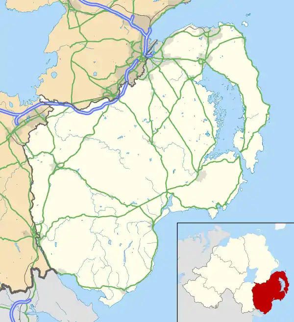 Ballygowan Location within County Down | |
| Population | 2,957 (2011 Census) |
| District | |
| County | |
| Country | Northern Ireland |
| Sovereign state | United Kingdom |
| Post town | NEWTOWNARDS |
| Postcode district | BT23 |
| Dialling code | 028 |
| UK Parliament | |
| NI Assembly | |
| Website | http://www.ballygowan.info |
Bus Services
Ballygowan has a bus depot connecting Ballygowan to Belfast, Comber, Newtownards and Darragh Cross.
Belfast Route (inc. Darragh Cross) - 12/512
Comber/Newtownards Route - 5b
These routes are run by Translink Ulsterbus. The Belfast route uses improved Urby buses run along this route, which include leather seats, free WiFi and USB Charging Ports.
History
Before the early 17th century Plantation of Ulster, when a lot of people moved from the Scottish Lowlands to settle in the area on lands granted by King James I to James Hamilton and Hugh Montgomery, the area of Ballygowan was sparsely inhabited by Irish Gaels. It was within the territory of Clannaboy, and in 1744 the McGowans of the Ards were associated with the Clannaboy O'Neills.[1]
In the late 18th century the village comprised a bridge (over the River Blackwater at the intersection of the Comber/Saintfield and Killyleagh/Belfast roads), a dozen or so small houses and an inn. The surrounding townlands were populated by a great number of small tenant farmers and weavers. The main landlords were Lord Dufferin and Lord Londonderry.
From the mid-19th century through the early 20th century the population of the rural area surrounding Ballygowan declined considerably as many people emigrated to North America or found work in Comber, Saintfield and particularly in Belfast. However, it was during this period, and subsequent to the introduction of the Belfast & County Down Railway in 1850, that the village began to grow. Ballygowan railway station opened on 10 September 1858, but finally closed on 16 January 1950.[4] After the railway closed in 1950 the village became an attractive "dormitory" town and the ensuing 50 years have seen rapid growth.[5]
On Monday, 15 September 2014, the remains of The Baron Bannside (better known as The Rev. Ian Paisley) were buried in the graveyard attached to Ballygowan Free Presbyterian Church. Lord Bannside was a former First Minister of Northern Ireland and a former Leader of the D.U.P..
Population
2001 Census
In the 2001 Census Ballygowan had a population of 2671 people.
2011 Census
On Census Day (27 March 2011) the usually resident population of Ballygowan Ward was 2,957 (1,077 households).[3]
- 21.39% were aged under 16 years and 12.27% were aged 65 and over;
- 49.40% of the usually resident population were male and 50.60% were female, and 40 years was the average (median) age of the population.
- 99.09% were from the white (including Irish Traveller) ethnic group;
- 11.22% belong to or were brought up Catholic and
- 80.19% belong to or were brought up in a 'Protestant and Other Christian (including Christian related)'denominations ;
- 75.81% indicated that they had a British national identity, 7.12% had an Irish national identity and 33.69% had a Northern Irish national identity (Respondents could indicate more than one national identity)
Education
Ballygowan has one primary school locally and 3 on the peripheral:
1. Alexander Dickson, in the centre of Ballygowan
2. Moneyrea primary school, a school in the village of Moneyreagh 3 miles outside Ballygowan
3. Carrickmannon Primary, a smaller school about 1 mile outside Ballygowan.
4. Millennium Integrated School, a bigger school than both of them about 3 miles outside Ballygowan.
Railways
The Ballygowan railway station was opened by the Belfast and County Down Railway on 10 September 1858.[6] The station was on the once extensive network that connected Belfast Queen's Quay railway station to Downpatrick and Newcastle, County Down.
The station closed in 1950 under the auspices of the Ulster Transport Authority.
See also
| Wikimedia Commons has media related to Ballygowan. |
References
- Place Names NI
- "Ballygowan". Placenames database of Ireland. Retrieved 21 February 2013.
- "Ballygowan". Census 2011 Results. NI Statistics and Research Agency. Retrieved 22 April 2015.
- "Ballygowan station" (PDF). Railscot - Irish Railways. Archived (PDF) from the original on 26 September 2007. Retrieved 11 September 2007.
- http://www.ninis2.nisra.gov.uk/public/AreaProfileReportViewer.aspx?FromAPAddressMulipleRecords=Ballygowan@Exact match of location name: @Exact Match Of Location Name: Ballygowan@4?
- "Ballygowan Halt station" (PDF). Railscot - Irish Railways. Retrieved 6 May 2012.
External links