Banguingui, Sulu
Banguingui, officially the Municipality of Banguingui (Tausūg: Dāira sin Banguingui; Tagalog: Bayan ng Banguingui), is a 4th class municipality in the province of Sulu, Philippines. According to the 2015 census, it has a population of 24,161 people. [3]
Banguingui
Tongkil | |
|---|---|
| Municipality of Banguingui | |
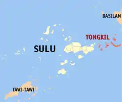 Map of Sulu with Banguingui highlighted | |
OpenStreetMap 
| |
.svg.png.webp) Banguingui Location within the Philippines | |
| Coordinates: 6°04′N 121°47′E | |
| Country | |
| Region | Bangsamoro Autonomous Region in Muslim Mindanao (BARMM) |
| Province | Sulu |
| District | 2nd District |
| Barangays | 14 (see Barangays) |
| Government | |
| • Type | Sangguniang Bayan |
| • Mayor | Whajid I. Sahidulla |
| • Vice Mayor | Denrasher A. Abdilla |
| • Representative | Munir M. Arbison |
| • Electorate | 12,573 voters (2019) |
| Area | |
| • Total | 352.59 km2 (136.14 sq mi) |
| Elevation | 3.0 m (9.8 ft) |
| Highest elevation | 386 m (1,266 ft) |
| Lowest elevation | 0 m (0 ft) |
| Population | |
| • Total | 24,161 |
| • Density | 69/km2 (180/sq mi) |
| • Households | 4,184 |
| Economy | |
| • Income class | 4th municipal income class |
| • Poverty incidence | 51.26% (2015)[4] |
| • Revenue | ₱77,512,300.34 (2016) |
| Service provider | |
| • Electricity | Sulu Electric Cooperative |
| Time zone | UTC+8 (PST) |
| ZIP code | 7406 |
| PSGC | |
| IDD : area code | +63 (0)68 |
| Climate type | tropical climate |
| Native languages | Tausug Tagalog |
| Website | www |
From its original name Tongkil, it was renamed Banguingui on January 29, 1999 by virtue of Muslim Mindanao Autonomy Act No. 71 of the Autonomous Region in Muslim Mindanao in honor of the dominant Banguingui tribe of the municipality.[5][6] It was inaugurated only on January 29, 2006.[7]
Barangays
Tongkil is politically subdivided into 14 barangays.
- Bakkaan
- Bangalaw
- Danao
- Dungon
- Kahikukuk
- Luuk (Poblacion)
- North Paarol
- Sigumbal
- South Paarol
- Tabialan
- Tainga-Bakkao
- Tambun-bun
- Tattalan
- Tinutungan
Climate
| Climate data for Banguingui, Sulu | |||||||||||||
|---|---|---|---|---|---|---|---|---|---|---|---|---|---|
| Month | Jan | Feb | Mar | Apr | May | Jun | Jul | Aug | Sep | Oct | Nov | Dec | Year |
| Average high °C (°F) | 28 (82) |
27 (81) |
28 (82) |
28 (82) |
28 (82) |
28 (82) |
28 (82) |
28 (82) |
28 (82) |
28 (82) |
28 (82) |
28 (82) |
28 (82) |
| Average low °C (°F) | 27 (81) |
27 (81) |
27 (81) |
27 (81) |
28 (82) |
28 (82) |
28 (82) |
28 (82) |
28 (82) |
28 (82) |
28 (82) |
27 (81) |
28 (82) |
| Average precipitation mm (inches) | 148 (5.8) |
110 (4.3) |
116 (4.6) |
127 (5.0) |
241 (9.5) |
318 (12.5) |
304 (12.0) |
281 (11.1) |
202 (8.0) |
262 (10.3) |
227 (8.9) |
164 (6.5) |
2,500 (98.5) |
| Average rainy days | 17.0 | 14.6 | 15.5 | 15.8 | 23.3 | 24.4 | 24.8 | 24.0 | 20.2 | 22.5 | 21.0 | 18.7 | 241.8 |
| Source: Meteoblue (modeled/calculated data, not measured locally)[8] | |||||||||||||
Demographics
|
| ||||||||||||||||||||||||||||||||||||||||||||||||
| Source: Philippine Statistics Authority [3] [9] [10][11] | |||||||||||||||||||||||||||||||||||||||||||||||||
Economy
| Poverty Incidence of Banguingui | |
| Source: Philippine Statistics Authority[12][13][14][15][16][17] | |
References
- Municipality of Banguingui | (DILG)
- "Province: Sulu". PSGC Interactive. Quezon City, Philippines: Philippine Statistics Authority. Retrieved 12 November 2016.
- Census of Population (2015). "ARMM – Autonomous Region in Muslim Mindanao". Total Population by Province, City, Municipality and Barangay. PSA. Retrieved 20 June 2016.
- https://psa.gov.ph/sites/default/files/City%20and%20Municipal-level%20Small%20Area%20Poverty%20Estimates_%202009%2C%202012%20and%202015_0.xlsx; publication date: 10 July 2019; publisher: Philippine Statistics Authority.
- "Muslim Mindanao Autonomy Act No. 71; An Act Changing the Name of the Municipality of Tongkil in the Province of Sulu to the Municipality of Banguingui" (PDF). Regional Legislative Assembly, Autonomous Region in Muslim Mindanao. Retrieved 27 January 2016.
- "MMA Act No. 71 : An Act Changing the name of the Municipality of Tongkil in the Province of Sulu to the municipality of Banguingui" (PDF). Archived from the original (PDF) on 2014-09-03. Retrieved 2013-10-06.
- Banguingui municipality celebrates 10th anniversary
- "Banguingui, Sulu : Average Temperatures and Rainfall". Meteoblue. Retrieved 31 January 2019.
- Census of Population and Housing (2010). "ARMM – Autonomous Region in Muslim Mindanao". Total Population by Province, City, Municipality and Barangay. NSO. Retrieved 29 June 2016.
- Censuses of Population (1903–2007). "ARMM – Autonomous Region in Muslim Mindanao". Table 1. Population Enumerated in Various Censuses by Province/Highly Urbanized City: 1903 to 2007. NSO.
- "Province of Sulu". Municipality Population Data. Local Water Utilities Administration Research Division. Retrieved 17 December 2016.
- "Poverty incidence (PI):". Philippine Statistics Authority. Retrieved 28 December 2020.
- https://psa.gov.ph/sites/default/files/NSCB_LocalPovertyPhilippines_0.pdf; publication date: 29 November 2005; publisher: Philippine Statistics Authority.
- https://psa.gov.ph/sites/default/files/2003%20SAE%20of%20poverty%20%28Full%20Report%29_1.pdf; publication date: 23 March 2009; publisher: Philippine Statistics Authority.
- https://psa.gov.ph/sites/default/files/2006%20and%202009%20City%20and%20Municipal%20Level%20Poverty%20Estimates_0_1.pdf; publication date: 3 August 2012; publisher: Philippine Statistics Authority.
- https://psa.gov.ph/sites/default/files/2012%20Municipal%20and%20City%20Level%20Poverty%20Estima7tes%20Publication%20%281%29.pdf; publication date: 31 May 2016; publisher: Philippine Statistics Authority.
- https://psa.gov.ph/sites/default/files/City%20and%20Municipal-level%20Small%20Area%20Poverty%20Estimates_%202009%2C%202012%20and%202015_0.xlsx; publication date: 10 July 2019; publisher: Philippine Statistics Authority.
External links
- Banguingui Profile at PhilAtlas.com
- Philippine Standard Geographic Code
- Philippine Census Information
- Local Governance Performance Management System
Places adjacent to Banguingui, Sulu | ||||||||||
|---|---|---|---|---|---|---|---|---|---|---|
| ||||||||||
Jolo (capital) | |
| Municipalities | |
This article is issued from Wikipedia. The text is licensed under Creative Commons - Attribution - Sharealike. Additional terms may apply for the media files.