Bara, Dildarnagar
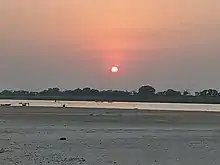
Bara is a village kamsar region in Ghazipur district in the Indian state of Uttar Pradesh. It is situated on the banks of the Holy river Ganges.
Bara | |
|---|---|
Village | |
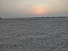
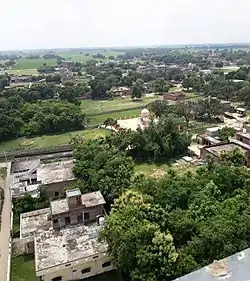 A view of Bara village from A greater hight | |
| Country | |
| State | Uttar Pradesh |
| District | Ghazipur |
| Established | 1530 |
| Government | |
| • Type | Indian government |
| • Body | Gram panchayat |
| Area | |
| • Total | 12.33 km2 (4.76 sq mi) |
| Population (2011) | |
| • Total | 21,405 |
| • Density | 1,700/km2 (4,500/sq mi) |
| Indian | |
| Time zone | UTC+5:30 (IST) |
| 232325 | 232325 |
| ISO 3166 code | IN-UP |
| Vehicle registration | UP 61 |
| Website | up |
The majority of the residents are Muslim (Pathan). The village has a Union Bank of India, Kashi Gomti Gramin Bank, sub-post office, petrol pump and a reporting Police Station. The village has a cricket team named Bara Cricket Club and a football team named Bara Football Club. There are three playgrounds in the village.
There is an English medium school named IQRA model school (managed by Muslim welfare and trust) and a college named Bara Inter College. As of 2011 census the main population of Bara lived in an area of 410 acres and had 2988 households.[1]
History
According to the old books and sayings it is said that the Bara village was established by the family Cherus. Tikam deo was a King of chero Dynasty and a ruler of Birpur estate. Later Kam dev and Dham dev came to this region and Tikam deo Lost the power and Birpur came in direct control of them and later Kamsar jagir. After Tikam deo Lost his estate his descendants name as Rajdhar Rai, Mukund Rai, and Pithaur Rai out of three brother, one brother setteld at Birpur, and one brother established Narayanpur and Ujjar villages. Later their family established many villages near Birpur.[2][3]
One brother adopted Islam in 1600s and established bara. The brother who adopted Islam and his descendents were in a good relationship from Kamsar because of which many Kamsar pathans settled at Bara and family from bara settled in different villages of Kamsar. At Birpur, Where one brother In the Mughal period and subsequently to the British Imperialism, it lies on an important route of Delhi to Kolkata, and there were constant movement of businessmen and traders.[2][3]
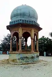
The village has a railway station known as Barakalan station. During Mughals the Bara was also a trade centre because of its distance from the ganga river. Their was a old port build in Bara build in early 1600s. Bara witnessed the Battle of Chausa, a military engagement between the Mughal Emperor Humayun, and the Pathan Sher Shah Suri, fought on 26 June 1539, 2 km away.[2][3]
Agriculture
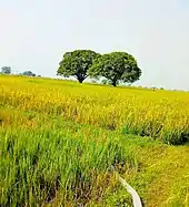
Agriculture is the main employment in the village. More than 2500 acres of land are used for agriculture. All kinds of machinery like tractors, combine harvesters, balers etc. are used in the village. The village has a good water supply for irrigation purposes. Most people have their own tube wells or other things for irrigation. The village is near to Dildarnagar and Chausa which are some of the main markets for agriculture. The village is surrounded by two river name as Karmanasa and Ganges. The soil of the village is good for farming. All kinds of crops which are grown in Purvanchal and Buxar district are grown in the village.[3]
Watermelon is grown at a large scale in the village as Ganges river passes about 4.8 kilometres from the village. The village has many ponds.[3]
How to reach Bara
Barakalan Halt RailWay Station, Gahmar RailWay Station, Dildarnagar junction and Buxar junction are the closest railway stations to Bara. The nearest airport is in Varanasi, Lal Bahadur Shastri International Airport and Sri Rajendra Nagar Patna Airport.
References