Dildarnagar Kamsar
Dildarnagar Kamsar or Kamsaar, is a Pargana in Ghazipur district, of Uttar Pradesh, India. It consists of 36 places: Dildarnagar Town, Dildarnagar Village, Usia, Faridpur, Rakasaha, Tajpur Kurrah, Gorasara, Mania, Khajuri, Kusi, Bhaksi, Jaburna, Dewaitha, Fufuao, Bahuwara, Saraila, Chitarkoni, Rasulpur, Kharaicha, Arangi, Akhini, Baksara, Nirahukapura, Palia, Sultanpur, Seorai village, Khizirpur, Mahana, Mircha, Muhammadpur, Sendura, Sihani, Tajpur, Kadirpur, and Kamesaradih [5][6][7][8][9][10][11][8]
Dildarnagar Kamsar
Kamsaar Kamsar-O-Bar | |
|---|---|
| Dildarnagar Kamsar | |
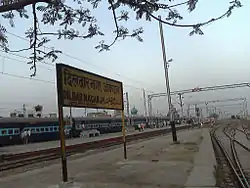 Dildarnagar Junction railway station build in 1862 | |
| Nickname(s): Land of Unity | |
 Dildarnagar Kamsar location of Dildarnagar Kamsar on Ghazipur | |
| Coordinates: 25.415°N 83.668°E | |
| Country | |
| State | Uttar Pradesh |
| District | Ghazipur |
| Established | 1542 |
| Founded by | Raja Narhar Khan |
| Named for | Karmanasa River |
| Government | |
| • Type | Gram Panchayat |
| • Body | Government of Uttar Pradesh |
| Area | |
| • Pargana | 138.7987 km2 (53.5905 sq mi) |
| • Land | 135.7987 km2 (52.4322 sq mi) |
| • Water | 3 km2 (1 sq mi) |
| • Urban | 6.483 km2 (2.503 sq mi) |
| • Rural | 132.3157 km2 (51.0874 sq mi) |
| Dimensions | |
| • Length | 21 km (13 mi) |
| • Width | 7.1 km (4.41 mi) |
| Elevation | 73.50 m (241.14 ft) |
| Population (2011) | |
| • Pargana | 172,217 [1] |
| • Urban | 29,208[2] |
| • Rural | 143,009 [3] |
| Demonym(s) | Kamsaari |
| Languages | |
• *Official
| |
| Time zone | UTC+5:30 (IST) |
| PIN | 232326 |
| Vehicle registration | UP 61 |
| Rivers | Karmanasa River, Durgavati River |
| Sex ratio | 926 (2011) ♂/♀ |
| Literacy | 74.511 % [4] |
| Literates | 128321 |
| Climate | BW (Köppen) |
All these villages were founded by the descendants of Narhar Khan or the relatives of the family. Other villages founded by Narhar's family members are known as Kamsar-o-bar. Most of the Pathans living in these 24 villages excluding Mircha and village and Dildarnagar are known as Kamsaar Pathans. All the villages have their Maha Gram Panchayat at Usia village of Dildarnagar Kamsar. The main Dildarnagar Kamsar has a total geographical area of 138.7987 km² with a population of 172217 (2011 census). There are more than 20,000 houses in Dildarnagar Kamsar. The entire Kamsar-o-bar region, which lies in Bihar and Uttarpradesh, has a population of 1587560 according to the 2011 census and occupies an area of 1840 km².[12][13] Anjume-isla founded in the year 1910 by Sir Khan Bahadur Mansur Ali Khan is the cultural and social reform organization of Kamsar Pathans and Dildarnagar Kamsar.[14] Anjume-isla regularly convenes the Maha Gram Panchayat of 120 odd villages established by the descendants of Kam and Dham Dev at Usia village. Other places which come under the panchayat of Dildarnagar kamsar and are founded by the descendants of Narhar Khan, Kam and Dham Deo are: Mahend, Dumri, Beur, Pakhanpura, Ramval, Bara, Machhati. Dildarnagar Kamsar was made a jagir during Mughal empire from year 1601 to 1952 and was later made a pargana in Ghazipur district in year 1960.[10]
History
Early History
The Kamsar Pathans, who are found mainly in the Ghazipur District of eastern Uttar Pradesh are the descendants of Narhar Khan, great grandson of Maharaja Kam Dev Misir alias Rao Dalpat Singh Sikarwar, born in 1445 AD, who was son of Maharaja Jay Raj Dev Singh. Kam Dev was ruler of Pahargarh estate and the army chief of his father's army. After the death of his father, Kam Deo's younger brother Maharaja Dham Dev Singh was made the king of Vijaypur Sikri (known as Fatehpur Sikri) and ruled from 1504 AD-1527 AD. Kam Deo had four sons, Anchal Misir, Vichal Misir alias Rao Ratan Pal Singh, Sarnag Misir alias Rao Bhairav Das Trilokdas Singh, and Rohit Misir alias Haibanth Rup Sen. Vichal Misir, Sarang Misir and Rohit Misir founded 70 villages near Morena in Madhya Pradesh. After the Battle of Khanwa and Battle of Madarpur Kam Dev along with his elder son's family and Dham Dev came down to Ghazipur on 26 October 1530, and purchased land by paying 10,000 gold coins to the Cheru tribal chief of Birpur named Tikam Deo. Kam Deo settled at place know known as Reotipur and Dham Deo settled at Gahmar village. It is said that they settled there because the region had 18 rivers. Kam Deo gave more fertile land to Dham Deo in a fatherly gesture. Dham Deo had two sons, Roop Ram Rao and Diwan Ram Rao. Descendants of Roop Ram Rao established 84 villages near Gahmar and Kudra in Bihar. Descendants of Diwan Ram Rao founded Bhabua, Chainpur and many other nearby villages. From among Kam Deo's family Anchal Misir had two sons, Raja Harish Chandra Misir also known as Harish Chandra Rao and Reosar Misir alias Reosar Rao. Descendants of Reosar Rao established Nagsar and some of the other villages near it and Mohania in Bihar estate. Harish Chadra Rao had four sons, Rajmal Rao, Sansarmal Rao, Gasaimal Rao and Puranmal Rao. Descendants of Rajmal Rao, Sansarmal Rao and Gosaimal Rao established many villages in Zamania thesil of Ghazipur district. Puranmal Rao had seven sons, Narhar Dev Rao, Ratan Dev Rao, Shahjamal Rao, Tejmal Rao, Thakurai Rao, Hindu Rao and Jatan Rao. Descendants of Ratan Dev Rao, Shahjamal Rao, Tejmal Rao, Thakurai Rao, Hindu Rao and Jatan Rao established many villages near Ramgarh bihar thesil, Reotipur, Rampur, Semra, Sherpur and Mahend.[10][15][11][8][5][16]
The Kamsar Pathans
Puranmal's elder son Narhar Dev Rao adopted Islam in the year 1542 AD and was renamed Narhar Khan. Narhar Khan adopted Islam, being influenced by Makhtom Saiyyad Shah Junaid Qadri Rahmatulla alae. He later had a poor relationship with his brothers and the rest of the family members because when he told he adopted Islam his father and younger brothers were angered and his father removed him from his house and given a peace of land near Karmanasaha river. Later, he became a large zamindar of the region and was also made Jagirdar by Sher Shah Suri. He established Dildarnagar kamsar pargana and Kamesardih kot (fort) in 8.25 acres(13.2 bigha) of land. There is disagreement regarding the area of the fort it also said that the fort was in 32.5 acres (52 bigha) of land. Descendants of Narhar Khan established villages in Dildarnagar kamsar. Narhar Khan was made Jagirdar of Ghazipur by the Mughal emperor Sher shah suri. Descendants of Narhar Khan are known as Kamsar pathans. Narhar Khan had five sons, Jahangir Khan, Baran Khan, Usman Khan, Khanjahan Khan and Barbal Khan. Jahangir Khan established Usia South and Khajuri villages. Descendants of Baran Khan established Mania, Gorasara, Rakasaha, Bahuara, Dewaitha, Saraila, Jaburna, Fufuao, Kahraicha, Rasulpur Newada and Sihani villages. Descendants of Usman Khan established Tajpur Kurrah and Akhini villages. Descendants of Khanjahan Khan established Kusi and Bhaksi villages. And descendants of Barbal Khan established Usia North and Arangi village. One family also diffused to Daltonsganj and established 12 villages there. Narhar Khan gave more land to Baran Khan because he had more sons. People from these villages (villages in Daltonsganj are not included) which were established by the descendants of Narhar Khan are Pathans and are known as "Kamsar Pathans" and the region is known as Dildarnagar Kamsar or Kamsar. The sons and grandsons of Narhar Khan also had a good relationship with the mughals, especially Akbar and also the ruler of the Sur dynasty, Sher Shah Suri. Narhar's great grandson named Sarkar Diwan Raja Kuttul Khan Zamindar Jagirdar Taluka Seorai was also made Sarkar of Ghazipur, Diwan of Bihar and Jagirdar and zamindar of 52 villages from Seorai by the Mughal emperor Akbar in year 1600AD. Kuttul Khan also made a small fort at Seorai. After the death of Kuttul Khan, his cousin Diwan Jagirdar Daud Khan zamindar was made the Diwan of Bihar ,Governor of Ghazipur and the Jagirdar of Zamania tehsil and Daudpur (Know Dewaitha) by the Mughal emperor Jahangir. The Archaeological Survey of India has also excavated some old polished cutlery from Kamesardih kot (fort) in 2009, giving insight into the region's history. 2.25 acres of land is taken for the survey.[10][17][18][14][19][20]
Jagirs & Zamindari estates
During Mughal era (1601-1687) the area of Kamsar Jagir was divided into two pargans name as Seorai and Daudpur. Both these parganas made the total Kamsar jagir and were spread over 52 villages.[11] Later the number of villages increased and was 122 villages during eirly Britsh rule and later Mughal rule (1687-1952) and had the total area of 1237.6 Km² and was kept on a revenue demand of ₹ 2.5 Lakh in 1830.The jagirdar of Kamsar was made by the Mughal emperors and had his court and office at Seorai and Daudpur and main office at Kamsaradih later at Dildarnagar. [21]The Population of the place increased a lot in late 1700s. Some of Cheif villages which made the Large parts of Seorai pargana were - Gahmar (A.166.46 Km²) , Reotipur (A.120.65 Km²), Bara (A.151.3 Km²), Mahend(A.98 Km²), Chausa (A.114km²), Usia (A.50.35 Km ²), Kusi (A.51.5 Km²). Some other relative Jagirs near Kamsar were Chainpur,(A.2134 Km²) and Jahanabad(Kudra)(A.911 Km²) during Mughal era and early Britsh era. [18][11][22]
Jagirdars of Kamsar
- Raja Babu Narhar Khan; as a zamindar (1542-1560 CE) Mughal empire
- Jagirdar, Nawab Ali Quli Khan urf Khan Zaman (1560-1590 CE) Mughal Empire; (Kamsar region before was a monarchy ruled by Kam dev and later his brother Dham dev and their descents from 1530-1560 CE and was known as Birpur estate, but later some parts of it came in Zamania Jagir which was established by Ali Quli Khan a Nawab of Ghazipur during Akbar rule in 1560 but later in 1601 Kuttul Khan made Kamsar jagir because the region had large settlements of his family.)
- Sarkar Diwan Jagirdar Raja Kuttul Khan zamindar taluka Seorai (1601-1640s CE);Mughal Empire ( zamindar of 52 villages and Sarkar of Ghazipur, Diwan of Bihar and Allahabad subah)
- Dewan Faujdar Jagirdar zamindar Raja Daud Khan (1640s-1660s CE);Mughal Empire.(Sarkar, Faujdar of Ghazipur and Dewan of Shahjahan and Aurangzeb from Allahabad and Bihar Subah. )
- Zamindar Sheikh Ruhul Alim Khan (1660-1680) ;Mughal Empire.( He was a relative of Nizam Mir Rustam Ali Khan and Jagirdar of Ghazipur and Nizam of Allahabad Subah)
- Zamindar Sheikh Muhammad Qasim Khan(1680-1687) ;Mughal Empire. (He was a Jagirdar of Zahurabad and Kamsar jagirs.)
- Raja Jagirdar Kunwar Muhammad Deendar Khan (1687-1711 CE); Mugha Empire (He was a Jagirdar of Lahore later established Dildarnagar in 1687 and became Jagirdar of Ghazipur)
- Raja Jagirdar Faujdar Zamindar Nizabat Khan (1711-1744) ; Mughal Empire.
- Nawab Fazal Ali Khan (1744-1757 CE); Awadh estate.(Nawab of Ghazipur and ruler of Zahurabad estate which had 1647 villages and 40 parganas)
- Amil Jagirdar Chaudhari Muhammad Azmal (1757-1790 CE); Banaras Estate.(Amil of Zamania)
- Raja zamindar Yad Ali Khan (1790-1810 CE); Jagdishpur estate.
- Raja Dewan Saleem Khan (1810-1837CE) ;Jagdishpur estate. (Dewan of Jagdishpur estate and friend of Kunwar Singh.)
- Raja Lambardar Jagirdar Khuda bhaksh Khan zamindar (1837-1882 CE) ;Jagdishpur estate & Campany rule.(102 villages)(During his region in Oct, 1862 the jagur was made small and Gahmar and Chausa wete removed)
- Rai Bahadur Babu Bindeshwari Saran Singh,(1882-1895) he was given the charge and Large zamindari in the region. He was a relative of ruler of Anapur estate, Allahbad.
- Thakurain Jodha Kunwar (1895-1905) She was the prices of Ana pur estate and doughter of Rai Bahadur Bindeshwari Saran Singh. [23][10][24][19][25][26][27][20][21][18]
Lambardars,Chaudhari & chief of some the villages after 1862 came in Kamsar
- Zamindar Muhammad Nur Khan (Lambardar of Daudpur)
- Zamindar Muhammad Wasil Khan (Lambardar of Daudpur)
- Zamindar Muhammad Haji Shamshuddin Khan raiees
- Zamindar Isa Khan
- Zamindar Alam Shah Khan
- Zamindar Nabi Bhaksh Khan
- Molvi Zameer Khan Nuhi
- Munshi Madhav Lal
- Chaudhari Muhammad Basheer Ahmad Khan.(Lambardar of Nauli) etc.
British era

During British era the land revenue was calculated in bighadam according to Indian land unit 'bigha' all the Reotipur and Sherpur pargana were joined and were combined to form Pachchisionhazar because ₹ 25000 revenue was collected from these two pargana during British the combined Reotipur and Sherpur had an area of 47750 bigha and was before known as "Qairat Reotipur", Sherpur had an area of 27346 bigha and Reotipur had an area of 20404 bigha.Nagsar had an area of 12005 bigha but, Utarauli, Nauli, were separated as the part of Nagsar pargana and was made another zamindari. Nagsar was left with the are of 2410 bigha. Dildarnagar Kamsar jagir was divided into two pargans name as Seorai and Daudpur later, during British villages of Kamsar pargana had a total land spread of 325 Km. The zamindars of Kamsar became immensely powerful during the rule of Sheikh Abdullah and Fazal Ali Khan who were the nawabs of Ghazipur. [11][27][15]
In 1857 in the first was of Indian Independence many Kamsar pathans and many other people revolted against the British and fought bravely. Some of them also joined with a zamindar of Jagdishpur estate named Kunwar Singh. Later, many Kamsar Pathans and people from Kamsar-o-bar joined the Indian Army and revolted against the British and in 1947 and also died, one zamindar of Dewaitha village name as Sona Khan was also given the harsh punishment of Kala Pani. Some social reformers from Dildarnagar Kamsar also assisted, Deputy Mohammad Sayed Khan (the founder of SKBM Degree College).[24]
Demography
As of the 2011 India census, Dildarnagar Kamsar had a population of 172217 Males constituted 51% of the population and females, 49%. Dildarnagar Kamsar has an average literacy rate of 74.511 % which is higher than the national average of 59.5%. Male literacy rate is 88.51% and, female literacy rate is 63.25%. 16% of the population is under 6 years of age as per the 2011 census. Islam is the religion of 70.8% people living in Dildarngar Kamsar and 20.2% are Hindus.[28][29]
| Population Growth of Dildarnagar Kamsar | |||
|---|---|---|---|
| Census | Population | %± | |
| 1861 | 28,600 | — | |
| 1871 | 28,780 | 0.6% | |
| 1881 | 28,962 | 0.6% | |
| 1891 | 32,080 | 10.8% | |
| 1901 | 35,210 | 9.8% | |
| 1911 | 36,295 | 3.1% | |
| 1921 | 38,700 | 6.6% | |
| 1931 | 40,784 | 5.4% | |
| 1941 | 42,700 | 4.7% | |
| 1951 | 49,224 | 15.3% | |
| 1961 | 64,483 | 31.0% | |
| 1971 | 84,472 | 31.0% | |
| 1981 | 110,657 | 31.0% | |
| 1991 | 151,626 | 37.0% | |
| 2001 | 161,292 | 6.4% | |
| 2011 | 172,217 | 6.8% | |
| Source:Census of India[30][31][32][33] | |||
Religion
Islam is the religion of 70.8% of Dildarnagar Kamsar's population. There are also large communities of Hindus(20.2%) in Dildarnagar Kamsar, the rest belong to other religions. Other minorities include Buddhists. Urdu, Hindi and Bhojpuri are the main spoken languages in Dildarnagar Kamsar.[34][35][36]
Notable people
- Syed Ishtiaq Ahmed - (1932-2003) was Attorney General of Bangladesh
- Syed Shahabuddin Salfi Firdausi - (1956-2018) scholar of Islamic Studies
- Nazir Hussain (1922 - 1987) film actor and director, born in Usia village
- Khan Shein Kunwar - (b 1955) story writer and businessman from Kurrah village
- Yunus Parvez - (1931-2007) film actor from Mahend village
Education
Notable schools and colleges include:
Railway stations
The four railway stations in Dildarnagar Kamsar are:
- Dildarnagar Junction Railway Station
- Darauli Railway Station
- Bhaduara Railway Station
- Usia khas Halt Railway Station
References
- "2011 census of India".
- "2011 census of India".
- "2011 census of India".
- "2011 census of India".
- "Babar Ki aulad? Who me? The world of Urdu".
- "Dewaitah Village in Dildarnagar Kamsar".
- "Mircha, India".
- "Kamsar-O-Bar Forum".
- "Kamsarbook".
- Ansari, Saiyad Hasan (1986). Evolution and Spatial Organization of Clan Settlements: A Case Study of Middle Ganga Valley. Concept Publishing Company. pp. 101–103.
- "Ghazipur Gazateer".
- [Kamsarbook. Webs. Com "Kamsarbook"] Check
|url=value (help). - [Groups. Google. Com "Dowry deaths in Bihari Pathans community-Google groups"] Check
|url=value (help). - "Kamsar Rajputs revive British era anti dowry reform".
- "Ballia District gazeteer".
- "Sakarwar-Synonyums of Sakarwar".
- "History of Dildarnagar in Ghazipur".
- "The Nawabs of Awadh".
- "Anapur Raj".
- "Seven people died in saving Kamsar amd Seorai Jagirs".
- "Ghazipur Gazeteer".
- Choudhary, Bijoy Kumar (2017). Kaimur District Gazetteer. ISBN 9788189785147.
- "Babu Amar Singh Jagdishpur estate. 1857 Revolution".
- "Freedom strugle in Ghazipur".
- "History of Dildarngar".
- "Shirvastava14".
- Ansari, Saiyad Hasan (1986). "Shahabad and Orissa District Gazetter".
- "2011 census of India".
- "2011 Religion data".
- "Census of India". mospi.gov.in. Archived from the original on 13 August 2008. Retrieved 23 June 2008.
- "2011 census of India".
- "Historical Census of India". Archived from the original on 17 February 2013. Retrieved 5 November 2015.
- "District|Ghazipur Religion and demographic data".
- "Zamana thesil, Ghazipur, Religion, Demographics, and Population data".
- "2011 India Religion Data".
- "Population by religious community - 2011". Census of India, 2011. Retrieved 8 December 2019.