Allahabad district
Allahabad district, officially known as Prayagraj district,[1] is one of the largest and the most populous district of Uttar Pradesh state of India. The district headquarters is Allahabad city which was renamed Prayagraj at the same time as the district was renamed. The District is divided into blocks within tehsils. As of 2011, there are 20 blocks in eight tehsils.[2][3][4] The Allahabad division includes the districts of Fatehpur, Kaushambi and Allahabad, with the western Pratagraj District becoming part of the new Kaushambi district.[5] The administrative divisions are Phulpur, Koraon, Meja, Sadar, Soraon, Handia, Bara, Shringverpur and Karchana.
Allahabad district | |
|---|---|
District of Uttar Pradesh | |
| Prayagraj district | |
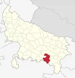 Location of Allahabad district in Uttar Pradesh | |
| Country | India |
| State | Uttar Pradesh |
| Division | Allahabad |
| Headquarters | Allahabad |
| Tehsils | 8 |
| Area | |
| • Total | 5,482 km2 (2,117 sq mi) |
| Population (2011) | |
| • Total | 5,954,391 |
| • Density | 1,100/km2 (3,000/sq mi) |
| Demographics | |
| • Literacy | 74.41% |
| • Sex ratio | 901 |
| Time zone | UTC+05:30 (IST) |
| Major highways | NH 2 |
| Lok Sabha constituencies | Allahabad, Phulpur |
| Website | prayagraj |
The three rivers of India - Ganges, Yamuna and the mythical river of Sarasvati - meet at a point in the district, known as Sangam, considered holy by Hindus. Allahabad was once the capital of United Province before independence. Allahabad is one of the largest educational hubs.
Demographics
| Year | Pop. | ±% p.a. |
|---|---|---|
| 1901 | 1,141,944 | — |
| 1911 | 1,124,143 | −0.16% |
| 1921 | 1,076,120 | −0.44% |
| 1931 | 1,142,845 | +0.60% |
| 1941 | 1,388,068 | +1.96% |
| 1951 | 1,568,592 | +1.23% |
| 1961 | 1,882,506 | +1.84% |
| 1971 | 2,292,284 | +1.99% |
| 1981 | 2,983,245 | +2.67% |
| 1991 | 3,899,660 | +2.71% |
| 2001 | 4,937,266 | +2.39% |
| 2011 | 5,954,391 | +1.89% |
| source:[6] | ||
According to the 2011 census of India the district has a population of 5,954,391,[6] roughly equal to the nation of Denmark[7] or the US state of Missouri.[6] This gives it a ranking of 13th in India (out of a total of 640).[6] As of 2011 it is the most populous district of Uttar Pradesh (out of 71).[6] The district has a population density of 1,087 inhabitants per square kilometre (2,820/sq mi).[6] Its population growth rate over the decade 2001-2011 was 20.74%.[6]
The district has a sex ratio of 902 females for every 1000 males,[6] and a literacy rate of 74.41%, highest in the region[8] and close to the all-India average of 74%.[6]
Languages
At the time of the 2011 Census of India, 96.98% of the population in the district spoke Hindi (or a variant of Hindi) and 2.69% Urdu as their first language.[6] People in the district speak Awadhi, a language in the Hindi continuum spoken by over 38 million people, mainly in the Awadh region;[9] and Bagheli, which has a lexical similarity of 72-91% with Hindi[10] (compared to 60% for German and English)[11] and is spoken by about 7,800,000 people in Bagelkhand.[10]
| Allahabad district: mother-tongue of population, according to the 2011 Census.[12] | |||
|---|---|---|---|
| Mother tongue code | Mother tongue | People | Percentage |
| 001002 | Assamese | 319 | 0.01% |
| 002007 | Bengali | 6,782 | 0.11% |
| 006030 | Awadhi | 110,468 | 1.86% |
| 006042 | Bagheli/Baghel Khandi | 920 | 0.02% |
| 006102 | Bhojpuri | 8,946 | 0.15% |
| 006142 | Chhattisgarhi | 1,135 | 0.02% |
| 006240 | Hindi | 5,651,508 | 94.91% |
| 007016 | Kannada | 348 | 0.01% |
| 011016 | Malayalam | 1,016 | 0.02% |
| 013071 | Marathi | 1,519 | 0.03% |
| 014011 | Nepali | 379 | 0.01% |
| 015043 | Odia | 1,172 | 0.02% |
| 016038 | Punjabi | 3,328 | 0.06% |
| 019014 | Sindhi | 635 | 0.01% |
| 020027 | Tamil | 685 | 0.01% |
| 021046 | Telugu | 843 | 0.01% |
| 022015 | Urdu | 159,916 | 2.69% |
| 028001 | Arabic/Arbi | 481 | 0.01% |
| 030073 | Tadavi | 411 | 0.01% |
| 040001 | English | 487 | 0.01% |
| NA | Other | 3,093 | 0.05% |
| Total | 5,954,391 | 100.00% | |
Religion
Hinduism is majority religion in the district with 85.69% followers. Islam is second most popular religion in district of Allahabad with approximately 13.38% following it. Around 0.93% stated 'Other Religion', approximately 0.90% stated 'No Particular Religion'. The Prayag Kumbh Mela is a major Hindu event. Allahabad has a Triveni Sangam. Akshayavat is a sacred fig tree. There is a Roman Catholic Diocese of Allahabad.
References
- "District Prayagraj, Government of Uttar Pradesh | the City of Kumbh | India". Retrieved 5 April 2020.
- "Development Blocks under Tehsils". District court of Allahabad. Archived from the original on 26 May 2012. Retrieved 4 August 2012.
- Hridai Ram Yadav (2009). Village Development Planning. Concept Publishing Company. pp. 9–13. ISBN 978-81-7268-187-6. Retrieved 4 August 2012.
- Pramod Lata Jain (1990). Co-operative Credit in Rural India: A Study of Its Utilisation. Mittal Publications. pp. 61–63. ISBN 978-81-7099-204-2. Retrieved 4 August 2012.
- blocks, Divisions and. "Maps, Tahsils and villages of Allahabad". Explore Allahabad Press. Retrieved 12 January 2014.
- "2010 Resident Population Data". U. S. Census Bureau. Archived from the original on 19 October 2013. Retrieved 30 September 2011.
Missouri 5,988,927
- US Directorate of Intelligence. "Country Comparison:Population". Retrieved 23 September 2019.
- "Allahabad has highest literacy rate in region". The Times of India. 15 April 2011. Retrieved 3 August 2012.
- M. Paul Lewis, ed. (2009). "Awadhi: A language of India". Ethnologue: Languages of the World (16th ed.). Dallas, Texas: SIL International. Retrieved 28 September 2011.
- M. Paul Lewis, ed. (2009). "Bagheli: A language of India". Ethnologue: Languages of the World (16th ed.). Dallas, Texas: SIL International. Retrieved 28 September 2011.
- M. Paul Lewis, ed. (2009). "English". Ethnologue: Languages of the World (16th ed.). Dallas, Texas: SIL International. Retrieved 28 September 2011.
- C-16 Population By Mother Tongue – Uttar Pradesh (Report). Office of the Registrar General & Census Commissioner, India. Retrieved 15 July 2020.
External links
Places adjacent to Allahabad district | |
|---|---|