Berowra Heights, New South Wales
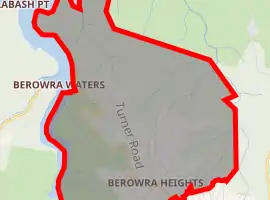
Berowra Heights is an outer suburb of Northern Sydney, in the state of New South Wales, Australia 39 kilometres north of the Sydney central business district, in the local government area of Hornsby Shire. Berowra Heights is north-west of the suburb of Berowra and east of Berowra Waters.
| Berowra Heights Sydney, New South Wales | |||||||||||||||
|---|---|---|---|---|---|---|---|---|---|---|---|---|---|---|---|
| |||||||||||||||
| Population | 5,264 (2016 census)[1] | ||||||||||||||
| Established | 1887 | ||||||||||||||
| Postcode(s) | 2082, 2081 | ||||||||||||||
| Location | 39 km (24 mi) north-west of Sydney CBD | ||||||||||||||
| LGA(s) | Hornsby Shire | ||||||||||||||
| State electorate(s) | Hornsby | ||||||||||||||
| Federal Division(s) | Berowra | ||||||||||||||
| |||||||||||||||
History
Berowra is an Aboriginal word that means place of many shells.
Berowra Heights Post Office opened on 2 September 1968.[2]
Demographics
According to the 2016 Census of Population, there are 5,264 residents of Berowra Heights. 78.1% of these residents were born in Australia, while the most common other countries of birth are England (7%), New Zealand (1.6%), China (0.8%), The Philippines (0.6%) and South Africa (0.6%). 89.6% of residents only speak English at home, while other languages spoken at home include Mandarin (0.9%), Spanish (0.5%), German (0.5%), Dutch (0.5%) and Russian (0.4)%. The most common religious affiliations are No Religion (34.7%), Catholic (22.8%) and Anglican (20%).[1]
Commercial area
Business is conducted in three shopping areas; the highway precinct, the Village Green and Berowra Marketplace (Foodtown). Businesses include a Bakers Delight, Bendigo Bank Community Bank, Coles supermarket, two pharmacies, a comprehensive medical centre and a range of restaurants.
Transport
Access to Berowra Heights is by road from Berowra, to the east, via Berowra Waters Road. Alternatively, the Berowra Waters Ferry, a car ferry, connects Berowra Waters with the western end of Berowra Waters Road. Transdev NSW route 599 provides a bus service from Berowra Heights to Berowra railway station and route 597 from Berowra to Hornsby railway station.
Schools
There are two primary schools in Berowra Heights and two in Berowra:
- St Bernard's Catholic Primary School (Berowra Heights).
- Wideview Public School (Berowra Heights).
- Berowra Public School (Berowra).
- Berowra Christian School (Berowra).
Churches
Together, Berowra and Berowra Heights have four churches:
- St Mark's Anglican Church (Berowra).
- Berowra Baptist Church (Berowra).
- St Bernard's Catholic Church (Berowra Heights).
- Berowra Uniting Church (Berowra Heights).
Services
Bush fires present a very real threat for the Berowra area due to the proximity of bushland. Fire protection for urbanised parts of Berowra Heights is provided by Station 75 (Berowra) of Fire and Rescue NSW and supported by Community Fire Units. Fire protection for bushland parts of Berowra Heights is provided by the NSW New South Wales Rural Fire Service, through the Berowra Rural Fire Brigade, located in new purpose built premises (opened 11 August 2018) at 14a Berowra Waters Road in Berowra.[3][4]
See also
References
- Australian Bureau of Statistics (27 June 2017). "Berowra Heights (State Suburb)". 2016 Census QuickStats. Retrieved 12 April 2018.

- Phoenix Auctions History. "Post Office List". Retrieved 19 January 2021.
- "Berowra brigade celebrates new station and honours members". NSW Rural Fire Service. 11 August 2018. Archived from the original on 31 March 2019. Retrieved 31 March 2019.
- "Welcome to Berowra Rural Fire Brigade". NSW Rural Fire Service. Archived from the original on 31 March 2019. Retrieved 31 March 2019.
Notes
- The Book of Sydney Suburbs, Compiled by Frances Pollen, Angus & Robertson Publishers, 1990, Published in Australia ISBN 0-207-14495-8
External links
- Berowra Community Home Page and Directory
- The Bush Telegraph: Local newsletter for Berowra and surrounding areas
- Niall Clugston (2008). "Berowra Heights". Dictionary of Sydney. Retrieved 25 September 2015. [CC-By-SA]