Mount Kuring-gai, New South Wales
Mount Kuring-gai is an outer suburb of Northern Sydney, in the state of New South Wales, Australia. Mount Kuring-gai is located 31 kilometres north-west of the Sydney central business district, in the local government area of Hornsby Shire. Mount Kuring-Gai is often referred to as “Far Northern” or Upper North Shore.
| Mount Kuring-gai Sydney, New South Wales | |||||||||||||||
|---|---|---|---|---|---|---|---|---|---|---|---|---|---|---|---|
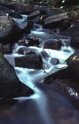 Cascades along Calna Creek | |||||||||||||||
| |||||||||||||||
| Population | 1,708 (2016 census)[1] | ||||||||||||||
| Postcode(s) | 2080 | ||||||||||||||
| Location | 31 km (19 mi) from Sydney CBD | ||||||||||||||
| LGA(s) | Hornsby Shire | ||||||||||||||
| State electorate(s) | Hornsby | ||||||||||||||
| Federal Division(s) | Berowra | ||||||||||||||
| |||||||||||||||
History
"Ku-ring-gai" is the anglicised term of the "Guringai", the indigenous people of the Sydney clan. These words both mean the same, it translates as an Aboriginal word that means hunting ground of the men. This area was once the home and hunting ground of the Ku-ring-gai Aborigines. The railway station opened on 5 October 1901 and was named Kuring-gai. The current station was constructed in 1909. The Mount was added to the name on 1 August 1904.
Kuring-gai Post Office opened on 27 January 1908 and was similarly renamed Mount Kuring-gai in 1933.[2]
Mount Kuring-gai Public School opened in 1957.
Population
In the 2016 Census, there were 1,708 people in Mount Kuring-Gai. 73.9% of people were born in Australia and 83.0% of people spoke only English at home. The most common responses for religion were No Religion 30.1%, Anglican 19.0% and Catholic 18.3%.[1]
Commercial areas and transport
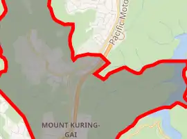
The suburb is divided in two by the Pacific Highway, Main Northern railway line and the Pacific Motorway.
The eastern side is home to a primary school, community hall and sports oval. The western side has a shopping centre, Mount Kuring-gai railway station and a Telstra telephone exchange. The east and west sides are connected by a road bridge and a pedestrian bridge.
In 2010, the existing shopping centre was demolished and an Aldi store was built in its place, along with a variety of other stores.
Mount Kuring-gai also has an industrial area which is home to many diverse businesses such as a hot air balloon manufacturer, electronics companies, a school paint manufacturer, a book publisher and one bus depot of Transdev NSW.
Geography
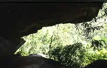
Mount Kuring-gai is located approximately 7 km north of Hornsby. Its neighbouring suburbs are Berowra to the north, and Mount Colah to the south. Surrounded by bushland, it is bordered by Ku-ring-gai Chase National Park on the eastern side and by Berowra Valley Regional Park on the western side. There are several bushwalks starting in the suburb including the Great North Walk and a path to Apple Tree Bay. Mount Kuring-gai varies in altitude from about 57 m to 214–221 m above sea level.[3][4]
See also
Notes
- Australian Bureau of Statistics (27 June 2017). "Mount Kuring-gai (State Suburb)". 2016 Census QuickStats. Retrieved 12 April 2018.

- Phoenix Auctions History. "Post Office List". Phoenix Auctions. Retrieved 21 January 2021.
- Mount Kuring-gai // bonzle
- Mount Kuring-gai // dictionary of Sydney
References
- The Book of Sydney Suburbs, Compiled by Frances Pollen, Angus & Robertson Publishers, 1990, Published in Australia ISBN 0-207-14495-8
External links
- Joan Rowland (2011). "Mount Kuring-gai". Dictionary of Sydney. Retrieved 28 September 2015. [CC-By-SA]