Boise Mountains
The Boise Mountains are a mountain range in the U.S. state of Idaho, spanning part of Boise and Sawtooth national forests.[4][3][5][6][7] The highest point in the range is Two Point Mountain at an elevation of 10,124 feet (3,086 m) above sea level.[1]
| Boise Mountains | |
|---|---|
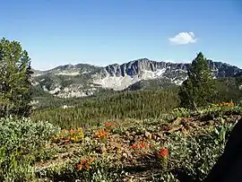 Mountains and Indian paintbrush (Castilleja sp.) in Boise National Forest | |
| Highest point | |
| Peak | Two Point Mountain |
| Elevation | 10,124 ft (3,086 m) [1] |
| Coordinates | 43°44′14″N 114°58′36″W [2] |
| Dimensions | |
| Length | 110 mi (180 km) E/W [3] |
| Width | 87 mi (140 km) N/S [3] |
| Area | 4,724 sq mi (12,240 km2) [3] |
| Geography | |
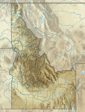 Location in Western Idaho | |
| Country | United States |
| State | Idaho |
| Range coordinates | 43°45′01″N 115°30′04″W [4] |
| Borders on | West Mountains |
| Topo map | USGS Barber Flat |
References
- "Two Point Mountain, Idaho". Peakbagger.com.
- "Two Point Mountain". Geographic Names Information System. United States Geological Survey.
- "Boise Mountains". Peakbagger.com.
- "Boise Mountains". Geographic Names Information System. United States Geological Survey.
- "About the forest". U.S. Forest Service. Archived from the original on August 14, 2014. Retrieved December 27, 2014.
- Sawtooth National Forest (Map). 1:126720. U.S. Forest Service. 2012.
- Boise National Forest (Map). 1:126720. U.S. Forest Service. 2012.
This article is issued from Wikipedia. The text is licensed under Creative Commons - Attribution - Sharealike. Additional terms may apply for the media files.