Baker Peak (Idaho)
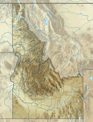
Baker Peak, at 10,174 feet (3,101 m) above sea level is the fifth-highest peak in the Smoky Mountains of the U.S. state of Idaho. Located in Sawtooth National Forest on the border of Blaine and Camas counties, Baker Peak is about 1.5 miles (2,400 m) east of Big Peak and 1.45 miles (2.33 kilometres) south of Backdrop Peak. It is the 407th-highest peak in Idaho.[3][4][5]
| Baker Peak | |
|---|---|
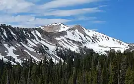 Baker Peak viewed from the Baker Lake Trail | |
| Highest point | |
| Elevation | 10,174 ft (3,101 m) [1] |
| Prominence | 1,074 ft (327 m) [1] |
| Coordinates | 43°40′12″N 114°40′47″W [2] |
| Geography | |
| Parent range | Smoky Mountains |
| Topo map | USGS Baker Peak |
| Climbing | |
| Easiest route | Simple scramble, class 2 |
References
- "Baker Peak". ListsOfJohn.com. Retrieved 2013-01-14.
- "Baker Peak". Geographic Names Information System. United States Geological Survey. Retrieved December 19, 2012.
- Sawtooth National Forest (Map) (1998 ed.). Sawtooth National Forest, U.S. Forest Service.
- "Baker Peak". Idaho Summits. Retrieved December 19, 2012.
- "Baker Peak". SummitPost.org. Retrieved December 19, 2012.
This article is issued from Wikipedia. The text is licensed under Creative Commons - Attribution - Sharealike. Additional terms may apply for the media files.
