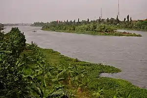
Brantas River
The Brantas is the longest river in East Java, Indonesia.[1] It has a length of 320 km,[2] and drains an area over 11,000 km² from the southern slope of Mount Kawi-Kelud-Butak, Mount Wilis, and the northern slopes of Mount Liman-Limas, Mount Welirang, and Mount Anjasmoro.[3] Its course is semi-circular or spiral in shape: at its source the river heads southeast, but gradually curves south, then southwest, then west, then north, and finally it flows generally eastward at the point where it branches off to become the Kalimas and Porong River.
| Brantas River Kali Brantas, Sungai Brantas | |
|---|---|
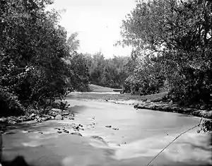
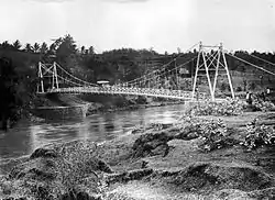 A suspension bridge above the Brantas near Kesamben, Kediri Residency, East Java (current day Kesamben, Blitar, East Java) (ca. 1922). | |
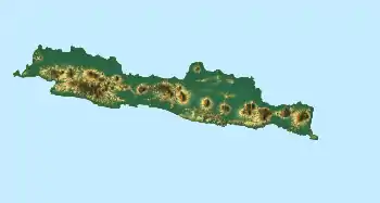 Location of river mouth  Brantas River (Indonesia) | |
| Location | |
| Country | Indonesia |
| Province | East Java |
| Physical characteristics | |
| Source | Arjuno-Welirang |
| Mouth | |
• location | Madura Strait |
| Length | 320 km (200 mi) |
| Basin size | 11,800 km2 (4,600 sq mi) |
History
King Mpu Sindok moved his kingdom from Mataram Kingdom in Central Java to a new location on this river at circa 950 A.D. Possibly (only one of a number of reasons given) due to a Mount Merapi volcanic eruption, he had to leave his kingdom to this new safe place near present city of Madiun.
Cities and regencies on Brantas River
Geography
The river flows in the eastern area of Java with predominantly tropical monsoon climate (designated as Am in the Köppen-Geiger climate classification).[4] The annual average temperature in the area is 26 °C. The warmest month is October, when the average temperature is around 30 °C, and the coldest is June, at 24 °C.[5] The average annual rainfall is 2982 mm. The wettest month is March, with an average of 496 mm rainfall, and the driest is August, with 28 mm rainfall.[6]
| Brantas River | ||||||||||||||||||||||||||||||||||||||||||||||||||||||||||||
|---|---|---|---|---|---|---|---|---|---|---|---|---|---|---|---|---|---|---|---|---|---|---|---|---|---|---|---|---|---|---|---|---|---|---|---|---|---|---|---|---|---|---|---|---|---|---|---|---|---|---|---|---|---|---|---|---|---|---|---|---|
| Climate chart (explanation) | ||||||||||||||||||||||||||||||||||||||||||||||||||||||||||||
| ||||||||||||||||||||||||||||||||||||||||||||||||||||||||||||
| ||||||||||||||||||||||||||||||||||||||||||||||||||||||||||||
References
- Kali Brantas at Geonames.org (cc-by); Last updated 2013-06-04; Database dump downloaded 2015-11-27
- Ramu, Kikkeri (December 2004). "Brantas River Basin Case Study, Indonesia" (PDF). Background Paper. Worldbank: 36. Cite journal requires
|journal=(help) - Whitten, T; Soeriaatmadja, R. E.; Suraya A. A. (1996). The Ecology of Java and Bali. Hong Kong: Periplus Editions Ltd. p. 132.
- Peel, M C; Finlayson, B L; McMahon, T A (2007). "Updated world map of the Köppen-Geiger climate classification". Hydrology and Earth System Sciences. 11 (5): 1633–1644. doi:10.5194/hess-11-1633-2007. Retrieved 30 January 2016.
- "NASA Earth Observations Data Set Index". NASA. 30 January 2016.
- "NASA Earth Observations: Rainfall (1 month - TRMM)". NASA/Tropical Rainfall Monitoring Mission. 30 January 2016.