Bumburet
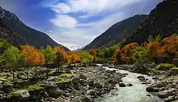
Bumburet (Kalasha: Mumuret, Urdu: وادی پمپوریت) is the largest valley of Kalasha Desh in Chitral District, Khyber Pakhtunkhwa the province of Pakistan.
Bumburet
وادی بمبوریت | |
|---|---|
Valley | |
 | |
 Bumburet  Bumburet | |
| Coordinates: 35°42′2″N 71°41′30″E | |
| Country | |
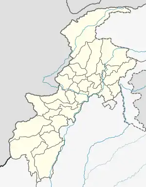
| State | Khyber Pakhtunkhwa |
| District | Chitral District |
| Elevation | 1,100 m (3,600 ft) |
| Time zone | UTC+5 (PST) |
The Bumburet valley joins the Rumbur valley at 35°44′20″N 71°43′40″E 1,640 metres (5,380 ft), and then joins the Kunar Valley at the village of Ayun (35°42′52″N 71°46′40″E, 1,400 metres (4,600 ft), some 20 kilometres (12 mi) south (downstream) of Chitral. To the west the valley rises to a pass connecting to Afghanistan's Nuristan Province at about 4,500 metres (14,800 ft). The valley is inhabited by the Kalash people, and has become a tourist destination.[1] However, their population is rapidly declining. As of 2019, only 37 households existed in the valley that still followed traditional practices.
References
- TP (2017-08-15). "Bumburet Valley". Today Pakistan. Retrieved 2020-09-28.
Kochetov, A., Arsenault, P., Petersen, J., Kalas, S., & Kalash, T. (2020). Kalasha (Bumburet variety). Journal of the International Phonetic Association, 1-22. doi:10.1017/S0025100319000367
Naeem, H., Rana, A., R., & Sarfarz, N. (June 2011). Attitude Measurement and Testing: An Empirical Study of Kalash People in Pakistan. INTERDISCIPLINARY JOURNAL OF CONTEMPORARY RESEARCH IN BUSINESS, vol 3, No 2. https://www.researchgate.net/profile/Muhammad_Atif22/publication/283190904_Exports_and_Economic_Growth_Empirical_Evidence_from_Canada/links/565bbdf908aefe619b24412a.pdf#page=1498
External links
![]() Media related to Bumburet Valley at Wikimedia Commons
Media related to Bumburet Valley at Wikimedia Commons
Pakistan articles | |||||||||||||||||||
|---|---|---|---|---|---|---|---|---|---|---|---|---|---|---|---|---|---|---|---|
| |||||||||||||||||||
| |||||||||||||||||||
| |||||||||||||||||||
| |||||||||||||||||||
| |||||||||||||||||||
| |||||||||||||||||||