Byron, Minnesota
Byron is a city in Olmsted County, Minnesota, United States, approximately five miles (8 km) west of Rochester on U.S. Route 14. It is surrounded by Kalmar Township.[8] The population was 4,914 at the 2010 census.[9]
- There are also two Byron Townships in Minnesota.
Byron | |
|---|---|
| Motto(s): "Where Neighbors Become Family"[1] | |
 Location of Byron, Minnesota | |
| Coordinates: 44°1′55″N 92°38′52″W | |
| Country | United States |
| State | Minnesota |
| County | Olmsted |
| Incorporated | 1873 |
| Government | |
| • Mayor | Andrew Ihrke[2] |
| • First Lady | Jordan Tanck |
| Area | |
| • Total | 3.03 sq mi (7.84 km2) |
| • Land | 3.03 sq mi (7.84 km2) |
| • Water | 0.00 sq mi (0.00 km2) |
| Elevation | 1,257 ft (383 m) |
| Population | |
| • Total | 4,914 |
| • Estimate (2019)[5] | 5,639 |
| • Density | 1,862.90/sq mi (719.19/km2) |
| Time zone | UTC-6 (Central (CST)) |
| • Summer (DST) | UTC-5 (CDT) |
| ZIP code | 55920 |
| Area code(s) | 507 |
| FIPS code | 27-09154[6] |
| GNIS feature ID | 0640721[7] |
| Website | |
Local industries are in the form of farm services and printing. A grain elevator is situated next to the rail line that runs through town, which is owned by the Dakota, Minnesota and Eastern Railroad. Schmidt Printing (a subsidiary of Taylor Corporation) is another major company in town. Byron is also a bedroom community for nearby Rochester.
History
Byron was platted in 1864.[10] The city was named after Port Byron, New York by a settler from that place.[11] A post office called Byron has been in operation since 1868.[12] Byron was incorporated in 1873.[10] Before the town was established a small community was in the area. This community was known as Bear Grove, which was just west outside the current city limits.
Geography
According to the United States Census Bureau, the city has a total area of 2.91 square miles (7.54 km2), all of it land.[13]
Demographics
| Historical population | |||
|---|---|---|---|
| Census | Pop. | %± | |
| 1880 | 222 | — | |
| 1890 | 291 | 31.1% | |
| 1900 | 347 | 19.2% | |
| 1910 | 272 | −21.6% | |
| 1920 | 302 | 11.0% | |
| 1930 | 323 | 7.0% | |
| 1940 | 341 | 5.6% | |
| 1950 | 385 | 12.9% | |
| 1960 | 660 | 71.4% | |
| 1970 | 1,419 | 115.0% | |
| 1980 | 1,715 | 20.9% | |
| 1990 | 2,441 | 42.3% | |
| 2000 | 3,500 | 43.4% | |
| 2010 | 4,914 | 40.4% | |
| 2019 (est.) | 5,639 | [5] | 14.8% |
| U.S. Decennial Census[14] | |||
2010 census
As of the census[4] of 2010, there were 4,914 people, 1,796 households, and 1,366 families residing in the city. The population density was 1,688.7 inhabitants per square mile (652.0/km2). There were 1,891 housing units at an average density of 649.8 per square mile (250.9/km2). The racial makeup of the city was 96.2% White, 0.7% African American, 0.1% Native American, 1.0% Asian, 0.1% Pacific Islander, 0.5% from other races, and 1.4% from two or more races. Hispanic or Latino of any race were 1.8% of the population.
There were 1,796 households, of which 44.7% had children under the age of 18 living with them, 60.7% were married couples living together, 11.6% had a female householder with no husband present, 3.8% had a male householder with no wife present, and 23.9% were non-families. 18.9% of all households were made up of individuals, and 4.6% had someone living alone who was 65 years of age or older. The average household size was 2.73 and the average family size was 3.15.
The median age in the city was 33.1 years. 31.1% of residents were under the age of 18; 7.4% were between the ages of 18 and 24; 29.8% were from 25 to 44; 24.3% were from 45 to 64; and 7.3% were 65 years of age or older. The gender makeup of the city was 49.4% male and 50.6% female.
Transportation
A commuter bus service to Rochester is operated by Rochester City Lines and has three trips daily through Byron each day. Two of those three go directly to a park-and-ride lot on the eastern edge of town, while the third zig-zags through the city to pick up customers.
The DM&E rail line was originally built by the Winona and St. Peter Railroad, which reached west through town to neighboring Kasson in 1865. The railroad is a major reason why Byron exists at all. The station was located west of what is now Byron Avenue, and was rebuilt in 1883.[15] The Chicago and North Western Railway gained control of the Winona and St. Peter a few years after the line reached Byron. The C&NW operated the line until the 1980s, when it was spun off to create the DM&E.
Community and government
Byron has a mayor and a four-member city council. There are also four other government boards including an economic development authority and a park board. Byron City Hall is near the elementary school on 10th Avenue. It is also a fairly new structure. The old city hall is in the center of town at Byron Avenue and 4th Street and was built in 1938.[16] The city's first water tower was built next to that location in 1935, and torn down around 2004. The Byron city flag consists of three strips of blue, white, and green. It has 3 stars and a bear in the center of the white stripe. The flag's design was chosen in a citywide contest and the winning design was by Jeff and Allison Ihrke.
The once-weekly Byron Review newspaper covers city events. It is owned by Community News Corporation, which also operates papers in Hayfield and Dodge Center.
Parks and recreation
Parks
One of the major parks in the county, Oxbow Park and Zollman Zoo, is 3.5 miles north of town. The zoo has dozens of animals from thirty different native species, including a number of birds, a mountain lion, wolves, otters, white-tailed deer, and some bison.
Byron has several city parks, a public pool open in the summer, and many recreational fields, such as soccer and baseball fields.[17]
Golf
Byron is home to two golf courses. Somerby Golf Club and Community is a private golf club and community on the north side of the city. Links of Byron is on the south side, and is a 9-hole, executive-length public course. The Links of Byron closed in 2015.
References
- "Official Website for the City of Byron Minnesota". Official Website for the City of Byron Minnesota. Retrieved October 4, 2012.
- https://www.byronmn.com/index.asp?SEC=CFE1A3F3-75A7-494F-81A1-C107598C811F&DE=14A1B9F8-E667-4D97-9DDC-88588A29D4DA. Missing or empty
|title=(help) - "2019 U.S. Gazetteer Files". United States Census Bureau. Retrieved July 26, 2020.
- "American FactFinder". United States Census Bureau. Archived from the original on February 12, 2020. Retrieved November 13, 2012.
- "Population and Housing Unit Estimates". United States Census Bureau. May 24, 2020. Retrieved May 27, 2020.
- "American FactFinder". United States Census Bureau. Archived from the original on 2020-02-12. Retrieved 2008-01-31.
- "US Board on Geographic Names". United States Geological Survey. October 25, 2007. Retrieved January 31, 2008.
- "Township Information". Olmsted County. Archived from the original on December 31, 2009. Retrieved January 4, 2010.
- "2010 Census Redistricting Data (Public Law 94-171) Summary File". American FactFinder. United States Census Bureau. Retrieved April 27, 2011.
- Upham, Warren (1920). Minnesota Geographic Names: Their Origin and Historic Significance. Minnesota Historical Society. p. 385.
- Chicago and North Western Railway Company (1908). A History of the Origin of the Place Names Connected with the Chicago & North Western and Chicago, St. Paul, Minneapolis & Omaha Railways. p. 50.
- "Olmsted County". Jim Forte Postal History. Retrieved July 27, 2015.
- "US Gazetteer files 2010". United States Census Bureau. Archived from the original on January 12, 2012. Retrieved 2012-11-13.
- "Census of Population and Housing". Census.gov. Archived from the original on April 26, 2015. Retrieved June 4, 2015.
- http://www.west2k.com/mnstations/olmsted.shtml
- "History". Byron, Minnesota. Retrieved December 31, 2009.
- "Welcome to the City of Byron Parks!". www.byronmn.com. Retrieved April 26, 2020.
External links
Municipalities and communities of Olmsted County, Minnesota, United States | ||
|---|---|---|
| Cities | 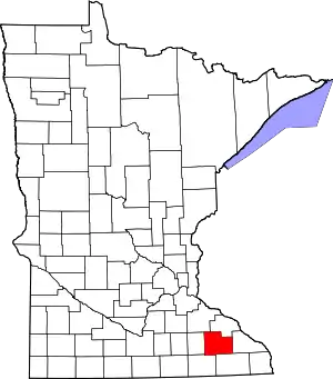 Map of Minnesota highlighting Olmsted County | |
| Townships | ||
| Unincorporated communities | ||
| Footnotes | ‡This populated place also has portions in an adjacent county or counties | |
| ||
| Core city | 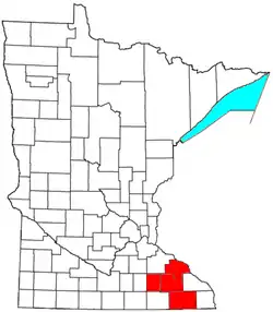 | |
|---|---|---|
| Incorporated Places | ||
| Counties | ||
‡ indicates that it is partially in the metropolitan area. † indicates a county seat. | ||
| Authority control |
|---|
