Fillmore County, Minnesota
Fillmore County is a county in the U.S. state of Minnesota. As of the 2010 United States Census, the population was 20,866.[1] Its county seat is Preston.[2]
Fillmore County | |
|---|---|
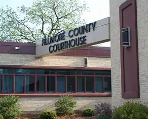 Fillmore County Courthouse | |
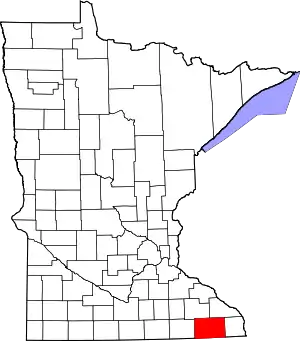 Location within the U.S. state of Minnesota | |
 Minnesota's location within the U.S. | |
| Coordinates: 43°41′N 92°05′W | |
| Country | |
| State | |
| Founded | March 5, 1853 |
| Named for | Millard Fillmore |
| Seat | Preston |
| Largest city | Spring Valley |
| Area | |
| • Total | 862 sq mi (2,230 km2) |
| • Land | 861 sq mi (2,230 km2) |
| • Water | 0.8 sq mi (2 km2) 0.09%% |
| Population (2010) | |
| • Total | 20,866 |
| • Estimate (2019) | 21,067 |
| • Density | 24.4/sq mi (9.4/km2) |
| Time zone | UTC−6 (Central) |
| • Summer (DST) | UTC−5 (CDT) |
| Congressional district | 1st |
| Website | www |
Fillmore County is included in the Rochester, MN Metropolitan Statistical Area.
History
Fillmore County was created on March 5, 1853.[3] It is named for Millard Fillmore, the 13th President of the United States.[4] Fillmore County was an early destination for Euro-American settlement following the United States' 1851 treaties with the Dakota nations. Norwegian immigrants were particularly numerous. In 1860 Fillmore was Minnesota's most populous county.[5]
Geography
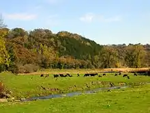
Fillmore County is on Minnesota's border with Iowa. The Root River drains the county, flowing eastward. The North Branch and the Middle Branch combine east of Shady Creek, while the South Branch meets their combined flow at Preston. Bear Creek drains the lower part of the county, discharging into the Root in the eastern part of the county. Willow Creek also drains a portion of the lower county, discharging into the Root at Preston. The Upper Iowa River flows eastward, mostly in adjoining Iowa counties, but briefly enters Fillmore County near the midpoint of its southern border.
The county's terrain consists of rolling hills, carved by gullies and drainages, with the available area dedicated to agriculture.[6] The terrain slopes to the east; its highest point is on the lower western border, at 1,378' (420m) ASL.[7] The county has a total area of 862 square miles (2,230 km2), of which 861 square miles (2,230 km2) is land and 0.8 square miles (2.1 km2) (0.09%) is water.[8]
The county is part of the Driftless Area or Paleozoic plateau. This part of Minnesota was ice-free during the last ice age. Fillmore County also displays a karst topography.
Major highways
Adjacent counties
- Winona County - northeast
- Houston County - east
- Winneshiek County, Iowa - southeast
- Howard County, Iowa - southwest
- Mower County - west
- Olmsted County - northwest
Protected areas[6]
- Forestville/Mystery Cave State Park
- Mystery Cave State Park
- Pin Oak Prairie Scientific and Natural Area
- Rushford Sand Barrens Scientific and Natural Area
- Wycoff Balsam Fir Scientific and Natural Area
Demographics
| Historical population | |||
|---|---|---|---|
| Census | Pop. | %± | |
| 1860 | 13,542 | — | |
| 1870 | 24,887 | 83.8% | |
| 1880 | 28,162 | 13.2% | |
| 1890 | 25,996 | −7.7% | |
| 1900 | 28,288 | 8.8% | |
| 1910 | 25,680 | −9.2% | |
| 1920 | 25,330 | −1.4% | |
| 1930 | 24,748 | −2.3% | |
| 1940 | 25,830 | 4.4% | |
| 1950 | 24,465 | −5.3% | |
| 1960 | 23,768 | −2.8% | |
| 1970 | 21,916 | −7.8% | |
| 1980 | 21,930 | 0.1% | |
| 1990 | 20,777 | −5.3% | |
| 2000 | 21,122 | 1.7% | |
| 2010 | 20,866 | −1.2% | |
| 2019 (est.) | 21,067 | [10] | 1.0% |
| US Decennial Census[11] 1790-1960[12] 1900-1990[13] 1990-2000[14] 2010-2019[1] | |||
2010 census
As of the 2010 United States Census,[15] there were 20,866 people, 8,545 households, and 5,763 families in the county. The population density was 24.2/sqmi (9.36/km2). There were 9,732 housing units at an average density of 11.3/sqmi (4.36/km2). The racial makeup of the county was 98.2% White, 0.2% Black or African American, 0.10% Native American, 0.3% Asian, 0.3% from other races, and 0.8% from two or more races. 1% of the population were Hispanic or Latino of any race.
There were 8,545 households, out of which 29.4% had children under the age of 18 living with them, 56.4% were married couples living together, 7% had a female householder with no husband present, 4% had a male householder with no wife present, and 32.60% were non-families. 28.30% of all households were made up of individuals, and 7.32% had someone living alone who was 65 years of age or older. The average household size was 2.40 and the average family size was 2.94.
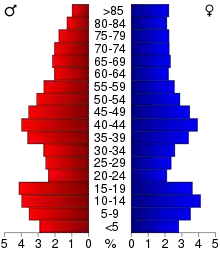
The county population contained 24.3% under the age of 18, 6.5% from 18 to 24, 21.9% from 25 to 44, 28.20% from 45 to 64, and 17.10% who were 65 years of age or older. The median age was 43 years. For every 100 females there were 97.30 males. For every 100 females age 18 and over, there were 98.80 males.
In 2010, the median income for a household in the county was $45,888, and the median income for a family was $59,034. Males had a median income of $39,239 versus $33,571 for females. 2015 estimates state the per capita income for the county was $26,348. In 2015, about 7.4% of families and 11.10% of the population were below the poverty line, including 16.50% of those under age 18 and 10.9% of those age 65 or over.[16]
Communities
Cities
Unincorporated communities
Townships
- Amherst Township
- Arendahl Township
- Beaver Township
- Bloomfield Township
- Bristol Township
- Canton Township
- Carimona Township
- Carrolton Township
- Chatfield Township
- Fillmore Township
- Forestville Township
- Fountain Township
- Harmony Township
- Holt Township
- Jordan Township
- Newburg Township
- Norway Township
- Pilot Mound Township
- Preble Township
- Preston Township
- Spring Valley Township
- Sumner Township
- York Township
Government and politics
Fillmore County was a swing county up until the 2016 presidential election. From 1980 to 2016, the county predicted the president 67% of the time. Since 2016, Fillmore County has shifted towards the right and has voted for the republican candidate by double digits.
Political Culture
| Year | Republican | Democratic | Third parties |
|---|---|---|---|
| 2020 | 60.1% 7,301 | 37.5% 4,551 | 2.4% 289 |
| 2016 | 56.7% 6,271 | 35.0% 3,872 | 8.3% 912 |
| 2012 | 45.1% 4,913 | 52.5% 5,713 | 2.4% 266 |
| 2008 | 44.5% 4,993 | 52.7% 5,921 | 2.9% 320 |
| 2004 | 48.7% 5,694 | 49.8% 5,825 | 1.5% 179 |
| 2000 | 45.5% 4,646 | 49.1% 5,020 | 5.5% 557 |
| 1996 | 35.2% 3,466 | 48.0% 4,732 | 16.9% 1,663 |
| 1992 | 33.6% 3,583 | 37.3% 3,977 | 29.1% 3,098 |
| 1988 | 54.4% 5,004 | 44.7% 4,114 | 0.9% 82 |
| 1984 | 58.9% 6,342 | 40.4% 4,351 | 0.6% 67 |
| 1980 | 57.0% 6,452 | 35.5% 4,010 | 7.5% 850 |
| 1976 | 54.6% 5,984 | 43.4% 4,758 | 2.0% 215 |
| 1972 | 67.9% 7,107 | 30.2% 3,155 | 1.9% 198 |
| 1968 | 59.0% 6,257 | 36.9% 3,918 | 4.1% 432 |
| 1964 | 45.3% 4,824 | 54.6% 5,813 | 0.1% 14 |
| 1960 | 65.6% 7,507 | 34.3% 3,926 | 0.1% 11 |
| 1956 | 67.1% 7,004 | 32.8% 3,427 | 0.1% 9 |
| 1952 | 76.0% 8,405 | 23.6% 2,612 | 0.4% 40 |
| 1948 | 55.2% 5,587 | 43.6% 4,414 | 1.3% 127 |
| 1944 | 66.3% 6,339 | 33.3% 3,183 | 0.4% 40 |
| 1940 | 67.0% 7,839 | 32.7% 3,826 | 0.3% 39 |
| 1936 | 48.6% 5,054 | 45.8% 4,764 | 5.6% 586 |
| 1932 | 48.2% 4,979 | 50.0% 5,166 | 1.7% 180 |
| 1928 | 77.8% 7,719 | 21.6% 2,143 | 0.6% 63 |
| 1924 | 62.8% 5,550 | 5.2% 460 | 32.1% 2,835 |
| 1920 | 85.9% 7,341 | 10.5% 899 | 3.6% 304 |
| 1916 | 65.2% 2,945 | 29.1% 1,313 | 5.7% 259 |
| 1912 | 26.2% 1,169 | 22.2% 990 | 51.6% 2,301 |
| 1908 | 69.9% 3,259 | 24.7% 1,153 | 5.4% 254 |
| 1904 | 80.2% 3,242 | 13.7% 554 | 6.2% 249 |
| 1900 | 69.8% 3,741 | 25.5% 1,364 | 4.7% 254 |
| 1896 | 66.1% 4,195 | 30.5% 1,939 | 3.4% 217 |
| 1892 | 56.5% 2,925 | 26.0% 1,346 | 17.5% 903 |
| Position | Name | District | Next Election | |
|---|---|---|---|---|
| Commissioner | Mitch Lentz | District 1 | 2020 | |
| Commissioner | Randy Dahl | District 2 | 2022 | |
| Commissioner | Larry Hindt | District 3 | 2020 | |
| Commissioner | Duane Bakke | District 4 | 2022 | |
| Commissioner | Marc Prestby | District 5 | 2020 | |
| Position | Name | Affiliation | District | |
|---|---|---|---|---|
| Senate | Jeremy Miller[19] | Republican | District 28 | |
| House of Representatives | Greg Davids[20] | Republican | District 28B | |
| Position | Name | Affiliation | District | |
|---|---|---|---|---|
| House of Representatives | Jim Hagedorn[21] | Republican | 1st | |
| Senate | Amy Klobuchar[22] | Democrat | N/A | |
| Senate | Tina Smith[23] | Democrat | N/A | |
See also
References
- "State & County QuickFacts". United States Census Bureau. Archived from the original on June 7, 2011. Retrieved August 31, 2013.
- "Find a County". National Association of Counties. Archived from the original on May 31, 2011. Retrieved June 7, 2011.
- Upham, Warren (1920). Minnesota Geographic Names: Their Origin and Historic Significance. Minnesota Historical Society. p. 190.
- Gannett, Henry (1905). The Origin of Certain Place Names in the United States. Govt. Print. Off. p. 125.
- Frame III, Robert M. (July 1981). "National Register of Historic Places Inventory—Nomination Form: Fillmore County Multiple Resource Area". National Park Service. Retrieved February 25, 2014. Cite journal requires
|journal=(help) - Fillmore County MN Google Maps (accessed 8 March 2019)
- ""Find an Altitude/Fillmore County MN" Google Maps (accessed 8 March 2019)". Archived from the original on May 21, 2019. Retrieved March 8, 2019.
- "2010 Census Gazetteer Files". US Census Bureau. August 22, 2012. Archived from the original on September 21, 2013. Retrieved October 15, 2014.
- Nelson, Steven (2011). Savanna Soils of Minnesota. Minnesota: Self. pp. 43-48. ISBN 978-0-615-50320-2.
- "Population and Housing Unit Estimates". Retrieved March 26, 2020.
- "US Decennial Census". United States Census Bureau. Retrieved October 15, 2014.
- "Historical Census Browser". University of Virginia Library. Retrieved October 15, 2014.
- "Population of Counties by Decennial Census: 1900 to 1990". US Census Bureau. Retrieved October 15, 2014.
- "Census 2000 PHC-T-4. Ranking Tables for Counties: 1990 and 2000" (PDF). US Census Bureau. Retrieved October 15, 2014.
- "U.S. Census website". Retrieved July 8, 2017.
- "U.S. Census website". Retrieved July 18, 2017.
- Leip, David. "Atlas of US Presidential Elections". uselectionatlas.org. Retrieved April 8, 2018.
- "Commissioners". www.co.fillmore.mn.us. Retrieved June 25, 2020.
- "MN State Senate". www.senate.mn. Retrieved June 25, 2020.
- "Rep. Greg Davids (28B) - Minnesota House of Representatives". www.house.leg.state.mn.us. Retrieved June 25, 2020.
- "Representative Jim Hagedorn". Representative Jim Hagedorn. Retrieved June 25, 2020.
- "U.S. Senator Amy Klobuchar". www.klobuchar.senate.gov. Retrieved June 24, 2020.
- "Home". Senator Tina Smith. Retrieved June 24, 2020.
External links
Places adjacent to Fillmore County, Minnesota | ||||||||||
|---|---|---|---|---|---|---|---|---|---|---|
| ||||||||||
Municipalities and communities of Fillmore County, Minnesota, United States | ||
|---|---|---|
| Cities | Map of Minnesota highlighting Fillmore County | |
| Townships | ||
| Unincorporated communities | ||
| Ghost towns | ||
| Footnotes | ||
| ||
| Core city | 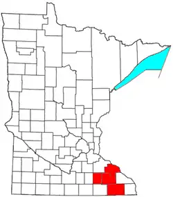 | |
|---|---|---|
| Incorporated Places | ||
| Counties | ||
‡ indicates that it is partially in the metropolitan area. † indicates a county seat. | ||

| Authority control |
|---|