Cachipay, Cundinamarca
Cachipay is a municipality and town of Colombia in the Tequendama Province, part of the department of Cundinamarca. Cachipay borders Quipile in the west, Zipacón in the east, Anolaima in the north and La Mesa in the south. The urban centre is located 53 kilometres (33 mi) east of Bogotá.[1]
Cachipay | |
|---|---|
Municipality and town | |
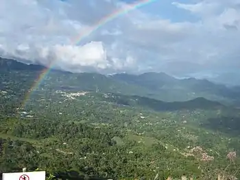 Rainbow at the view of Cachipay | |
.svg.png.webp) Flag  Seal | |
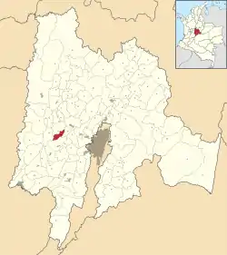 Location of the municipality and town inside Cundinamarca Department of Colombia | |
 Cachipay Location in Colombia | |
| Coordinates: 4°43′51″N 74°26′15″W | |
| Country | |
| Department | |
| Province | Tequendama Province |
| Founded | 26 November 1982 |
| Government | |
| • Mayor | Efraín Moncada Sánchez (2020-2023) |
| Area | |
| • Municipality and town | 56 km2 (22 sq mi) |
| Elevation | 1,600 m (5,200 ft) |
| Population (2015) | |
| • Municipality and town | 9,833 |
| • Density | 180/km2 (450/sq mi) |
| • Urban | 3,153 |
| Time zone | UTC-5 (Colombia Standard Time) |
| Website | Official website |
Etymology
The name Cachipay is probably derived from the Chibcha name for a fruit similar to the typical Colombian fruit corozo.[1]
History
The history of the present municipality of Cachipay dates back at least to the Herrera Period, from which ceramics have been found in the current vereda Tocarema, dated at 2750 years BP (750 BCE).[2] The region before the Spanish conquest of the Muisca was inhabited by the Panche people, who were in constant conflict with the Muisca inhabiting the Altiplano Cundiboyacense to the east.
Tocarema was the site of the Battle of Tocarema on August 20, 1538, where an alliance of Muisca guecha warriors and troops of the Spanish conquistador Gonzalo Jiménez de Quesada confronted and submitted the Panche, due to their superior weaponry, calvalry and the dogs trained for war.[1]
Modern Cachipay was not founded until November 26, 1982.[1]
Gallery
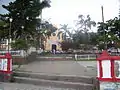 Central square of Cachipay
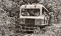 Former train in Cachipay
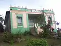 Colonial house
 Council house
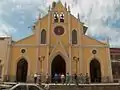 Church of Cachipay
References
- (in Spanish) Official website Cachipay
- Argüello García, Pedro María. 2015. Subsistence economy and chiefdom emergence in the Muisca area. A study of the Valle de Tena (PhD), 1–193. University of Pittsburgh. Accessed 2016-07-08.
| Wikimedia Commons has media related to Cachipay. |