Sutatausa
Sutatausa (Spanish pronunciation: [sutaˈtawsa]) is a municipality and town of Colombia in the Ubaté Province, part of the department of Cundinamarca. The municipality is located on the Altiplano Cundiboyacense at a distance of 88 kilometres (55 mi) from the capital Bogotá and borders Ubaté in the north, Tausa in the south, Cucunubá in the east and Carmen de Carupa and Tausa in the west.[1]
Sutatausa | |
|---|---|
Municipality and town | |
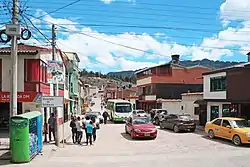 Street in Sutatausa | |
.svg.png.webp) Flag  Seal | |
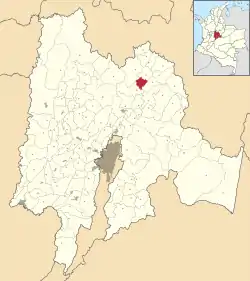 Location of the municipality and town inside Cundinamarca Department of Colombia | |
 Sutatausa Location in Colombia | |
| Coordinates: 5°14′50″N 73°51′9″W | |
| Country | |
| Department | |
| Province | Ubaté Province |
| Founded | 24 June 1537 |
| Founded by | Hernán Pérez de Quesada |
| Government | |
| • Mayor | Hugo Orlando Santa Rodríguez (2016-2019) |
| Area | |
| • Municipality and town | 67 km2 (26 sq mi) |
| Elevation | 2,550 m (8,370 ft) |
| Population (2015) | |
| • Municipality and town | 5,564 |
| • Density | 83/km2 (220/sq mi) |
| • Urban | 1,743 |
| Time zone | UTC-5 (Colombia Standard Time) |
| Website | Official website |
History
The area of Sutatause before the Spanish conquest was inhabited by the Muisca, organised in their loose Muisca Confederation. Sutatausa was ruled by the zipa based in Bacatá.
Modern Sutatausa was founded on June 24 (Saint John's day), 1537 by Hernán Pérez de Quesada, brother of conquistador Gonzalo Jiménez de Quesada, who on the same day founded Tenza.[1]
Economy
Main economical activities of Sutatausa are agriculture, dairy farming and small-scale mining. Tourism is also an important factor of income.[1]
Gallery
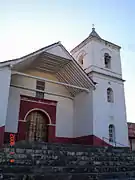 Church of Sutatausa
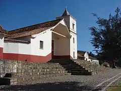 Church
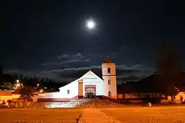 Church by night
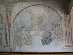 Church interior;
Last Supper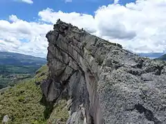 Rock outcrop in Sutatausa
References
- (in Spanish) Official website Sutatausa Archived 2016-02-12 at the Wayback Machine
