Gachancipá
Gachancipá is a municipality and town of Colombia in the Central Savanna Province, part of the department of Cundinamarca. The urban centre is located on the Altiplano Cundiboyacense at 42 kilometres (26 mi) from the capital Bogotá. The municipality borders Guatavita and Tocancipá in the south, Sesquilé and Guatavita in the east, Nemocón in the west and Suesca in the north.[1]
Gachancipá | |
|---|---|
Municipality and town | |
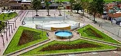 Central square | |
 Flag  Seal | |
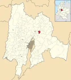 Location of the municipality and town inside Cundinamarca department of Colombia | |
 Gachancipá Location in Colombia | |
| Coordinates: 4°59′27″N 73°52′23″W | |
| Country | |
| Department | |
| Province | Central Savanna Province |
| Founded | 1 January 1612 |
| Government | |
| • Mayor | José Joaquín Cubides Ariza (2016-2019) |
| Area | |
| • Municipality and town | 44 km2 (17 sq mi) |
| • Urban | 42.5086 km2 (16.4127 sq mi) |
| Elevation | 2,568 m (8,425 ft) |
| Population (2015) | |
| • Municipality and town | 14,442 |
| • Density | 330/km2 (850/sq mi) |
| • Urban | 8,365 |
| Time zone | UTC-5 (Colombia Standard Time) |
| Website | Official website |
History
The area of Gachancipá before the Spanish conquest was inhabited by the Muisca, organised in their loose Muisca Confederation. Gachancipá, as the name suggests, was ruled by the zipa based in Bacatá.
Modern Gachancipá was founded on January 1, 1612 but the founders are unknown.[1]
In the late 18th century Muisca scholar José Domingo Duquesne was based in Gachancipá. A school in the town is named after him.[2]
Economy
The economy of Gachancipá traditionally was centered around agriculture and livestock farming. In recent years flowers are cultivated in the municipality.[1]
Gallery
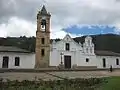 Church of Gachancipá
 Church
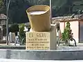 Monument to the indigenous people
References
- (in Spanish) Official website Gachancipá Archived 2014-03-10 at Archive.today
- (in Spanish) School named after Duquesne in Gachancipá
| Wikimedia Commons has media related to Gachancipá. |
