Caloire
Çaloire (French pronunciation: [salwaʁ]) is a commune in the Loire department in central France.
Çaloire | |
|---|---|
.svg.png.webp) Coat of arms | |
Location of Çaloire 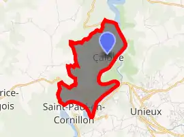
| |
 Çaloire  Çaloire | |
| Coordinates: 45°25′11″N 4°14′36″E | |
| Country | France |
| Region | Auvergne-Rhône-Alpes |
| Department | Loire |
| Arrondissement | Saint-Étienne |
| Canton | Firminy |
| Intercommunality | Saint-Étienne Métropole |
| Government | |
| • Mayor (2014–2020) | Gilles Estable |
| Area 1 | 4.7 km2 (1.8 sq mi) |
| Population (2017-01-01)[1] | 316 |
| • Density | 67/km2 (170/sq mi) |
| Time zone | UTC+01:00 (CET) |
| • Summer (DST) | UTC+02:00 (CEST) |
| INSEE/Postal code | 42031 /42240 |
| Elevation | 421–772 m (1,381–2,533 ft) (avg. 540 m or 1,770 ft) |
| 1 French Land Register data, which excludes lakes, ponds, glaciers > 1 km2 (0.386 sq mi or 247 acres) and river estuaries. | |
It is close to the villages of Unieux, Chambles and Saint-Paul-en-Cornillon, and 5 km northwest of Firminy, the largest town in the area.
Population
| Year | Pop. | ±% |
|---|---|---|
| 1793 | 295 | — |
| 1806 | 299 | +1.4% |
| 1821 | 291 | −2.7% |
| 1831 | 335 | +15.1% |
| 1841 | 267 | −20.3% |
| 1851 | 242 | −9.4% |
| 1861 | 213 | −12.0% |
| 1872 | 166 | −22.1% |
| 1881 | 175 | +5.4% |
| 1891 | 201 | +14.9% |
| 1901 | 159 | −20.9% |
| 1911 | 150 | −5.7% |
| 1921 | 110 | −26.7% |
| 1931 | 135 | +22.7% |
| 1946 | 101 | −25.2% |
| 1954 | 139 | +37.6% |
| 1962 | 124 | −10.8% |
| 1968 | 108 | −12.9% |
| 1975 | 169 | +56.5% |
| 1982 | 195 | +15.4% |
| 1990 | 227 | +16.4% |
| 1999 | 273 | +20.3% |
| 2006 | 320 | +17.2% |
| 2015 | 339 | +5.9% |
See also
References
- "Populations légales 2017". INSEE. Retrieved 6 January 2020.
External links
- (in French) Çaloire website
- (in French) Saint-Étienne Metro website
| Wikimedia Commons has media related to Çaloire. |
| Authority control |
|---|
This article is issued from Wikipedia. The text is licensed under Creative Commons - Attribution - Sharealike. Additional terms may apply for the media files.
