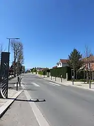
Saint-André-le-Puy
Saint-André-le-Puy (French pronunciation: [sɛ̃.t‿ɑ̃dʁe lə pɥi]) is a commune in the Loire department in central France.
Saint-André-le-Puy | |
|---|---|
Commune | |
 | |
.svg.png.webp) Coat of arms | |
Location of Saint-André-le-Puy 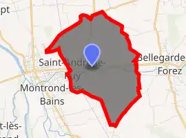
| |
 Saint-André-le-Puy  Saint-André-le-Puy | |
| Coordinates: 45°38′47″N 4°15′39″E | |
| Country | France |
| Region | Auvergne-Rhône-Alpes |
| Department | Loire |
| Arrondissement | Montbrison |
| Canton | Andrézieux-Bouthéon |
| Government | |
| • Mayor (2020–2026) | Jean Achard |
| Area 1 | 8.66 km2 (3.34 sq mi) |
| Population | 1,539 |
| • Density | 180/km2 (460/sq mi) |
| Time zone | UTC+01:00 (CET) |
| • Summer (DST) | UTC+02:00 (CEST) |
| INSEE/Postal code | 42200 /42210 |
| Elevation | 357–374 m (1,171–1,227 ft) (avg. 383 m or 1,257 ft) |
| 1 French Land Register data, which excludes lakes, ponds, glaciers > 1 km2 (0.386 sq mi or 247 acres) and river estuaries. | |
Location
It is located 26 km (16 mi) from Saint-Étienne (turn off the N89 westbound at Montrond-les-Bains onto the N82 southwards).
Population
| Year | Pop. | ±% |
|---|---|---|
| 1793 | 300 | — |
| 1806 | 266 | −11.3% |
| 1821 | 293 | +10.2% |
| 1831 | 279 | −4.8% |
| 1841 | 356 | +27.6% |
| 1851 | 367 | +3.1% |
| 1861 | 374 | +1.9% |
| 1872 | 438 | +17.1% |
| 1881 | 454 | +3.7% |
| 1891 | 476 | +4.8% |
| 1901 | 500 | +5.0% |
| 1911 | 475 | −5.0% |
| 1921 | 441 | −7.2% |
| 1931 | 480 | +8.8% |
| 1946 | 523 | +9.0% |
| 1954 | 555 | +6.1% |
| 1962 | 595 | +7.2% |
| 1968 | 653 | +9.7% |
| 1975 | 662 | +1.4% |
| 1982 | 1,002 | +51.4% |
| 1990 | 1,151 | +14.9% |
| 1999 | 1,182 | +2.7% |
| 2009 | 1,256 | +6.3% |
| 2016 | 1,545 | +23.0% |
Miscellaneous
Puy derives from the Provençal word "Puech", meaning an isolated hill. It rejected the proposed European Constitution by 60%.
See also
External links
All sites in French, unless otherwise indicated
- Weather for Saint-André-le-Puy
- Financial Data for Saint-André-le-Puy from the Ministry of the Economy, Finances and Industry
- Picture of the belltower of the parish church
Map links
- Map and list of communes of the Loire
- Map of Saint-André-le-Puy on the Institut Géographique National site
- Saint-André-le-Puy on the Cassini map
- Calculate straight-line distance from Saint-André-le-Puy to other towns in the Loire
| Wikimedia Commons has media related to Saint-André-le-Puy. |
| Authority control |
|---|
This article is issued from Wikipedia. The text is licensed under Creative Commons - Attribution - Sharealike. Additional terms may apply for the media files.