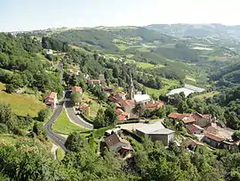
Valfleury
Valfleury is a commune in the Loire department in central France.
Valfleury | |
|---|---|
Commune | |
 | |
Location of Valfleury 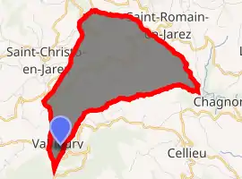
| |
 Valfleury  Valfleury | |
| Coordinates: 45°31′23″N 4°29′36″E | |
| Country | France |
| Region | Auvergne-Rhône-Alpes |
| Department | Loire |
| Arrondissement | Saint-Étienne |
| Canton | Sorbiers |
| Intercommunality | Saint-Étienne Métropole |
| Government | |
| • Mayor (2014–2020) | Michel Maisonnette |
| Area 1 | 8.77 km2 (3.39 sq mi) |
| Population (2017-01-01)[1] | 708 |
| • Density | 81/km2 (210/sq mi) |
| Time zone | UTC+01:00 (CET) |
| • Summer (DST) | UTC+02:00 (CEST) |
| INSEE/Postal code | 42320 /42320 |
| Elevation | 359–820 m (1,178–2,690 ft) (avg. 720 m or 2,360 ft) |
| 1 French Land Register data, which excludes lakes, ponds, glaciers > 1 km2 (0.386 sq mi or 247 acres) and river estuaries. | |
Population
|
|
See also
References
- "Populations légales 2017". INSEE. Retrieved 6 January 2020.
| Wikimedia Commons has media related to Valfleury. |
| Authority control |
|---|
This article is issued from Wikipedia. The text is licensed under Creative Commons - Attribution - Sharealike. Additional terms may apply for the media files.
