Canal Street station (IRT Broadway–Seventh Avenue Line)
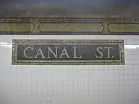
Canal Street is a local station on the IRT Broadway–Seventh Avenue Line of the New York City Subway, located in Lower Manhattan at the intersection of Canal and Varick Streets. It is served by the 1 train at all times and by the 2 train during late nights.
Canal Street | ||||||||||||||||||||||||||||||||||||||||||||||||||||||||||||||||||||
|---|---|---|---|---|---|---|---|---|---|---|---|---|---|---|---|---|---|---|---|---|---|---|---|---|---|---|---|---|---|---|---|---|---|---|---|---|---|---|---|---|---|---|---|---|---|---|---|---|---|---|---|---|---|---|---|---|---|---|---|---|---|---|---|---|---|---|---|---|
.jpg.webp) Platform towards South Ferry and Brooklyn | ||||||||||||||||||||||||||||||||||||||||||||||||||||||||||||||||||||
| Station statistics | ||||||||||||||||||||||||||||||||||||||||||||||||||||||||||||||||||||
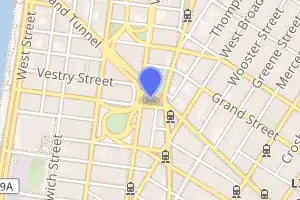
| Address | Canal Street & Varick Street New York, NY 10013 | |||||||||||||||||||||||||||||||||||||||||||||||||||||||||||||||||||
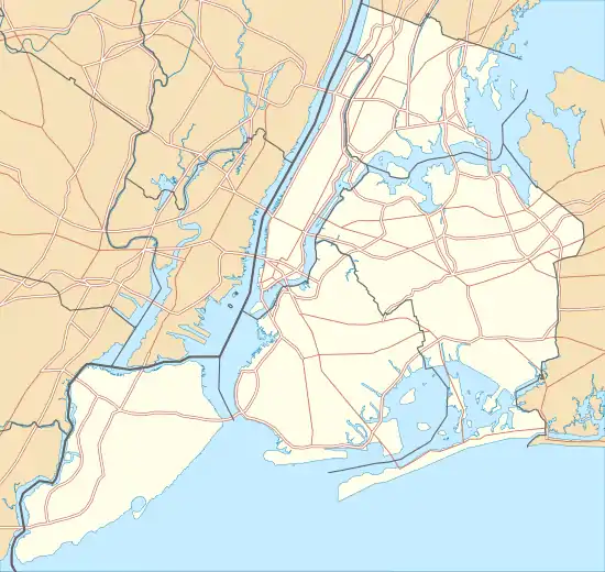
| Borough | Manhattan | |||||||||||||||||||||||||||||||||||||||||||||||||||||||||||||||||||
| Locale | SoHo, Tribeca | |||||||||||||||||||||||||||||||||||||||||||||||||||||||||||||||||||
| Coordinates | 40.722°N 74.006°W | |||||||||||||||||||||||||||||||||||||||||||||||||||||||||||||||||||
| Division | A (IRT) | |||||||||||||||||||||||||||||||||||||||||||||||||||||||||||||||||||
| Line | IRT Broadway–Seventh Avenue Line | |||||||||||||||||||||||||||||||||||||||||||||||||||||||||||||||||||
| Services | 1 2 | |||||||||||||||||||||||||||||||||||||||||||||||||||||||||||||||||||
| Transit | ||||||||||||||||||||||||||||||||||||||||||||||||||||||||||||||||||||
| Structure | Underground | |||||||||||||||||||||||||||||||||||||||||||||||||||||||||||||||||||
| Platforms | 2 side platforms | |||||||||||||||||||||||||||||||||||||||||||||||||||||||||||||||||||
| Tracks | 4 | |||||||||||||||||||||||||||||||||||||||||||||||||||||||||||||||||||
| Other information | ||||||||||||||||||||||||||||||||||||||||||||||||||||||||||||||||||||
| Opened | July 1, 1918 | |||||||||||||||||||||||||||||||||||||||||||||||||||||||||||||||||||
| Station code | 325[1] | |||||||||||||||||||||||||||||||||||||||||||||||||||||||||||||||||||
| Opposite- direction transfer | No | |||||||||||||||||||||||||||||||||||||||||||||||||||||||||||||||||||
| Traffic | ||||||||||||||||||||||||||||||||||||||||||||||||||||||||||||||||||||
| 2019 | 1,984,827[2] | |||||||||||||||||||||||||||||||||||||||||||||||||||||||||||||||||||
| Rank | 237 out of 424[2] | |||||||||||||||||||||||||||||||||||||||||||||||||||||||||||||||||||
| Station succession | ||||||||||||||||||||||||||||||||||||||||||||||||||||||||||||||||||||
| Next north | Houston Street: 1 | |||||||||||||||||||||||||||||||||||||||||||||||||||||||||||||||||||
| Next south | Franklin Street: 1 | |||||||||||||||||||||||||||||||||||||||||||||||||||||||||||||||||||
| ||||||||||||||||||||||||||||||||||||||||||||||||||||||||||||||||||||
| ||||||||||||||||||||||||||||||||||||||||||||||||||||||||||||||||||||
| ||||||||||||||||||||||||||||||||||||||||||||||||||||||||||||||||||||
| ||||||||||||||||||||||||||||||||||||||||||||||||||||||||||||||||||||

History
The Dual Contracts, which were signed on March 19, 1913, were contracts for the construction and/or rehabilitation and operation of rapid transit lines in the City of New York. The contracts were "dual" in that they were signed between the City and two separate private companies (the Interborough Rapid Transit Company and the Brooklyn Rapid Transit Company), all working together to make the construction of the Dual Contracts possible. The Dual Contracts promised the construction of several lines in Brooklyn. As part of Contract 4, the IRT agreed to build a branch of the original subway line south down Seventh Avenue, Varick Street, and West Broadway to serve the West Side of Manhattan.[3][4][5]
The construction of this line, in conjunction with the construction of the Lexington Avenue Line, would change the operations of the IRT system. Instead of having trains go via Broadway, turning onto 42nd Street, before finally turning onto Park Avenue, there would be two trunk lines connected by the 42nd Street Shuttle. The system would be changed from looking like a "Z" system on a map to an "H" system. One trunk would run via the new Lexington Avenue Line down Park Avenue, and the other trunk would run via the new Seventh Avenue Line up Broadway. In order for the line to continue down Varick Street and West Broadway, these streets needed to be widened, and two new streets were built, the Seventh Avenue Extension and the Varick Street Extension.[6] It was predicted that the subway extension would lead to the growth of the Lower West Side, and to neighborhoods such as Chelsea and Greenwich Village.[7][8]
Canal Street opened as the line was extended south to South Ferry from 34th Street–Penn Station on July 1, 1918, and was served by a shuttle.[9] The new "H" system was implemented on August 1, 1918, joining the two halves of the Broadway–Seventh Avenue Line and sending all West Side trains south from Times Square.[10] An immediate result of the switch was the need to transfer using the 42nd Street Shuttle in order to retrace the original layout. The completion of the "H" system doubled the capacity of the IRT system.[7]
To make room for the construction of the Holland Tunnel exit plaza, a subway entrance at the station was reconstructed.[11] In 1926, New York City, the New York State Bridge and Tunnel Commission, and the New Jersey Interstate Bridge and Tunnel Commission, reached an agreement to construct a passageway from the south side of Canal Street to the south side of Laight Street on the east side of Varick Street to replace the entrance.[12] The cost of the project was split between the Bridge and Tunnel Commissions and the City, and was the first project done to separate pedestrian and vehicular traffic.[13] Work on the project was underway in 1927. Pattelli & Wilson got the winning bid of $116,723 to construct the project.[14][15]
The station was renovated in 1992 by MTA New York City Transit's in-house staff, and the passageway and the two staircases to the corner of Laight Street and Varick Street were closed.[16]
Station layout
| G | Street level | Exit/entrance |
| P Platform level |
Side platform | |
| Northbound local | ← ← | |
| Northbound express | ← | |
| Southbound express | | |
| Southbound local | | |
| Side platform | ||
This station has two side platforms and four tracks. The center tracks are used by the 2 and 3 express trains during daytime hours. The platforms are mildly offset and, although there are no crossovers or crossunders to allow free transfers between directions, there is evidence of a sealed crossunder on both of the platforms.
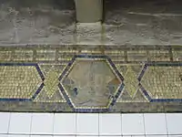
This underground station is located on the street of the same name, which is the boundary of SoHo and Tribeca. Lying within a block of three different pocket parks (St. John's Park, Duane Park, and Cavala Park), the station sits at the entrance to the Holland Tunnel outside of the Tribeca North Historic District.[17] Much of the surrounding area is characterized by its historic loft architecture.
Exits
Fare control is on platform level for both sides. The two northbound street stairs are on the northeast corner of Varick Street and Canal Street, and the one southbound street stair is on the northwest corner.[18] The northeast-corner entrances have been floodproofed.[19][20] At the end of the uptown platform, there was a free zone passageway that had two staircases to Laight and Varick Streets; it was not monitored and was closed down for security reasons.[16]
References
- "Station Developers' Information". Metropolitan Transportation Authority. Retrieved June 13, 2017.
- "Facts and Figures: Annual Subway Ridership 2014–2019". Metropolitan Transportation Authority. 2020. Retrieved May 26, 2020.
- "Terms and Conditions of Dual System Contracts". nycsubway.org. Public Service Commission. March 19, 1913. Retrieved February 16, 2015.
- "The Dual System of Rapid Transit (1912)". nycsubway.org. Public Service Commission. September 1912. Retrieved May 30, 2017.
- "Most Recent Map of the Dual Subway System Which Shows How Brooklyn Borough Is Favored In New Transit Lines". The Brooklyn Daily Eagle. September 9, 1917. p. 37. Retrieved August 23, 2016 – via Brooklyn Public Library; newspapers.com.
- Engineering News-record. McGraw-Hill Publishing Company. 1916.
- Whitney, Travis H. (March 10, 1918). "The Seventh and Lexington Avenue Subways Will Revive Dormant Sections" (PDF). The New York Times. p. 12. ISSN 0362-4331. Retrieved August 26, 2016.
- "Public Service Commission Fixes July 15 For Opening of The New Seventh and Lexington Avenue Subway Lines" (PDF). The New York Times. May 19, 1918. p. 32. ISSN 0362-4331. Retrieved November 6, 2016.
- "Open New Subway to Regular Traffic" (PDF). The New York Times. July 2, 1918. p. 11. ISSN 0362-4331. Retrieved November 6, 2016.
- "Open New Subway Lines to Traffic; Called a Triumph" (PDF). The New York Times. August 2, 1918. p. 1. ISSN 0362-4331. Retrieved April 21, 2020.
- Commission, New York State Bridge and Tunnel (1922). Report of the New York State Bridge and Tunnel Commission. J.B. Lyon Company, printers. p. 15.
- Commission, New York (State) Transit (1926). Proceedings of the Transit Commission, State of New York. p. 457.
- Apportionment, New York (N Y. ) Board of Estimate and (1926). Report of the Chief Engineer. p. 26.
- Transportation, New York (N Y. ) Board of (1927). Proceedings of the Board of Transportation of the City of New York. The Board. p. 1087.
- Transportation, New York (N Y. ) Board of (1928). Proceedings of the Board of Transportation of the City of New York. The Board. p. 485.
-
- January 1992 Transit Authority Committee Agenda. New York City Transit Authority. January 17, 1992. pp. E.14.
- January 1992 Transit Authority Committee Agenda. New York City Transit Authority. January 17, 1992. pp. E.15.
- January 1992 Transit Authority Committee Agenda. New York City Transit Authority. January 17, 1992. pp. E.16.
- January 1992 Transit Authority Committee Agenda. New York City Transit Authority. January 17, 1992. pp. E.17.
- January 1992 Transit Authority Committee Agenda. New York City Transit Authority. January 17, 1992. pp. E.42.
- "Tribeca North Historic District" (PDF). New York City Landmarks Commission. Archived from the original (PDF) on August 6, 2012. Retrieved July 10, 2011.
- "MTA Neighborhood Maps: SoHo / Tribeca" (PDF). Metropolitan Transportation Authority. 2015. Retrieved August 6, 2015.
- Kirby, Jen (April 7, 2016). "Here's One Way the MTA Is Getting the Subway Ready for the Next Superstorm Sandy". Daily Intelligencer. Retrieved January 1, 2017.
- "Can We Make Our Subways Flood-Proof Or What?". Popular Science. August 3, 2016. Retrieved January 1, 2017.
Further reading
External links
| Wikimedia Commons has media related to Canal Street (IRT Broadway – Seventh Avenue Line). |
- nycsubway.org – IRT West Side Line: Canal Street
- Station Reporter – 1 Train
- Canal Street entrance from Google Maps Street View
- Platforms from Google Maps Street View