Canning Parish, New Brunswick
Canning is a civil parish in Queens County, New Brunswick, Canada.[2]
Canning | |
|---|---|
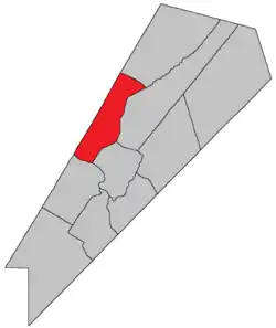 Location within Queens County, New Brunswick. | |
| Country | |
| Province | |
| County | Queens County |
| Erected | 1827 |
| Area | |
| • Land | 174.38 km2 (67.33 sq mi) |
| Population (2016)[1] | |
| • Total | 924 |
| • Density | 5.3/km2 (14/sq mi) |
| • Change 2011–16 | |
| • Dwellings | 755 |
| Time zone | UTC-4 (AST) |
| • Summer (DST) | UTC-3 (ADT) |
For governance purposes it is divided between the village of Minto and the local service district of the parish of Canning,[3] both of which are members of Regional Service Commission 11 (RSC11).[4]
Origin of name
The parish was probably named for George Canning, British Secretary of State for Foreign Affairs and Leader of the House of Commons at the time.[5] Shortly after the parish's erection Canning became Prime Minister of the United Kingdom.
History
Canning was erected in 1827 from Waterborough Parish.[6]
In 1835 the northwestern part of Canning was included in the newly erected Chipman Parish.[7]
Delineation
The Parish is defined in the Territorial Division Act[2] as being bounded:
- Northeast by Chipman Parish; northwest by the County line; southwest by the Saint John River, and southeast by Cambridge and Waterborough Parishes.
Communities
Parish population total does not include incorporated municipalities (in bold).
- Back Road
- Canning
- Clarks Corners
- Douglas Harbour
- Flowers Cove
- Lake Road
- Maquapit Lake
- Newcastle Center
- Newcastle Centre
- Newcastle Creek
- Princess Park
- Scotchtown
- Sunnyside Beach
- Sypher Cove
- Upper Gagetown
- Wuhr's Beach Road
Bodies of water & Islands
Rivers, lakes, streams, creeks, marshes and Islands that are at least partially in this parish include:
- Grand Lake
- Maquapit Lake
- Pickerel Pond Nature Preserve
- Grand Lake Meadow
- Lower Timber Lake
- Saint John River
- The Keyhole
Demographics
Access Routes
Highways and numbered routes that run through the parish, including external routes that start or finish at the parish limits:[11]
|
|
|
|
See also
References
- "Census Profile, 2016 Census Canning, Parish [Census subdivision], New Brunswick". Statistics Canada. Retrieved September 27, 2019.
- "Chapter T-3 Territorial Division Act". Government of New Brunswick. Retrieved 13 November 2020.
- "New Brunswick Regulation 84-168 under the Municipalities Act (O.C. 84-582)". Government of New Brunswick. Retrieved 19 July 2020.
- "Communities in each of the 12 Regional Service Commissions (RSC) / Les communautés dans chacune des 12 Commissions de services régionaux (CSR)" (PDF), Government of New Brunswick, July 2017, retrieved 2 February 2021
- Ganong, William F. (1896). A Monograph of the Place-Nomenclature of the Province of New Brunswick. Royal Society of Canada. p. 224.
- "8 Geo. IV c. 12 An Act for erecting the North-western part of the Town or Parish of Waterborough, in Queens County, into a separate Town or Parish.". Acts of the General Assembly of His Majesty's Province of New-Brunswick, Passed in the Year 1827. Fredericton: Government of New Brunswick. 1827. pp. 26–27.
- "5 Wm. IV c. 23 An Act for erecting parts of the Towns or Parishes of Brunswick and Canning in Queen's County into a separate Town or Parish.". Acts of the General Assembly of His Majesty's Province of New-Brunswick, Passed in the Year 1835. Fredericton: Government of New Brunswick. 1835. p. 31.
- Statistics Canada: 2001, 2006 census
- Profile: Canning Parish, New Brunswick
- 2011 Statistics Canada Census Profile: Canning Parish, New Brunswick
- Atlantic Canada Back Road Atlas ISBN 978-1-55368-618-7
Places adjacent to Canning Parish, New Brunswick | |
|---|---|
| Subdivisions | |
|---|---|
| Cities | |
| Counties | |
| |