Cambridge Parish, New Brunswick
Cambridge is a civil parish in Queens County, New Brunswick, Canada.[2]
Cambridge | |
|---|---|
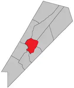 Location within Queens County, New Brunswick. | |
| Coordinates: 45.84°N 64.59°W | |
| Country | |
| Province | |
| County | Queens County |
| Erected | 1852 |
| Area | |
| • Land | 113.65 km2 (43.88 sq mi) |
| Population (2016)[1] | |
| • Total | 647 |
| • Density | 5.7/km2 (15/sq mi) |
| • Change 2011-2016 | |
| • Dwellings | 617 |
| Time zone | UTC-4 (AST) |
| • Summer (DST) | UTC-3 (ADT) |
For governance purposes it is divided between the village of Cambridge-Narrows and the local service district of the parish of Cambridge,[3] both of which are members of Regional Service Commission 11 (RSC11).[4]
Origin of name
The parish was "said to" have been named in honour of the Duke of Cambridge,[5] who died in 1850.
History
Cambridge was erected in 1852 from Johnston, Waterborough, and Wickham Parishes.[6]
In 1856 the boundary with Johnston and Waterborough Parishes was altered.[7]
Delineation
Cambridge Parish is defined in the Territorial Division Act[2] as being bounded:
- Beginning on the northeastern shore of the Saint John River, at the southeast angle of lot number sixteen, granted to Isaac Gilbert; thence following the course of the lower or southeastern line of said lot numbered sixteen northeasterly until it meets the waters of the Grand Lake; thence by the waters of the Grand Lake to the road[lower-alpha 1] leading from Mill Cove on the said lake, to Fowlers Cove on the Washademoak Lake; thence southeasterly by said road to Washademoak Lake; thence southwesterly by the waters of the Washademoak Lake and through the Colwells Creek and Lawson Passage to the Saint John River; and thence following the shore of the Saint John River up stream to the place of beginning.
Communities
Parish population total does not include incorporated municipalities (in bold):
|
|
Bodies of water & Islands
This is a list of rivers, lakes, streams, creeks, marshes and Islands that are at least partially in this parish
- Coreys Island
- Nevers Island
- Saint John River
Demographics
Access Routes
Highways and numbered routes that run through the parish, including external routes that start or finish at the parish limits:[10]
|
|
|
|
See also
Notes
- Fowler Road.
References
- "Census Profile, 2016 Census Cambridge, Parish [Census subdivision], New Brunswick". Statistics Canada. Retrieved September 27, 2019.
- "Chapter T-3 Territorial Division Act". Government of New Brunswick. Retrieved 13 November 2020.
- "New Brunswick Regulation 84-168 under the Municipalities Act (O.C. 84-582)". Government of New Brunswick. Retrieved 19 July 2020.
- "Communities in each of the 12 Regional Service Commissions (RSC) / Les communautés dans chacune des 12 Commissions de services régionaux (CSR)" (PDF), Government of New Brunswick, July 2017, retrieved 2 February 2021
- Ganong, William F. (1896). A Monograph of the Place-Nomenclature of the Province of New Brunswick. Royal Society of Canada. p. 223.
- "15 Vic. c. 36 An Act for the erection of a new Parish in Queen's County.". Acts of the General Assembly of Her Majesty's Province of New Brunswick, Passed in the Year 1852. Fredericton: Government of New Brunswick. 1852. pp. 55–56.
- "19 Vic. c. 5 An Act to alter the Division Line of the Parish of Cambridge, in Queen's County.". Acts of the General Assembly of Her Majesty's Province of New Brunswick, Passed in the Months of March, April, and May 1856. Fredericton: Government of New Brunswick. 1856. pp. 4–5.
- Statistics Canada: 2001, 2006 census
- 2011 Statistics Canada Census Profile: Cambridge Parish, New Brunswick
- Atlantic Canada Back Road Atlas ISBN 978-1-55368-618-7
Places adjacent to Cambridge Parish, New Brunswick | |
|---|---|
| Subdivisions | |
|---|---|
| Cities | |
| Counties | |
| |