Chipman Parish, New Brunswick
Chipman is a civil parish in Queens County, New Brunswick, Canada.[2]
Chipman | |
|---|---|
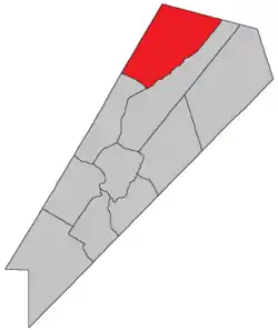 Location within Queens County, New Brunswick. | |
| Country | |
| Province | |
| County | Queens County |
| Erected | 1835 |
| Area | |
| • Land | 483.44 km2 (186.66 sq mi) |
| Population (2016)[1] | |
| • Total | 913 |
| • Density | 1.9/km2 (5/sq mi) |
| • Change 2011-2016 | |
| • Dwellings | 541 |
| Time zone | UTC-4 (AST) |
| • Summer (DST) | UTC-3 (ADT) |
For governance purposes it is divided between the village of Chipman and the local service district of the parish of Chipman,[3] both of which are members of Regional Service Commission 11 (RSC11).[4]
Origin of name
The parish was named for Ward Chipman Jr., Chief Justice of New Brunswick at the time of its erection.[5]
History
Chipman was erected in 1835 from Brunswick and Canning Parishes.[6]
In 1855 all of Chipman southest of Coal Creek was transferred to Waterborough Parish.[7]
In 1896 the boundary with Waterborough was altered, parallelling the Brunswick line from the mouth of North Branch Coal Creek to the county line;[8] the lost territory became part of Waterborough.
Delineation
Chipman Parish is defined in the Territorial Division Act[2] as being bounded:
- Northwest and northeast by the County lines; southwest by a line beginning on the Sunbury County line, intersected by the northern line of lot number nine[lower-alpha 1] on the eastern side of the Hardwood Ridge Road;[lower-alpha 2] thence easterly along said line to the northeast angle of said lot; thence south forty-five degrees east to Salmon Bay; thence southeasterly in a direct line to Indian Point; thence easterly up the northeast arm of Grand Lake to Coal Creek; thence easterly up Coal Creek to the southeast angle of lot number one, surveyed for Malcolm Carmichael, at the Round Turns on said Coal Creek; thence northeasterly parallel to the northwest line of Brunswick Parish to the County line.
Communities
Parish population total does not include incorporated municipalities (in bold).
|
|
|
Bodies of water and Islands
This is a list of rivers, lakes, streams, creeks, marshes and Islands that are at least partially in this parish
- Gaspereau River
- Salmon River
Demographics
Access Routes
Highways and numbered routes that run through the parish, including external routes that start or finish at the parish limits:[12]
See also
Notes
- Now within lot 157 due to a resurvey and redivision of the area.
- Now part of Route 10.
References
- "Census Profile, 2016 Census: Chipman, Parish [Census subdivision], New Brunswick". Statistics Canada. Retrieved 27 September 2019.
- "Chapter T-3 Territorial Division Act". Government of New Brunswick. Retrieved 13 November 2020.
- "New Brunswick Regulation 84-168 under the Municipalities Act (O.C. 84-582)". Government of New Brunswick. Retrieved 19 July 2020.
- "Communities in each of the 12 Regional Service Commissions (RSC) / Les communautés dans chacune des 12 Commissions de services régionaux (CSR)" (PDF), Government of New Brunswick, July 2017, retrieved 2 February 2021
- Ganong, William F. (1896). A Monograph of the Place-Nomenclature of the Province of New Brunswick. Royal Society of Canada. p. 226.
- "5 Wm. IV c. 23 An Act for erecting parts of the Towns or Parishes of Brunswick and Canning in Queen's County into a separate Town or Parish.". Acts of the General Assembly of His Majesty's Province of New-Brunswick, Passed in the Year 1835. Fredericton: Government of New Brunswick. 1835. p. 31.
- "18 Vic. c. 50 An Act to alter the division line between the Parishes of Chipman and Waterborough, in Queen's County.". Acts of the General Assembly of Her Majesty's Province of New Brunswick, Passed in the Month of November, 1854, and in the Months of February, March, and April, 1855. Fredericton: Government of New Brunswick. 1855. p. 179.
- "59 Vic. c. 8 An Act to Revise and Codify an Act to Provide for the Division of the Province into Counties, Towns and Parishes.". Acts of the General Assembly of Her Majesty's Province of New Brunswick. Passed in the Month of March, 1896. Fredericton: Government of New Brunswick. 1896. pp. 86–123.
- Statistics Canada: 2001, 2006 census
- Profile: Chipman Parish, New Brunswick
- 2011 Statistics Canada Census Profile: Chipman Parish, New Brunswick
- Atlantic Canada Back Road Atlas ISBN 978-1-55368-618-7
Places adjacent to Chipman Parish, New Brunswick | |
|---|---|
| Subdivisions | |
|---|---|
| Cities | |
| Counties | |
| |