Captain Cook Highway
Captain Cook Highway is a short Queensland highway that starts in Cairns and ends in Mossman, where it joins Mossman-Daintree Road, which continues to Daintree.[1][2]
Captain Cook Highway | |
|---|---|
 | |
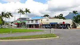
The highway at Craiglie near Port Douglas | |
 | |
Captain Cook Highway (green on black) | |
| General information | |
| Type | Highway |
| Length | 75 km (47 mi) |
| Route number(s) |
|
| Major junctions | |
| South end | |
| |
| North end | Mossman-Daintree Road, Mossman |
| Location(s) | |
| Major settlements | Smithfield, Palm Cove, Port Douglas |
| Highway system | |
Captain Cook Highway is used by many tourists to travel to Port Douglas north of Cairns. Apart from being a vital link between two tourist locations, Captain Cook Highway is a scenic highway that winds alongside the coast of the tropical seaside rainforest heading towards Port Douglas and Daintree National Park.
Route description
The highway commences at the northern end of the A1 Bruce Highway, in Cairns. It runs as the A1 north through Cairns to the suburb of Smithfield at the Smithfield Shopping Centre roundabout junction with the Kennedy Highway, crossing the south arm of the Barron River. From the Smithfield Shopping Centre roundabout north-east it continues as State Route 44 through the beachside suburbs of Kewarra Beach and Palm Cove, and then follows the coast almost to Port Douglas. It then proceeds north-west to Mossman where it terminates.
Major intersections
| LGA | Location | km | mi | Destinations | Notes |
|---|---|---|---|---|---|
| Cairns | Cairns | 0 | 0.0 | Sheridan Street - south-east - Cairns CBD / Florence Street - north-east - Cairns waterfront | Southern end of Captain Cook Highway (National Route 1) Continues north-west as Sheridan Street. |
| Barron River | 6.9 | 4.3 | William Walter Mason Bridges | ||
| Cairns | Smithfield | 12.1 | 7.5 | ||
| 13.1 | 8.1 | Captain Cook Highway continues north as State Route 44 | |||
| Douglas | Port Douglas | 61.1 | 38.0 | Port Douglas Road - north-east - Port Douglas | |
| Bonnie Doon / Shannonvale / Cassowary tripoint[3] | 71.2 | 44.2 | Captain Cook Highway continues west with no route number | ||
| Mossman | 75.4 | 46.9 | Mill Street - east - Mossman CBD / Mossman Daintree Road (Foxton Avenue) - north-west - Daintree / Junction Road - north-east - Bonnie Doon | Northern end of Captain Cook Highway | |
1.000 mi = 1.609 km; 1.000 km = 0.621 mi
| |||||
 Captain Cook Highway, Ellis Beach, 2018
.JPG.webp) Captain Cook Highway, Wangetti, 2015
Captain Cook Highway, Wangetti, 2015- Captain Cook Highway, Craiglie, 2015
 Captain Cook Highway at Mossman, 2015
References
- Hema, Maps (2007). Australia Road and 4WD Atlas (Map). Eight Mile Plains Queensland: Hema Maps. p. 14. ISBN 978-1-86500-456-3.
- Queensland Government - Department of Transport and Main Roads - Maps
- Google (20 July 2017). "Bonnie Doon / Shannonvale / Cassowary tripoint" (Map). Google Maps. Google. Retrieved 20 July 2017.