Chickasaw County, Mississippi
Chickasaw County is a county located in the U.S. state of Mississippi. As of the 2010 census, the population was 17,392.[1] Its county seats are Houston and Okolona.[2] The county is named for the Chickasaw people, who lived in this area for hundreds of years. Most were forcibly removed to Indian Territory in the 1830s, but some remained and became citizens of the state and the United States.
Chickasaw County | |
|---|---|
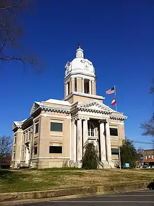 East façade of Chickasaw County Court House | |
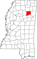 Location within the U.S. state of Mississippi | |
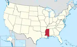 Mississippi's location within the U.S. | |
| Coordinates: 33°55′N 88°57′W | |
| Country | |
| State | |
| Founded | 1836 |
| Named for | Chickasaw people |
| Seat | Houston and Okolona |
| Largest city | Houston |
| Area | |
| • Total | 504 sq mi (1,310 km2) |
| • Land | 502 sq mi (1,300 km2) |
| • Water | 2.5 sq mi (6 km2) 0.5% |
| Population (2010) | |
| • Total | 17,392 |
| • Estimate (2018) | 17,171 |
| • Density | 35/sq mi (13/km2) |
| Time zone | UTC−6 (Central) |
| • Summer (DST) | UTC−5 (CDT) |
| Congressional district | 1st |
| Website | www |
Early in the 20th century, the first agricultural high school in Mississippi opened in the unincorporated community of Buena Vista. Cully Cobb, a pioneer of southern agriculture, long-term farm publisher, and an official of the Agricultural Adjustment Administration in Washington, D.C., was the superintendent of the school from 1908 to 1910.[3]
History
The Mississippi state legislature created Chickasaw County in 1836, following the cession of the land by the Chickasaw Indians. It was quickly settled by Americans from the east, mainly from the Southern states. By the time of the Civil War, riverfront landings had been developed by the many large cotton plantations worked by slaves, who outnumbered the white residents of the county.[4]
Civil War
The American Civil War devastated the local economy, completely destroying the plantation-based infrastructure of Chickasaw County. The newly freed slaves had to adapt to the new labor system, in which the white landowners still retained partial control over their lives through the practice of sharecropping. The economy declined again in the late 19th century, when falling cotton prices reduced both black and white residents to poverty. Farmers eventually began diversifying their crops, and the economy slowly began to improve.[4]
Geography
According to the U.S. Census Bureau, the county has a total area of 504 square miles (1,310 km2), of which 502 square miles (1,300 km2) is land and 2.5 square miles (6.5 km2) (0.5%) is water.[5]
Major highways
Adjacent counties
- Pontotoc County (north)
- Lee County (northeast)
- Monroe County (east)
- Clay County (southeast)
- Webster County (southwest)
- Calhoun County (west)
National protected areas
- Natchez Trace Parkway (part)
- Tombigbee National Forest (part)
Demographics
| Historical population | |||
|---|---|---|---|
| Census | Pop. | %± | |
| 1840 | 2,955 | — | |
| 1850 | 16,369 | 453.9% | |
| 1860 | 16,426 | 0.3% | |
| 1870 | 19,899 | 21.1% | |
| 1880 | 17,905 | −10.0% | |
| 1890 | 19,891 | 11.1% | |
| 1900 | 19,892 | 0.0% | |
| 1910 | 22,846 | 14.9% | |
| 1920 | 22,212 | −2.8% | |
| 1930 | 20,835 | −6.2% | |
| 1940 | 21,427 | 2.8% | |
| 1950 | 18,951 | −11.6% | |
| 1960 | 16,891 | −10.9% | |
| 1970 | 16,805 | −0.5% | |
| 1980 | 17,853 | 6.2% | |
| 1990 | 18,085 | 1.3% | |
| 2000 | 19,440 | 7.5% | |
| 2010 | 17,392 | −10.5% | |
| 2018 (est.) | 17,171 | [6] | −1.3% |
| U.S. Decennial Census[7] 1790-1960[8] 1900-1990[9] 1990-2000[10] 2010-2013[1] | |||
As of the 2010 United States Census, there were 17,392 people living in the county. 54.0% were White, 42.1% Black or African American, 0.3% Asian, 0.1% Native American, 2.5% of some other race and 1.0% of two or more races. 3.7% were Hispanic or Latino (of any race).
As of the census[11] of 2000, there were 19,440 people, 7,253 households, and 5,287 families living in the county. The population density was 39 people per square mile (15/km2). There were 7,981 housing units at an average density of 16 per square mile (6/km2). The racial makeup of the county was 56.89% White, 41.26% Black or African American, 0.19% Native American, 0.17% Asian, 0.04% Pacific Islander, 0.99% from other races, and 0.46% from two or more races. 2.29% of the population were Hispanic or Latino of any race.
According to the census[11] of 2000, the largest ancestry groups in Chickasaw County were English 44.1%, African 41% and Scots-Irish 13.5%.
There were 7,253 households, out of which 36.30% had children under the age of 18 living with them, 50.80% were married couples living together, 18.00% had a female householder with no husband present, and 27.10% were non-families. 24.90% of all households were made up of individuals, and 11.90% had someone living alone who was 65 years of age or older. The average household size was 2.65 and the average family size was 3.17.
In the county, the population was spread out, with 28.60% under the age of 18, 9.30% from 18 to 24, 27.60% from 25 to 44, 21.00% from 45 to 64, and 13.50% who were 65 years of age or older. The median age was 34 years. For every 100 females there were 92.60 males. For every 100 females age 18 and over, there were 87.40 males.
The median income for a household in the county was $26,364, and the median income for a family was $33,819. Males had a median income of $25,459 versus $20,099 for females. The per capita income for the county was $13,279. About 16.80% of families and 20.00% of the population were below the poverty line, including 23.90% of those under age 18 and 22.40% of those age 65 or over.
Communities
Towns
Villages
Notable people
- Singer-songwriter Bobbie Gentry, a Mississippi Musicians Hall of Fame inductee, was born in Chickasaw County in 1944.
- Bukka White, early blues performer
- William Raspberry, journalist
- Milan Williams, founding member of The Commodores
- Jim Hood, Former Mississippi Attorney General
- Jeff Busby, Congressman who spearheaded the Natchez Trace Parkway
- Shaquille Vance, 2012 U.S. Paralympic National Championship, gold medal (100m), silver medal (200m)
- Ida Mae Brandon Gladney, central character in the Pulitzer Prize winning book, The Warmth of Other Suns by Isabel Wilkerson[12]
In popular culture
Titus Andromedon, aka Ronald Ephen Wilkerson, a fictional character from the comedy series Unbreakable Kimmy Schmidt, was from Chickasaw County.[13]
Candieland, the plantation of the fictional Calvin Candie, played by Leonardo DiCaprio in Quentin Tarantino's film Django Unchained, is located in Chickasaw County.[14]
Politics
| Year | Republican | Democratic | Third parties |
|---|---|---|---|
| 2020 | 51.3% 4,175 | 46.8% 3,810 | 1.9% 156 |
| 2016 | 52.3% 4,127 | 46.3% 3,649 | 1.4% 114 |
| 2012 | 47.0% 3,994 | 51.5% 4,378 | 1.5% 131 |
| 2008 | 48.5% 4,395 | 50.7% 4,588 | 0.8% 75 |
| 2004 | 50.2% 4,193 | 48.8% 4,078 | 1.0% 79 |
| 2000 | 49.5% 3,549 | 49.1% 3,519 | 1.5% 107 |
| 1996 | 42.8% 2,535 | 50.1% 2,971 | 7.2% 424 |
| 1992 | 45.0% 3,150 | 46.0% 3,220 | 9.1% 637 |
| 1988 | 55.4% 3,390 | 44.3% 2,713 | 0.4% 22 |
| 1984 | 60.5% 3,605 | 39.1% 2,329 | 0.4% 23 |
| 1980 | 40.1% 2,540 | 57.2% 3,622 | 2.6% 167 |
| 1976 | 45.1% 2,581 | 50.5% 2,891 | 4.4% 251 |
| 1972 | 84.7% 3,753 | 13.1% 579 | 2.3% 101 |
| 1968 | 7.4% 381 | 14.0% 720 | 78.7% 4,062 |
| 1964 | 91.8% 3,138 | 8.2% 279 | |
| 1960 | 15.2% 385 | 31.2% 791 | 53.7% 1,362 |
| 1956 | 11.2% 231 | 80.3% 1,650 | 8.5% 175 |
| 1952 | 27.5% 685 | 72.5% 1,805 | |
| 1948 | 0.6% 12 | 5.9% 115 | 93.5% 1,827 |
| 1944 | 8.5% 180 | 91.5% 1,935 | |
| 1940 | 3.2% 58 | 96.8% 1,764 | 0.1% 1 |
| 1936 | 1.1% 18 | 98.8% 1,559 | 0.1% 1 |
| 1932 | 1.1% 16 | 98.6% 1,455 | 0.3% 4 |
| 1928 | 10.3% 171 | 89.7% 1,495 | |
| 1924 | 6.1% 86 | 91.9% 1,301 | 2.1% 29 |
| 1920 | 16.7% 194 | 81.1% 944 | 2.2% 26 |
| 1916 | 3.6% 47 | 93.3% 1,215 | 3.1% 40 |
| 1912 | 2.0% 19 | 90.3% 856 | 7.7% 73 |
References
- "State & County QuickFacts". United States Census Bureau. Archived from the original on July 8, 2011. Retrieved September 3, 2013.
- "Find a County". National Association of Counties. Archived from the original on 2015-05-09. Retrieved 2011-06-07.
- "The Founders of the Cobb Institute of Archaeology". Mississippi State University. Retrieved July 16, 2010.
- "Chickasaw County History". msgw.org. Retrieved October 9, 2014.
- "2010 Census Gazetteer Files". United States Census Bureau. August 22, 2012. Archived from the original on September 28, 2013. Retrieved November 3, 2014.
- "Population and Housing Unit Estimates". Retrieved June 4, 2019.
- "U.S. Decennial Census". United States Census Bureau. Retrieved November 3, 2014.
- "Historical Census Browser". University of Virginia Library. Retrieved November 3, 2014.
- "Population of Counties by Decennial Census: 1900 to 1990". United States Census Bureau. Retrieved November 3, 2014.
- "Census 2000 PHC-T-4. Ranking Tables for Counties: 1990 and 2000" (PDF). United States Census Bureau. Retrieved November 3, 2014.
- "U.S. Census website". United States Census Bureau. Retrieved 2008-01-31.
- "The Great Migration: Journey That Reshaped America". 2 October 2010. Retrieved 12 February 2017.
- "Tituss Burgess Airs His Launcry". Retrieved 12 February 2017.
- Kaster, Gregory L. (January 2, 2013). "The Law of Slavery Lies at the Heart of the Movies "Lincoln" and "Django Unchained"". The Ohio State University. Retrieved 2018-03-05.
- Leip, David. "Dave Leip's Atlas of U.S. Presidential Elections". uselectionatlas.org. Retrieved 2018-03-05.
Places adjacent to Chickasaw County, Mississippi | ||||||||||
|---|---|---|---|---|---|---|---|---|---|---|
| ||||||||||
Municipalities and communities of Chickasaw County, Mississippi, United States | ||
|---|---|---|
| Cities | Map of Mississippi highlighting Chickasaw County | |
| Town | ||
| Village | ||
| Unincorporated communities | ||
| ||
.svg.png.webp)
| Authority control |
|---|