Brunswick Parish, New Brunswick
Brunswick is a civil parish in Queens County, New Brunswick, Canada.[2]
Brunswick | |
|---|---|
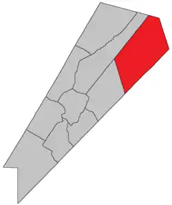 Location within Queens County, New Brunswick. | |
| Coordinates: 45.84°N 64.59°W | |
| Country | |
| Province | |
| County | Queens County |
| Erected | 1816 |
| Area | |
| • Land | 704.43 km2 (271.98 sq mi) |
| Population (2016)[1] | |
| • Total | 203 |
| • Density | 0.3/km2 (0.8/sq mi) |
| • Change 2011-2016 | |
| • Dwellings | 159 |
| Time zone | UTC-4 (AST) |
| • Summer (DST) | UTC-3 (ADT) |
For governance purposes it forms the local service district of the parish of Brunswick,[3] which is a member of Regional Service Commission 8 (RSC8).[4]
Origin of name
The parish was probably named in honour of the Duke of Brunswick,[5] German military leader against Napoleon, killed at the Battle of Quatre-Bras the year before the parish's erection.
History
Brunswick was erected in 1816 from unassigned territory to the rear of Waterborough and Wickham Parishea.[6]
In 1835 part of Brunswick was included in the newly erected Chipman Parish.[7]
Delineation
Brunswick Parish is defined in the Territorial Division Act[2] as being bounded:
- Southeast, east and northeast by the County lines; west by Johnston Parish, and northwest by the northeasterly prolongation of the northwest line of Johnston Parish.
Communities
Parish population total does not include incorporated municipalities (in bold):
|
|
Demographics
Access Routes
Highways and numbered routes that run through the parish, including external routes that start or finish at the parish limits:[10]
|
|
|
|
See also
References
- "Census Profile, 2016 Census: Brunswick, Parish [Census subdivision], New Brunswick". Statistics Canada. Retrieved September 28, 2019.
- "Chapter T-3 Territorial Division Act". Government of New Brunswick. Retrieved 13 November 2020.
- "New Brunswick Regulation 84-168 under the Municipalities Act (O.C. 84-582)". Government of New Brunswick. Retrieved 19 July 2020.
- "Communities in each of the 12 Regional Service Commissions (RSC) / Les communautés dans chacune des 12 Commissions de services régionaux (CSR)" (PDF), Government of New Brunswick, July 2017, retrieved 2 February 2021
- Ganong, William F. (1896). A Monograph of the Place-Nomenclature of the Province of New Brunswick. Royal Society of Canada. p. 222.
- "56 Geo. III c. 27 An Act to erect into a separate Parish all the Lands in Queen's County, in the rear of the Parishes of Wickham and Waterborough.". Acts of the General Assembly of His Majesty's Province of New-Brunswick. Passed in the Year 1816. Fredericton: Government of New Brunswick. 1816. p. 51.
- "5 Wm. IV c. 23 An Act for erecting parts of the Towns or Parishes of Brunswick and Canning in Queen's County into a separate Town or Parish.". Acts of the General Assembly of His Majesty's Province of New-Brunswick, Passed in the Year 1835. Fredericton: Government of New Brunswick. 1835. p. 31.
- Statistics Canada: 2001, 2006 census
- 2011 Statistics Canada Census Profile: Brunswick Parish, New Brunswick
- Atlantic Canada Back Road Atlas ISBN 978-1-55368-618-7
Places adjacent to Brunswick Parish, New Brunswick | |
|---|---|
| Subdivisions | |
|---|---|
| Cities | |
| Counties | |
| |