Coverdale Parish, New Brunswick
Coverdale is a civil parish in Albert County, New Brunswick, Canada,[2] located along the Petitcodiac River opposite Moncton and Dieppe. It comprises one incorporated town and one local service district (LSD), both of which are members of the Southeast Regional Service Commission.[3]
Coverdale | |
|---|---|
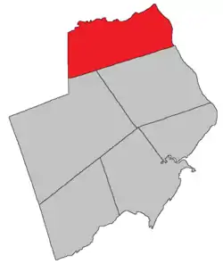 Location within Albert County. | |
| Coordinates: 46.03°N 64.86°W | |
| Country | |
| Province | |
| County | Albert County |
| Erected | 1828 |
| Area | |
| • Land | 236.04 km2 (91.14 sq mi) |
| Population (2016)[1] | |
| • Total | 4,466 |
| • Density | 18.9/km2 (49/sq mi) |
| • Pop 2011-2016 | |
| • Dwellings | 1,806 |
| Time zone | UTC-4 (AST) |
| • Summer (DST) | UTC-3 (ADT) |
The Census subdivision of the same name includes only the unincorporated part of the parish.
Origin of name
The parish takes its name from Coverdale River,[4] a former name of Little River, a tributary of the Petitcodiac.[5]
The Coverdale River may have been named in honour of Myles Coverdale (1488-1569), translator of the Bible and Bishop of Exeter.
History
Coverdale Parish was erected in 1828 from Hillsborough Parish,[6] taking in all of Hillsborough north of the mouth of Stoney Creek; the parish was then part of Westmorland County.
The boundaries were adjusted in 1846,[7] taking in part of Salisbury Parish on its western edge when the new county line was adjusted.
The southern boundary was moved slightly south in 1850, from the mouth of Stoney Creek to the southern line of the land grant the mouth is in.[8]
Boundaries
Coverdale Parish is bounded on the east and north by the Petitcodiac River, on the west by the county line, and on the south by the prolongation of the southern line of a land grant at the mouth of Stoney Creek.[2]
Municipality
The town of Riverview is located opposite Moncton.[9] It was created in 1973 as the town of Coverdale by the forced amalgamation of the villages of (from east to west) Bridgedale, Gunningsville, and Riverview Heights along with parts of Coverdale Parish.[10] The first act of the town council was to change the name to Riverview.
Local service district
The local service district of the parish of Coverdale contains all of the parish outside Riverview; it was established on 23 November 1966 to assess for fire protection and community services & recreational facilities[11] following the abolition of the county councils by the new Municipalities Act. First aid & ambulance services were added on 14 March 1973.[12]
Today the LSD assesses for community & recreation services in addition to the basic LSD services of fire protection, police services, land use planning, emergency measures, and dog control.[13] The taxing authority is 618.00 Coverdale.
Communities
Parish population total does not include incorporated municipalities (in bold).
|
|
|
Bodies of water & Islands
This is a list of rivers, lakes, streams, creeks, marshes and Islands that are at least partially in this parish
- Coverdale River
- Petitcodiac River
Demographics
Access Routes
Highways and numbered routes that run through the parish, including external routes that start or finish at the parish limits:[16]
See also
References
- "Census Profile, 2016 Census: Coverdale, Parish [Census subdivision], New Brunswick". Statistics Canada. Retrieved September 4, 2019.
- "Chapter T-3 Territorial Division Act". Government of New Brunswick. Retrieved 20 October 2020.
- "Communities in each of the 12 Regional Service Commissions (RSC) / Les communautés dans chacune des 12 Commissions de services régionaux (CSR)" (PDF), Government of New Brunswick, July 2017, retrieved 1 February 2021
- Ganong, William F. (1896). A Monograph of the Place-Nomenclature of the Province of New Brunswick. Royal Society of Canada. p. 228..
- "Coverdale River". Georaphical names in Canada. Natural Resources Canada. Retrieved 20 October 2020.
- "9 Geo. IV c. 17 An Act to erect a part of the Parish of Hillsborough in the County of Westmoreland, into a distinct Town or Parish.". Acts of the General Assembly of His Majesty's Province of New-Brunswick, Passed in the Year 1828. Fredericton: Government of New Brunswick. 1828. p. 22.
- "9 Vic. c. 7 An Act to alter the Division Line between the Counties of Westmorland and Albert, and also certain Parish Lines in the said County of Albert.". Acts of the General Assembly of Her Majesty's Province of New Brunswick, Passed in the Year 1846. Fredericton: Government of New Brunswick. 1846. pp. 20–21.
- "13 Vic. c. 51 An Act to consolidate all the Laws now in force for the division of the Province into Counties, Towns and Parishes.". Acts of the General Assembly of Her Mjaesty's Province of New Brunswick, Passed in the Year 1850. Fredericton: Government of New Brunswick. 1850. pp. 142–152, 145–149. Book was poorly proofread, resulting in title typo and reuse of page numbers 145–152.
- "New Brunswick Regulation 85-6 under the Municipalities Act (O.C. 85-45)". Government of New Brunswick. Retrieved 12 December 2020.
- "Regulation 73–58 under the Municipalities Act (O. C. 73–359)". The Royal Gazette. Fredericton. 131: 513–525. 30 May 1973.
- "Regulation 66–41 under the Municipalities Act (O. C. 66–968)". The Royal Gazette. Fredericton. 124: 604–605. 21 December 1966.
- "Regulation 73–34 under the Municipalities Act (O. C. 73–210)". The Royal Gazette. Fredericton. 131: 258–259. 21 March 1973.
- "2020 Local Government Statistics for New Brunswick" (PDF). Department of Environment and Local Government. p. 55. Retrieved 12 December 2020.
- Statistics Canada: 2001, 2006 census
- 2011 Statistics Canada Census Profile: Coverdale Parish, New Brunswick
- Atlantic Canada Back Road Atlas ISBN 978-1-55368-618-7
Places adjacent to Coverdale Parish, New Brunswick | |
|---|---|
| Subdivisions | |
|---|---|
| Cities | |
| Counties | |
| |