Craigsville, Virginia
Craigsville is a town in Augusta County, Virginia, United States. The population was 923 at the 2010 census.[5] It is part of the Staunton–Waynesboro Micropolitan Statistical Area.
Craigsville, Virginia | |
|---|---|
_near_Cherry_Street_in_Craigsville%252C_Augusta_County%252C_Virginia.jpg.webp) SR 42 in Craigsville | |
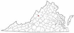 Location of Craigsville, Virginia | |
| Coordinates: 38°4′46″N 79°22′52″W | |
| Country | United States |
| State | Virginia |
| County | Augusta |
| Area | |
| • Total | 2.07 sq mi (5.35 km2) |
| • Land | 2.07 sq mi (5.35 km2) |
| • Water | 0.00 sq mi (0.00 km2) |
| Elevation | 1,529 ft (466 m) |
| Population (2010) | |
| • Total | 923 |
| • Estimate (2019)[2] | 931 |
| • Density | 450.41/sq mi (173.94/km2) |
| Time zone | UTC-5 (Eastern (EST)) |
| • Summer (DST) | UTC-4 (EDT) |
| ZIP code | 24430 |
| Area code(s) | 540 |
| FIPS code | 51-19904[3] |
| GNIS feature ID | 1492819[4] |
History
The Craigsville School was listed on the National Register of Historic Places in 1985.[6]
Geography
Craigsville is located at 38°4′46″N 79°22′52″W (38.079439, -79.381224).[7]
According to the United States Census Bureau, the town has a total area of 2.0 square miles (5.3 km2), all of it land.[5]
_just_south_of_Poplar_Avenue_in_Craigsville%252C_Augusta_County%252C_Virginia.jpg.webp)
Transportation
The only significant highway providing access to Craigsville is Virginia State Route 42. To the northeast, the road connects with U.S. Route 250 and, via Virginia State Route 254, Interstate 81 near Staunton. To the southwest, the road connects to Interstate 64.
Demographics
| Historical population | |||
|---|---|---|---|
| Census | Pop. | %± | |
| 1880 | 117 | — | |
| 1960 | 978 | — | |
| 1970 | 988 | 1.0% | |
| 1980 | 845 | −14.5% | |
| 1990 | 812 | −3.9% | |
| 2000 | 979 | 20.6% | |
| 2010 | 923 | −5.7% | |
| 2019 (est.) | 931 | [2] | 0.9% |
| U.S. Decennial Census[8] | |||
As of the census[3] of 2000, there were 979 people, 413 households, and 272 families living in the town. The population density was 495.5 people per square mile (190.9/km2). There were 474 housing units at an average density of 239.9 per square mile (92.4/km2). The racial makeup of the town was 96.73% White, 1.74% African American, 0.31% Native American, 0.20% from other races, and 1.02% from two or more races. Hispanic or Latino of any race were 0.41% of the population.
There were 413 households, out of which 31.5% had children under the age of 18 living with them, 49.2% were married couples living together, 13.6% had a female householder with no husband present, and 34.1% were non-families. 32.0% of all households were made up of individuals, and 14.8% had someone living alone who was 65 years of age or older. The average household size was 2.37 and the average family size was 2.98.
In the town, the population was spread out, with 24.9% under the age of 18, 8.0% from 18 to 24, 29.6% from 25 to 44, 21.7% from 45 to 64, and 15.8% who were 65 years of age or older. The median age was 38 years. For every 100 females there were 83.3 males. For every 100 females age 18 and over, there were 82.8 males.
The median income for a household in the town was $27,500, and the median income for a family was $36,771. Males had a median income of $23,688 versus $21,667 for females. The per capita income for the town was $16,226. About 9.3% of families and 13.1% of the population were below the poverty line, including 11.3% of those under age 18 and 13.3% of those age 65 or over.
Notable person
- Tony Schiavone, AEW and WCW professional wrestling announcer and sports talk show host
Climate
The climate in this area is characterized by hot, humid summers and generally mild to cool winters. According to the Köppen Climate Classification system, Craigsville has a humid subtropical climate, abbreviated "Cfa" on climate maps.[9]
References
- "2019 U.S. Gazetteer Files". United States Census Bureau. Retrieved August 7, 2020.
- "Population and Housing Unit Estimates". United States Census Bureau. May 24, 2020. Retrieved May 27, 2020.
- "U.S. Census website". United States Census Bureau. Retrieved 2008-01-31.
- "US Board on Geographic Names". United States Geological Survey. 2007-10-25. Retrieved 2008-01-31.
- "Geographic Identifiers: 2010 Demographic Profile Data (G001): Craigsville town, Virginia". U.S. Census Bureau, American Factfinder. Archived from the original on February 12, 2020. Retrieved August 30, 2013.
- "National Register Information System". National Register of Historic Places. National Park Service. July 9, 2010.
- "US Gazetteer files: 2010, 2000, and 1990". United States Census Bureau. 2011-02-12. Retrieved 2011-04-23.
- "Census of Population and Housing". Census.gov. Retrieved June 4, 2015.
- Climate Summary for Craigsville, Virginia
| Wikimedia Commons has media related to Craigsville, Virginia. |
Municipalities and communities of Augusta County, Virginia, United States | ||
|---|---|---|
| Towns | 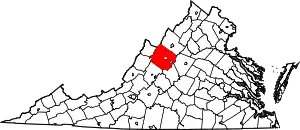 Map of Virginia highlighting Augusta County | |
| CDPs | ||
| Unincorporated communities | ||
| Footnotes | ‡This populated place also has portions in an adjacent county or counties | |
| ||