Troutdale, Virginia
Troutdale is a town in Grayson County, Virginia, United States.[4] The population was 178 at the 2010 census.[5]
Troutdale, Virginia | |
|---|---|
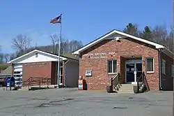 Post office and bank | |
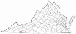 Location of Troutdale, Virginia | |
| Coordinates: 36°42′3″N 81°26′41″W | |
| Country | United States |
| State | Virginia |
| County | Grayson |
| Area | |
| • Total | 3.13 sq mi (8.10 km2) |
| • Land | 3.12 sq mi (8.09 km2) |
| • Water | 0.00 sq mi (0.00 km2) |
| Elevation | 3,127 ft (953 m) |
| Population (2010) | |
| • Total | 178 |
| • Estimate (2019)[2] | 166 |
| • Density | 53.14/sq mi (20.52/km2) |
| Time zone | UTC-5 (Eastern (EST)) |
| • Summer (DST) | UTC-4 (EDT) |
| ZIP code | 24378 |
| Area code(s) | 276 |
| FIPS code | 51-79456[3] |
| GNIS feature ID | 2391451[4] |
Geography
Troutdale is located at 36°42′3″N 81°26′41″W (36.700963, -81.444823).[6]
According to the United States Census Bureau, the town has a total area of 3.1 square miles (8.1 km2), all land.
Climate
The climate in this area has mild differences between highs and lows, and there is adequate rainfall year-round. According to the Köppen Climate Classification system, Troutdale has a marine west coast climate, abbreviated "Cfb" on climate maps.[7]
History
Troutdale was chartered as a town by the Virginia Legislature in 1906 and remains an incorporated town with a council and mayor. The Troutdale town limit is a circle of 1 mile radius. In 1930, Carrie Wright was elected as mayor, possibly the first female mayor in Virginia.
Demographics
| Historical population | |||
|---|---|---|---|
| Census | Pop. | %± | |
| 1910 | 431 | — | |
| 1920 | 636 | 47.6% | |
| 1930 | 357 | −43.9% | |
| 1940 | 334 | −6.4% | |
| 1950 | 250 | −25.1% | |
| 1960 | 273 | 9.2% | |
| 1970 | 209 | −23.4% | |
| 1980 | 248 | 18.7% | |
| 1990 | 196 | −21.0% | |
| 2000 | 1,230 | 527.6% | |
| 2010 | 178 | −85.5% | |
| 2019 (est.) | 166 | [2] | −6.7% |
| U.S. Decennial Census[8] | |||
The original 2000 census listed Troutdale with a population of 1,230, a very sharp increase from 192 in 1990. This, and the similarly anomalous figure of 30.89% African-American population, was the result of a tabulation error in which much of the population of Wise County's correctional facilities were counted as Troutdale residents. census revision
As of the census[3] of 2000, there were 1,230 people, 79 households, and 56 families living in the town. The population density was 395.5 inhabitants per square mile (152.7/km2). There were 111 housing units at an average density of 35.7 per square mile (13.8/km2). The racial makeup of the town was 67.80% White, 30.89% African American, 0.41% Asian, 0.81% from other races, and 0.08% from two or more races. Hispanic or Latino of any race were 0.89% of the population.
There were 79 households, out of which 21.5% had children under the age of 18 living with them, 54.4% were married couples living together, 11.4% had a female householder with no husband present, and 29.1% were non-families. 22.8% of all households were made up of individuals, and 7.6% had someone living alone who was 65 years of age or older. The average household size was 2.46 and the average family size was 2.93.
The median income for a household in the town was $38,438, and the median income for a family was $45,833. Males had a median income of $24,258 versus $16,250 for females. The per capita income for the town was $18,139. About 3.2% of families and 3.6% of the population were below the poverty line, including 5.6% of those under age 18 and 2.9% of those age 65 or over.
Event
The Troutdale Fire Department sponsors "Troutdale Days" on the second Saturday of August each year, including a parade, contests, entertainment, and food.
Notable natives and residents
- The American writer Sherwood Anderson lived here during the summers from 1927 and full-time in his later years. His Ripshin Farm has been designated as a National Historic Landmark.[9]
Further reading
- Fussell, Fred C. (2003). Blue Ridge Music Trails: Finding a Place in the Circle. North Carolina Folklife Institute. 080785459X.
- Clayton, Ed (2016). A History of Troutdale Virginia: Living In the Land of the Rhododendron, the Balsam Tree, and the Mountain Trout.
- David Combs (2014). Troutdale Boy: The story of a correctional worker from Appalachia. Waldenhouse Publishers, Inc.
References
- "2019 U.S. Gazetteer Files". United States Census Bureau. Retrieved August 7, 2020.
- "Population and Housing Unit Estimates". United States Census Bureau. May 24, 2020. Retrieved May 27, 2020.
- "U.S. Census website". United States Census Bureau. Retrieved 2008-01-31.
- "Town of Troutdale". Geographic Names Information System. United States Geological Survey. Retrieved February 25, 2014.
- "U.S. Census website". United States Census Bureau. Retrieved 2011-05-14.
- "US Gazetteer files: 2010, 2000, and 1990". United States Census Bureau. 2011-02-12. Retrieved 2011-04-23.
- Climate Summary for Troutdale, Virginia
- "Census of Population and Housing". Census.gov. Retrieved June 4, 2015.
- "Ripshin Farm". National Historic Landmark summary listing. National Park Service. Archived from the original on 2011-06-06. Retrieved 2008-04-16.
Municipalities and communities of Grayson County, Virginia, United States | ||
|---|---|---|
| Towns |  Map of Virginia highlighting Grayson County | |
| Unincorporated communities | ||
| ||