Nickelsville, Virginia
Nickelsville is a town in Scott County, Virginia, United States. The population was 383 at the 2010 census. It is part of the Kingsport–Bristol (TN)–Bristol (VA) Metropolitan Statistical Area, which is a component of the Johnson City–Kingsport–Bristol, TN-VA Combined Statistical Area – commonly known as the "Tri-Cities" region.
Nickelsville, Virginia | |
|---|---|
 Methodist church | |
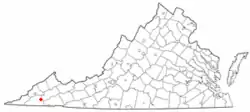 Location of Nickelsville, Virginia | |
| Coordinates: 36°45′7″N 82°25′1″W | |
| Country | United States |
| State | Virginia |
| County | Scott |
| Area | |
| • Total | 0.48 sq mi (1.24 km2) |
| • Land | 0.48 sq mi (1.24 km2) |
| • Water | 0.00 sq mi (0.00 km2) |
| Elevation | 1,916 ft (584 m) |
| Population (2010) | |
| • Total | 383 |
| • Estimate (2019)[2] | 360 |
| • Density | 751.57/sq mi (290.11/km2) |
| Time zone | UTC−5 (Eastern (EST)) |
| • Summer (DST) | UTC−4 (EDT) |
| ZIP code | 24271 |
| Area code(s) | 276 |
| FIPS code | 51-56304[3] |
| GNIS feature ID | 1493348[4] |
| Website | www |
History
Bush Mill and the Kilgore Fort House are listed on the National Register of Historic Places.[5]
Geography
Nickelsville is located at 36°45′07″N 82°25′01″W (36.751927, −82.416951).[6]
According to the United States Census Bureau, the town has a total area of 0.5 square miles (1.3 km2), all of it land.
Demographics
| Historical population | |||
|---|---|---|---|
| Census | Pop. | %± | |
| 1920 | 214 | — | |
| 1930 | 263 | 22.9% | |
| 1940 | 256 | −2.7% | |
| 1950 | 268 | 4.7% | |
| 1960 | 291 | 8.6% | |
| 1970 | 338 | 16.2% | |
| 1980 | 464 | 37.3% | |
| 1990 | 411 | −11.4% | |
| 2000 | 448 | 9.0% | |
| 2010 | 383 | −14.5% | |
| 2019 (est.) | 360 | [2] | −6.0% |
| U.S. Decennial Census[7] | |||
As of the census[3] of 2000, there were 448 people, 184 households, and 117 families living in the town. The population density was 932.8 people per square mile (360.4/km2). There were 210 housing units at an average density of 437.2 per square mile (168.9/km2). The racial makeup of the town was 99.78% White, and 0.22% from two or more races. Hispanic or Latino of any race were 0.67% of the population.
There were 184 households, out of which 28.3% had children under the age of 18 living with them, 52.2% were married couples living together, 9.8% had a female householder with no husband present, and 35.9% were non-families. 34.2% of all households were made up of individuals, and 20.1% had someone living alone who was 65 years of age or older. The average household size was 2.33 and the average family size was 2.97.
In the town, the population was spread out, with 21.9% under the age of 18, 9.8% from 18 to 24, 21.7% from 25 to 44, 26.3% from 45 to 64, and 20.3% who were 65 years of age or older. The median age was 43 years. For every 100 females, there were 77.8 males. For every 100 females age 18 and over, there were 78.6 males.
The median income for a household in the town was $20,250, and the median income for a family was $31,750. Males had a median income of $21,528 versus $25,625 for females. The per capita income for the town was $11,871. About 15.2% of families and 26.7% of the population were below the poverty line, including 36.0% of those under age 18 and 27.9% of those age 65 or over.
Notable people
- Maybelle Carter, bluegrass artist, mother of June Carter Cash.
- Ollan Cassell, sprinter who won a gold medal at the 1964 Summer Olympics.
References
- "2019 U.S. Gazetteer Files". United States Census Bureau. Retrieved August 7, 2020.
- "Population and Housing Unit Estimates". United States Census Bureau. May 24, 2020. Retrieved May 27, 2020.
- "U.S. Census website". United States Census Bureau. Retrieved 2008-01-31.
- "US Board on Geographic Names". United States Geological Survey. 2007-10-25. Retrieved 2008-01-31.
- "National Register Information System". National Register of Historic Places. National Park Service. July 9, 2010.
- "US Gazetteer files: 2010, 2000, and 1990". United States Census Bureau. 2011-02-12. Retrieved 2011-04-23.
- "Census of Population and Housing". Census.gov. Retrieved June 4, 2015.
External links
Municipalities and communities of Scott County, Virginia, United States | ||
|---|---|---|
| Towns | 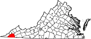 Map of Virginia highlighting Scott County | |
| Unincorporated communities | ||
| ||
| Authority control |
|---|