Dakota Ridge, Colorado
Dakota Ridge is an unincorporated community and a census-designated place (CDP) located in and governed by Jefferson County, Colorado, United States. The CDP is a part of the Denver–Aurora–Lakewood, CO Metropolitan Statistical Area. The population of the Dakota Ridge CDP was 32,005 at the United States Census 2010.[4] In 1988, voters turned down a proposal to incorporate Dakota Ridge.[5] The community lies in ZIP codes 80127 and 80465.[3]
Dakota Ridge, Colorado | |
|---|---|
 Location of the Dakota Ridge CDP in Jefferson County, Colorado. | |
 Dakota Ridge Location of the Dakota Ridge CDP in the United States. | |
| Coordinates: 39°37′09″N 105°08′04″W[1] | |
| Country | |
| State | |
| County | Jefferson County |
| Government | |
| • Type | unincorporated community |
| Area | |
| • Total | 9.685 sq mi (25.085 km2) |
| • Land | 9.387 sq mi (24.311 km2) |
| • Water | 0.299 sq mi (0.774 km2) |
| Elevation | 5,771 ft (1,759 m) |
| Population (2010) | |
| • Total | 32,005 |
| • Density | 3,410/sq mi (1,316/km2) |
| Time zone | UTC-7 (MST) |
| • Summer (DST) | UTC-6 (MDT) |
| ZIP Code[3] | 80127, 80465 |
| Area codes | 303 & 720 |
| GNIS feature[2] | Dakota Ridge CDP |
Geography
Dakota Ridge is bordered to the east by Denver, to the north by Lakewood, and to the south by unincorporated Ken Caryl. It is bordered to the west by the Dakota Hogback, a sharp hogback ridge that to the north near Morrison is also known as Dinosaur Ridge.
Colorado State Highway 470, part of the beltway around the Denver metropolitan area, runs through the western part of the community, leading north to Golden and southeast to Highlands Ranch. Downtown Denver is 17 miles (27 km) to the northeast.
The Dakota Ridge CDP has an area of 6,199 acres (25.085 km2), including 191 acres (0.774 km2) of water.[1]
Demographics
The United States Census Bureau initially defined the Dakota Ridge CDP for the United States Census 2010.
| Year | Pop. | ±% |
|---|---|---|
| 2010 | 32,005 | — |
| 2020 | — | |
| Source: United States Census Bureau | ||
Education
Dakota Ridge is served by the Jefferson County Public Schools.
See also
- Outline of Colorado
- State of Colorado
- Colorado cities and towns
- Colorado counties
- Colorado metropolitan areas
References
- "State of Colorado Census Designated Places - BAS20 - Data as of January 1, 2020". United States Census Bureau. Retrieved December 17, 2020.
- "U.S. Board on Geographic Names: Domestic Names". United States Geological Survey. Retrieved December 17, 2020.
- "Zip Code 80127 Map and Profile". zipdatamaps.com. 2020. Retrieved January 18, 2020.
- "2010: DEC Summary File 1". United States Census Bureau. Retrieved December 20, 2020.
- "Western History Subject Index". digital.denverlibrary.org. Retrieved 2021-01-12.
External links
Municipalities and communities of Jefferson County, Colorado, United States | ||
|---|---|---|
| Cities | 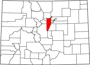 Map of Colorado highlighting Jefferson County | |
| Towns | ||
| CDPs | ||
| Unincorporated communities | ||
| Ghost town | ||
| Footnotes | ‡This populated place also has portions in an adjacent county or counties | |
| ||