East Pleasant View, Colorado
East Pleasant View is an unincorporated community and a census-designated place (CDP) located in and governed by Jefferson County, Colorado, United States. The CDP is a part of the Denver–Aurora–Lakewood, CO Metropolitan Statistical Area. The population of the East Pleasant View CDP was 356 at the United States Census 2010.[4] The Pleasant View Metropolitan District provides services. The Golden Post Office (ZIP Code 80401) serves the area. [3]
East Pleasant View, Colorado | |
|---|---|
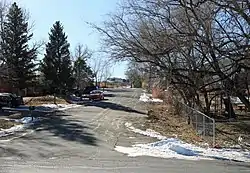 Ellis Street in East Pleasant View. | |
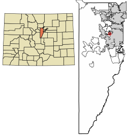 Location of the East Pleasant View CDP in Jefferson County, Colorado. | |
 East Pleasant View Location of the East Pleasant View CDP in the United States. | |
| Coordinates: 39°43′40″N 105°09′26″W[1] | |
| Country | |
| State | |
| County | Jefferson County |
| Government | |
| • Type | unincorporated community |
| Area | |
| • Total | 0.111 sq mi (0.287 km2) |
| • Land | 0.111 sq mi (0.287 km2) |
| • Water | 0.000 sq mi (0.000 km2) |
| Elevation | 5,837 ft (1,779 m) |
| Population (2010) | |
| • Total | 356 |
| • Density | 3,207/sq mi (1,240/km2) |
| Time zone | UTC-7 (MST) |
| • Summer (DST) | UTC-6 (MDT) |
| ZIP Code[3] | Golden 80401 |
| Area codes | 303 & 720 |
| GNIS feature[2] | East Pleasant View CDP |
Geography
The East Pleasant View CDP has an area of 71 acres (0.287 km2), all land.[1]
Demographics
The United States Census Bureau initially defined the East Pleasant View CDP for the United States Census 2000.
| Year | Pop. | ±% |
|---|---|---|
| 2000 | 369 | — |
| 2010 | 356 | −3.5% |
| 2020 | — | |
| Source: United States Census Bureau | ||
Education
East Pleasant View is served by the Jefferson County Public Schools.
See also
- Outline of Colorado
- State of Colorado
- Colorado cities and towns
- Colorado counties
- Colorado metropolitan areas
References
- "State of Colorado Census Designated Places - BAS20 - Data as of January 1, 2020". United States Census Bureau. Retrieved December 18, 2020.
- "U.S. Board on Geographic Names: Domestic Names". United States Geological Survey. Retrieved December 18, 2020.
- "Zip Code 80401 Map and Profile". zipdatamaps.com. 2020. Retrieved December 20, 2020.
- "2010: DEC Summary File 1". United States Census Bureau. Retrieved December 20, 2020.
External links
Municipalities and communities of Jefferson County, Colorado, United States | ||
|---|---|---|
| Cities | 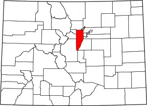 Map of Colorado highlighting Jefferson County | |
| Towns | ||
| CDPs | ||
| Unincorporated communities | ||
| Ghost town | ||
| Footnotes | ‡This populated place also has portions in an adjacent county or counties | |
| ||
This article is issued from Wikipedia. The text is licensed under Creative Commons - Attribution - Sharealike. Additional terms may apply for the media files.