Idledale, Colorado
Idledale is an unincorporated town, a post office, and a census-designated place (CDP) located in Jefferson County, Colorado, United States. The Idledale post office has the ZIP code 80453.[3] At the United States Census 2010, the population of the Idledale CDP was 252, while the population of the 80453 ZIP Code Tabulation Area was 197.[4] Jefferson County governs the unincorporated town.
Idledale, Colorado | |
|---|---|
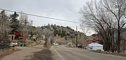 Idledale in 2014 | |
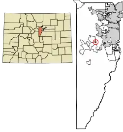 Location of the Idledale CDP in Jefferson County, Colorado. | |
 Idledale Location of the Idledale CDP in the United States. | |
| Coordinates: 39°40′08″N 105°14′35″W[1] | |
| Country | |
| State | |
| County | Jefferson County |
| Government | |
| • Type | unincorporated community |
| Area | |
| • Total | 0.277 sq mi (0.717 km2) |
| • Land | 0.277 sq mi (0.717 km2) |
| • Water | 0.000 sq mi (0.000 km2) |
| Elevation | 6,598 ft (2,011 m) |
| Population (2010) | |
| • Total | 252 |
| • Density | 910/sq mi (351/km2) |
| Time zone | UTC-7 (MST) |
| • Summer (DST) | UTC-6 (MDT) |
| ZIP Code[3] | 80453 |
| Area codes | 303 & 720 |
| GNIS feature[2] | Idledale CDP |
History
Originally called "Starbuck Heights", the town was almost washed out by a storm in 1933. When it was rebuilt, the town became known as Idledale.[2]
Geography
Idledale is located on the north side of Bear Creek. Colorado State Highway 74 passes through the community as it traverses Bear Creek Canyon; to the east, the highway is known as Bear Creek Canyon Scenic Mountain Drive and leads downstream 4 miles (6 km) to Morrison; to the west the highway leads up the canyon the same distance to Kittredge.
The Idledale CDP has an area of 177 acres (0.717 km2), all land.[1]
Demographics
The United States Census Bureau initially defined the Idledale CDP for the United States Census 2010.
| Year | Pop. | ±% |
|---|---|---|
| 2010 | 252 | — |
| 2020 | — | |
| Source: United States Census Bureau | ||
Education
Idledale is served by the Jefferson County Public Schools.
See also
- Outline of Colorado
- State of Colorado
- Colorado cities and towns
- Colorado counties
- Colorado metropolitan areas
References
- "State of Colorado Census Designated Places - BAS20 - Data as of January 1, 2020". United States Census Bureau. Retrieved December 18, 2020.
- "U.S. Board on Geographic Names: Domestic Names". United States Geological Survey. Retrieved December 18, 2020.
- "Look Up a ZIP Code". United States Postal Service. Retrieved December 18, 2020.
- "2010: DEC Summary File 1". United States Census Bureau. Retrieved December 20, 2020.
External links
- Idledale @ Colorado.com
- Idledale @ UncoverColorado.com
- Idledale, Colorado Mining Claims And Mines
- Jefferson County website
- Jeffco Public Schools
Municipalities and communities of Jefferson County, Colorado, United States | ||
|---|---|---|
| Cities | 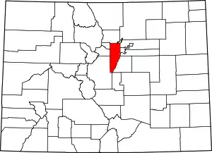 Map of Colorado highlighting Jefferson County | |
| Towns | ||
| CDPs | ||
| Unincorporated communities | ||
| Ghost town | ||
| Footnotes | ‡This populated place also has portions in an adjacent county or counties | |
| ||
