Dimataling
Dimataling, officially the Municipality of Dimataling (Cebuano: Lungsod sa Dimataling; Subanen: Benwa Dimataling; Chavacano: Municipalidad de Dimataling; Tagalog: Bayan ng Dimataling), is a 4th class municipality in the province of Zamboanga del Sur, Philippines. According to the 2015 census, it has a population of 30,081 people. [3]
Dimataling | |
|---|---|
| Municipality of Dimataling | |
 Map of Zamboanga del Sur with Dimataling highlighted | |
OpenStreetMap 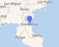
| |
.svg.png.webp) Dimataling Location within the Philippines | |
| Coordinates: 7°32′N 123°22′E | |
| Country | |
| Region | Zamboanga Peninsula (Region IX) |
| Province | Zamboanga del Sur |
| District | 2nd District |
| Founded | June 17, 1950 |
| Barangays | 24 (see Barangays) |
| Government | |
| • Type | Sangguniang Bayan |
| • Mayor | Avelino J. Yrauda |
| • Vice Mayor | Omar T. Buluan |
| • Representative | Leonardo L. Babasa Jr. |
| • Electorate | 21,204 voters (2019) |
| Area | |
| • Total | 141.80 km2 (54.75 sq mi) |
| Elevation | 12 m (39 ft) |
| Population | |
| • Total | 30,081 |
| • Density | 210/km2 (550/sq mi) |
| • Households | 6,501 |
| Economy | |
| • Income class | 4th municipal income class |
| • Poverty incidence | 48.92% (2015)[4] |
| • Revenue | ₱76,075,698.43 (2016) |
| Time zone | UTC+8 (PST) |
| ZIP code | 7032 |
| PSGC | |
| IDD : area code | +63 (0)62 |
| Climate type | tropical climate |
| Native languages | Subanon Cebuano Chavacano Tagalog |
| Website | www |
Dimataling was created in 1950 from the barrios of Dinas, Legarda, Mirapao, Migpulao, Kalipapa, Pisaan, Bubway, Tiniguangan, Tabina and Dimataling from Pagadian (not yet as a city at that time) and the barrios of Punta Flecha, Pitogo, Qugbay, Balong-balong, Libertad and Dumanguilas from Margosatubig.[5]
Barangays
Dimataling is administratively subdivided into 24 barangays.
- Bacayawan
- Baha
- Balanagan
- Baluno
- Binuay
- Buburay
- Grap
- Josefina
- Kagawasan
- Lalab
- Libertad
- Magahis
- Mahayag
- Mercedes
- Poblacion
- Saloagan
- San Roque
- Sugbay Uno
- Sumbato
- Sumpot
- Tinggabulong
- Tiniguangan
- Tipangi
- Upper Ludiong
Climate
| Climate data for Dimataling, Zamboanga del Sur | |||||||||||||
|---|---|---|---|---|---|---|---|---|---|---|---|---|---|
| Month | Jan | Feb | Mar | Apr | May | Jun | Jul | Aug | Sep | Oct | Nov | Dec | Year |
| Average high °C (°F) | 31 (88) |
31 (88) |
32 (90) |
32 (90) |
31 (88) |
30 (86) |
29 (84) |
29 (84) |
29 (84) |
29 (84) |
30 (86) |
31 (88) |
30 (87) |
| Average low °C (°F) | 21 (70) |
22 (72) |
22 (72) |
23 (73) |
24 (75) |
24 (75) |
24 (75) |
24 (75) |
24 (75) |
24 (75) |
23 (73) |
22 (72) |
23 (74) |
| Average precipitation mm (inches) | 22 (0.9) |
18 (0.7) |
23 (0.9) |
24 (0.9) |
67 (2.6) |
120 (4.7) |
132 (5.2) |
156 (6.1) |
119 (4.7) |
124 (4.9) |
54 (2.1) |
24 (0.9) |
883 (34.6) |
| Average rainy days | 9.4 | 9.1 | 11.5 | 11.9 | 20.1 | 22.5 | 22.4 | 23.2 | 21.5 | 22.2 | 15.7 | 11.5 | 201 |
| Source: Meteoblue [6] | |||||||||||||
Demographics
| Year | Pop. | ±% p.a. |
|---|---|---|
| 1960 | 30,632 | — |
| 1970 | 28,341 | −0.77% |
| 1975 | 20,883 | −5.94% |
| 1980 | 16,497 | −4.60% |
| 1990 | 20,365 | +2.13% |
| 1995 | 23,116 | +2.40% |
| 2000 | 25,843 | +2.42% |
| 2007 | 26,902 | +0.56% |
| 2010 | 27,715 | +1.09% |
| 2015 | 30,081 | +1.57% |
| Source: Philippine Statistics Authority [3] [7] [8][9] | ||
References
- Municipality of Dimataling | (DILG)
- "Province: Zamboanga del Sur". PSGC Interactive. Quezon City, Philippines: Philippine Statistics Authority. Retrieved 12 November 2016.
- Census of Population (2015). "Region IX (Zamboanga Peninsula)". Total Population by Province, City, Municipality and Barangay. PSA. Retrieved 20 June 2016.
- "PSA releases the 2015 Municipal and City Level Poverty Estimates". Quezon City, Philippines. Retrieved 12 October 2019.
- "An act to create the municipality of Dimataling in the province of Zamboanga". LawPH.com. Archived from the original on 2012-07-12. Retrieved 2011-04-09.
- "Dimataling: Average Temperatures and Rainfall". Meteoblue. Retrieved 1 May 2020.
- Census of Population and Housing (2010). "Region IX (Zamboanga Peninsula)". Total Population by Province, City, Municipality and Barangay. NSO. Retrieved 29 June 2016.
- Censuses of Population (1903–2007). "Region IX (Zamboanga Peninsula)". Table 1. Population Enumerated in Various Censuses by Province/Highly Urbanized City: 1903 to 2007. NSO.
- "Province of Zamboanga del Sur". Municipality Population Data. Local Water Utilities Administration Research Division. Retrieved 17 December 2016.
External links
- Dimataling Profile at PhilAtlas.com
- Philippine Standard Geographic Code
- Philippine Census Information
Places adjacent to Dimataling | ||||||||||
|---|---|---|---|---|---|---|---|---|---|---|
| ||||||||||
Pagadian (capital) | |
| Municipalities | |
| Component city | |
| Highly urbanized city |
|
This article is issued from Wikipedia. The text is licensed under Creative Commons - Attribution - Sharealike. Additional terms may apply for the media files.
