Tigbao, Zamboanga del Sur
Tigbao, officially the Municipality of Tigbao (Cebuano: Lungsod sa Tigbao; Subanen: Benwa Tigbao; Chavacano: Municipalidad de Tigbao; Tagalog: Bayan ng Tigbao), is a 5th class municipality in the province of Zamboanga del Sur, Philippines. According to the 2015 census, it has a population of 20,979 people. [3]
Tigbao | |
|---|---|
| Municipality of Tigbao | |
 Map of Zamboanga del Sur with Tigbao highlighted | |
OpenStreetMap 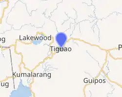
| |
.svg.png.webp) Tigbao Location within the Philippines | |
| Coordinates: 7°49′14″N 123°13′40″E | |
| Country | |
| Region | Zamboanga Peninsula (Region IX) |
| Province | Zamboanga del Sur |
| District | 2nd District |
| Founded | November 8, 1991 |
| Barangays | 18 (see Barangays) |
| Government | |
| • Type | Sangguniang Bayan |
| • Mayor | Eleazar C. Carcallas |
| • Vice Mayor | Joy Balandra |
| • Representative | Leonardo L. Babasa Jr. |
| • Electorate | 12,799 voters (2019) |
| Area | |
| • Total | 120.69 km2 (46.60 sq mi) |
| Elevation | 419 m (1,375 ft) |
| Population | |
| • Total | 20,979 |
| • Density | 170/km2 (450/sq mi) |
| • Households | 4,591 |
| Economy | |
| • Income class | 5th municipal income class |
| • Poverty incidence | 44.5% (2015)[4] |
| • Revenue | ₱69,045,717.36 (2016) |
| Time zone | UTC+8 (PST) |
| ZIP code | 7043 |
| PSGC | |
| IDD : area code | +63 (0)62 |
| Climate type | tropical climate |
| Native languages | Subanon Cebuano Chavacano Tagalog |
| Website | www |
It was created by virtue of Republic Act No. 7162 on November 8, 1991.[5]
Mount Timolan, the highest peak in Zamboanga del Sur, overlooks the town. The name of the town was derived from the abundance of "Tigbao" Grasses in the area.
Barangays
Tigbao is politically subdivided into 18 barangays.
- Begong
- Busol
- Caluma
- Diana Countryside
- Guinlin
- Lacarayan
- Lacupayan
- Libayoy
- Limas
- Longmot
- Maragang
- Mati
- Nangan-nangan
- New Tuburan
- Nilo
- Tigbao
- Timolan
- Upper Nilo
Climate
| Climate data for Tigbao, Zamboanga del Sur | |||||||||||||
|---|---|---|---|---|---|---|---|---|---|---|---|---|---|
| Month | Jan | Feb | Mar | Apr | May | Jun | Jul | Aug | Sep | Oct | Nov | Dec | Year |
| Average high °C (°F) | 29 (84) |
29 (84) |
30 (86) |
30 (86) |
28 (82) |
27 (81) |
27 (81) |
26 (79) |
27 (81) |
27 (81) |
28 (82) |
28 (82) |
28 (82) |
| Average low °C (°F) | 19 (66) |
19 (66) |
20 (68) |
21 (70) |
22 (72) |
22 (72) |
21 (70) |
21 (70) |
21 (70) |
21 (70) |
21 (70) |
20 (68) |
21 (69) |
| Average precipitation mm (inches) | 22 (0.9) |
18 (0.7) |
23 (0.9) |
24 (0.9) |
67 (2.6) |
120 (4.7) |
132 (5.2) |
156 (6.1) |
119 (4.7) |
124 (4.9) |
54 (2.1) |
24 (0.9) |
883 (34.6) |
| Average rainy days | 9.4 | 9.1 | 11.5 | 11.9 | 20.1 | 22.5 | 22.4 | 23.2 | 21.5 | 22.2 | 15.7 | 11.5 | 201 |
| Source: Meteoblue [6] | |||||||||||||
Demographics
| Year | Pop. | ±% p.a. |
|---|---|---|
| 1995 | 15,915 | — |
| 2000 | 16,914 | +1.31% |
| 2007 | 18,598 | +1.32% |
| 2010 | 19,300 | +1.36% |
| 2015 | 20,979 | +1.60% |
| Source: Philippine Statistics Authority [3] [7] [8][9] | ||
References
- Municipality of Tigbao | (DILG)
- "Province: Zamboanga del Sur". PSGC Interactive. Quezon City, Philippines: Philippine Statistics Authority. Retrieved 12 November 2016.
- Census of Population (2015). "Region IX (Zamboanga Peninsula)". Total Population by Province, City, Municipality and Barangay. PSA. Retrieved 20 June 2016.
- "PSA releases the 2015 Municipal and City Level Poverty Estimates". Quezon City, Philippines. Retrieved 12 October 2019.
- "Republic Act No. 7162; An Act Creating the Municipality of Tigbao in the Province of Zamboanga del Sur". Chan Robles Virtual Law Library. 8 November 1991. Retrieved 28 January 2016.
- "Tigbao: Average Temperatures and Rainfall". Meteoblue. Retrieved 1 May 2020.
- Census of Population and Housing (2010). "Region IX (Zamboanga Peninsula)". Total Population by Province, City, Municipality and Barangay. NSO. Retrieved 29 June 2016.
- Censuses of Population (1903–2007). "Region IX (Zamboanga Peninsula)". Table 1. Population Enumerated in Various Censuses by Province/Highly Urbanized City: 1903 to 2007. NSO.
- "Province of Zamboanga del Sur". Municipality Population Data. Local Water Utilities Administration Research Division. Retrieved 17 December 2016.
External links
Places adjacent to Tigbao, Zamboanga del Sur | ||||||||||
|---|---|---|---|---|---|---|---|---|---|---|
| ||||||||||
Pagadian (capital) | |
| Municipalities | |
| Component city | |
| Highly urbanized city |
|
This article is issued from Wikipedia. The text is licensed under Creative Commons - Attribution - Sharealike. Additional terms may apply for the media files.