Vincenzo A. Sagun, Zamboanga del Sur
Vincenzo A. Sagun, officially the Municipality of Vincenzo A. Sagun (Cebuano: Lungsod sa Vincenzo A. Sagun; Subanen: Benwa Vincenzo A. Sagun; Chavacano: Municipalidad de Vincenzo A. Sagun; Tagalog: Bayan ng Vincenzo A. Sagun), is a 5th class municipality in the province of Zamboanga del Sur, Philippines. According to the 2015 census, it has a population of 23,759 people. [3]
Vincenzo A. Sagun | |
|---|---|
| Municipality of Vincenzo A. Sagun | |
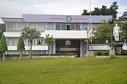 Municipal Hall | |
 Map of Zamboanga del Sur with Vincenzo A. Sagun highlighted | |
OpenStreetMap 
| |
.svg.png.webp) Vincenzo A. Sagun Location within the Philippines | |
| Coordinates: 7°31′N 123°10′E | |
| Country | |
| Region | Zamboanga Peninsula (Region IX) |
| Province | Zamboanga del Sur |
| District | 2nd District |
| Founded | 1982 |
| Barangays | 14 (see Barangays) |
| Government | |
| • Type | Sangguniang Bayan |
| • Mayor | Merlinda P. Maata |
| • Vice Mayor | Adriano G. Balugtod Sr. |
| • Representative | Leonardo L. Babasa Jr. |
| • Electorate | 14,680 voters (2019) |
| Area | |
| • Total | 63.00 km2 (24.32 sq mi) |
| Elevation | 102 m (335 ft) |
| Population | |
| • Total | 23,759 |
| • Density | 380/km2 (980/sq mi) |
| • Households | 4,898 |
| Economy | |
| • Income class | 5th municipal income class |
| • Poverty incidence | 45.51% (2015)[4] |
| • Revenue | ₱69,883,297.31 (2016) |
| Time zone | UTC+8 (PST) |
| ZIP code | 7036 |
| PSGC | |
| IDD : area code | +63 (0)62 |
| Climate type | tropical climate |
| Native languages | Subanon Cebuano Chavacano Tagalog |
| Website | zds-vsagun |
The municipality is named after Zamboanga del Sur Governor and Representative Vincenzo Sagun.
History
There are no known historical records that can establish as to when the municipality started to exist as a community. What is known is that the municipality of Vincenzo Sagun as he is known today, was a product of the extraordinary efforts of a man bearing the same name.
The man VINCENZO A. SAGUN was a former member of the House of Representatives, representing the Province of Zamboanga del Sur, who left "no stones unturned" in seeking the formal creation of this erstwhile barangay of its mother Municipality, Margosatubig. Thru this tireless endeavor, President Diosdado Macapagal signed Presidential Proclamation No. 177, series of 1965, which created the MUNICIPALITY OF VINCENZO SAGUN.
In utmost recognition of the man whose efforts made it all possible for the municipality to exist as a distinct and separate local governing entity, the municipality was so named in his honor.
Folklore tell us that the municipality's first inhabitants were the Subanons. They were to have established their settlements along the riverbanks and in the hinterlands as a very peaceful and highly coordinated tribe ruled by a powerful warrior-leader. Legend has it that this warrior-leader, called Culangan, possessed magical powers and is capable of superhuman strength-like jumping as high as seven feet with a 50-kilogram pig on his shoulders.
These early settlers lived in a scattered, pocket-sized settlements. But to celebrate the "LOMPOK", a local religious rite, they congregate in a certain place they called "PAGBATAN". For quite some time the place was called as such, until it was changed to "KABATAN", meaning "the inhabitants". In fact, when Vincenzo Sagun was still part of Margosatubig, it was known as Barangay Kabatan.
Geography
Vicenzo A. Sagun is a coastal municipality that is found in the southern section of Zamboanga del Sur. It is in the Baganian Peninsula, some 60 kilometers northwest of the province’s capital of Pagadian City. As for its boundaries, the municipality of Margosatubig can be found on the north, while the south is occupied by Maligay Bay and Dumanquilas Bay, on the southeast and the southwest, respectively. The municipality of Dimataling cradles it on the east. The total area of Vincenzo A. Sagun makes up 8.15% of Zamboanga del Sur’s area, and .041% of the whole Zamboanga Peninsula Region.
Of the 14 barangays that Vincenzo Sagun has, 11 of them are coastal, and most of the inhabitants are fisherfolk by trade and livelihood. The municipality is noted for its rich marine resources, with some parts being groomed to be prime tourist aquatic spot. One of the Vincenzo Sagun’s featured products are the dried fish which are usually exported to the other provinces.
Climate
| Climate data for Vincenzo A. Sagun, Zamboanga del Sur | |||||||||||||
|---|---|---|---|---|---|---|---|---|---|---|---|---|---|
| Month | Jan | Feb | Mar | Apr | May | Jun | Jul | Aug | Sep | Oct | Nov | Dec | Year |
| Average high °C (°F) | 30 (86) |
31 (88) |
32 (90) |
32 (90) |
30 (86) |
29 (84) |
28 (82) |
28 (82) |
29 (84) |
29 (84) |
30 (86) |
30 (86) |
30 (86) |
| Average low °C (°F) | 21 (70) |
21 (70) |
22 (72) |
23 (73) |
24 (75) |
24 (75) |
23 (73) |
23 (73) |
23 (73) |
23 (73) |
23 (73) |
21 (70) |
23 (73) |
| Average precipitation mm (inches) | 22 (0.9) |
18 (0.7) |
23 (0.9) |
24 (0.9) |
67 (2.6) |
120 (4.7) |
132 (5.2) |
156 (6.1) |
119 (4.7) |
124 (4.9) |
54 (2.1) |
24 (0.9) |
883 (34.6) |
| Average rainy days | 9.4 | 9.1 | 11.5 | 11.9 | 20.1 | 22.5 | 22.4 | 23.2 | 21.5 | 22.2 | 15.7 | 11.5 | 201 |
| Source: Meteoblue [5] | |||||||||||||
Barangays
Vincenzo A. Sagun is politically subdivided into 14 barangays.
- Ambulon
- Biu-os
- Cogon
- Danan
- Kabatan (Poblacion)
- Kapatagan
- Limason
- Linoguayan
- Lumbal
- Lunib
- Maculay
- Maraya
- Sagucan
- Waling-waling
Demographics
| Year | Pop. | ±% p.a. |
|---|---|---|
| 1990 | 17,294 | — |
| 1995 | 17,410 | +0.13% |
| 2000 | 19,072 | +1.97% |
| 2007 | 19,984 | +0.65% |
| 2010 | 20,583 | +1.08% |
| 2015 | 23,759 | +2.77% |
| Source: Philippine Statistics Authority [3] [6] [7][8] | ||
Religion
- Assembly of God
- Christian and Missionary Alliance Churches of the Philippines
- Church of Christ
- Church of Vincenzo Sagun
- Community Baptist Church
- Iglesia ni Cristo
- International One Way Outreach Foundation Inc.
- Jehova's Witnesses
- Panon sa Napolog Duha ka Banay
- Roman Catholic
- Seventh-day Adventist
- True Jesus Church
- United Church of Christ in the Philippines
- United Pentecostal Church International
Education
College
- Josephina H. Cerilles State College-Vincenzo Sagun External Studies Unit
High schools
- Cogon National High School
- Judge Edmundo Pinga National High School
- Kabatan National High School
- Sagucan National High School
Elementary schools
- Vincenzo Sagun Central School
- Biu-os Elementary School
- Cogon Elementary School
- Danan Elementary School
- Kapatagan Elementary School
- Limason Elementary School
- Linoguayan Elementary School
- Lumbal Elementary School
- Lunib Elementary School
- Maculay Elementary School
- Maraya Elementary School
- Sagucan Elementary School
- Talaptap Elementary School
- Waling-waling Elementary School
- Vincenzo Sagun Precious Gems Elementary School Inc.
References
- Municipality of Vincenzo A. Sagun | (DILG)
- "Province: Zamboanga del Sur". PSGC Interactive. Quezon City, Philippines: Philippine Statistics Authority. Retrieved 12 November 2016.
- Census of Population (2015). "Region IX (Zamboanga Peninsula)". Total Population by Province, City, Municipality and Barangay. PSA. Retrieved 20 June 2016.
- "PSA releases the 2015 Municipal and City Level Poverty Estimates". Quezon City, Philippines. Retrieved 12 October 2019.
- "Vincenzo A. Sagun: Average Temperatures and Rainfall". Meteoblue. Retrieved 1 May 2020.
- Census of Population and Housing (2010). "Region IX (Zamboanga Peninsula)". Total Population by Province, City, Municipality and Barangay. NSO. Retrieved 29 June 2016.
- Censuses of Population (1903–2007). "Region IX (Zamboanga Peninsula)". Table 1. Population Enumerated in Various Censuses by Province/Highly Urbanized City: 1903 to 2007. NSO.
- "Province of Zamboanga del Sur". Municipality Population Data. Local Water Utilities Administration Research Division. Retrieved 17 December 2016.
External links
- Vincenzo A. Sagun Profile at PhilAtlas.com
- Philippine Standard Geographic Code
- Philippine Census Information
Places adjacent to Vincenzo A. Sagun, Zamboanga del Sur | ||||||||||
|---|---|---|---|---|---|---|---|---|---|---|
| ||||||||||
Pagadian (capital) | |
| Municipalities | |
| Component city | |
| Highly urbanized city |
|