Dufferin Parish, New Brunswick
Dufferin is a civil parish in Charlotte County, New Brunswick, Canada,[2] located east of St. Stephen. It comprises a single local service district (LSD), which is a member of the Southwest New Brunswick Service Commission (SNBSC).[3]
Dufferin | |
|---|---|
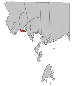 Location within Charlotte County. | |
| Country | |
| Province | |
| County | Charlotte County |
| Erected | 1873 |
| Area | |
| • Land | 12.34 km2 (4.76 sq mi) |
| Population (2016)[1] | |
| • Total | 573 |
| • Density | 46.4/km2 (120/sq mi) |
| • Change 2011-2016 | |
| • Dwellings | 256 |
| Time zone | UTC-4 (AST) |
| • Summer (DST) | UTC-3 (ADT) |
The Census subdivision of the same name shares the parish's boundaries.[1]
Origin of name
The parish was named for the Earl of Dufferin, who was Governor General of Canada at time.[4][lower-alpha 1]
History
Dufferin was erected in 1873 from Saint Stephen Parish.[5]
Boundaries
Dufferin comprises a tier of grants fronting on the St. Croix River, with the Old Bay Road and Dennis Stream forming its western boundary.[2]
Local service district
The local service district of the parish of Dufferin comprises the entire parish.[6]
The LSD was established in 1969 to assess for community services,[7] in this case to provide ambulance service after local funeral homes ceased doing so.[8] Fire protection was added in 1970.[9]
Today the LSD assesses for only the basic LSD services of fire protection, police services, land use planning, emergency measures, and dog control.[10] The taxing authority is 509.00 Dufferin.
Communities
Communities at least partly within the parish.[11][12][13]
- Champlain
- Crocker Hill
- The Ledge
Bodies of water
Bodies of water at least partly within the parish.[11][12][13]
- Oak Bay
- Pagans Cove
- St. Croix River
- The Narrows
Demographics
Population
| Canada census – Dufferin Parish, New Brunswick community profile | |||
|---|---|---|---|
| 2016 | 2011 | 2006 | |
| Population: | 573 (0.0% from 2011) | 573 (+7.1% from 2006) | 535 (-2.4% from 2001) |
| Land area: | 12.34 km2 (4.76 sq mi) | 12.40 km2 (4.79 sq mi) | 12.40 km2 (4.79 sq mi) |
| Population density: | 46.4/km2 (120/sq mi) | 46.2/km2 (120/sq mi) | 43.1/km2 (112/sq mi) |
| Median age: | 49.6 (M: 48.2, F: 50.2) | 49.5 (M: 50.5, F: 47.9) | 49.2 (M: 49.1, F: 49.5) |
| Total private dwellings: | 256 | 288 | 272 |
| Median household income: | $73,387 | $.N/A | $62,207 |
| Notes: Income data for this area has been suppressed for data quality or confidentiality reasons. – References: 2016[14] 2011[15] 2006[16] earlier[17] | |||
|
|
| |||||||||||||||||||||||||||
| [18][1] | |||||||||||||||||||||||||||||
Language
| Canada Census Mother Tongue - Dufferin Parish, New Brunswick[18] | ||||||||||||||||||
|---|---|---|---|---|---|---|---|---|---|---|---|---|---|---|---|---|---|---|
| Census | Total | English |
French |
English & French |
Other | |||||||||||||
| Year | Responses | Count | Trend | Pop % | Count | Trend | Pop % | Count | Trend | Pop % | Count | Trend | Pop % | |||||
2011 |
575 |
545 | 94.78% | 15 | 2.61% | 0 | 0.00% | 15 | 2.61% | |||||||||
2006 |
535 |
525 | 98.13% | 10 | 1.87% | 0 | 0.00% | 0 | 0.00% | |||||||||
2001 |
550 |
515 | 93.64% | 25 | 4.54% | 0 | 0.00% | 10 | 1.82% | |||||||||
1996 |
450 |
430 | n/a | 95.56% | 20 | n/a | 4.44% | 0 | n/a | 0.00% | 0 | n/a | 0.00% | |||||
Access Routes
Highways and numbered routes that run through the parish, including external routes that start or finish at the parish limits:[19]
|
|
|
|
See also
Notes
- Often cited as the 1st Marquess of Dufferin and Ava, a title he didn't hold until 1888.
References
- "Census Profile, 2016 Census: Dufferin, Parish [Census subdivision], New Brunswick". Statistics Canada. Retrieved 8 September 2019.
- "Chapter T-3 Territorial Division Act". Government of New Brunswick. Retrieved 1 August 2020.
- "Communities in each of the 12 Regional Service Commissions (RSC) / Les communautés dans chacune des 12 Commissions de services régionaux (CSR)" (PDF), Government of New Brunswick, July 2017, retrieved 1 February 2021
- Ganong, William F. (1896). A Monograph of the Place-Nomenclature of the Province of New Brunswick. Royal Society of Canada. p. 231.
- "36 Vic. c. 75 An Act to erect a part of the Parish of Saint Stephen, in the County of Charlotte, into a separate Town or Parish.". Acts of the General Assembly of Her Majesty's Province of New Brunswick. Passed in the Months of March & April 1873. Fredericton: Government of New Brunswick. 1873. pp. 253–254.
- "New Brunswick Regulation 84-168 under the Municipalities Act (O.C. 84-582)". Government of New Brunswick. Retrieved 6 February 2021.
- "Regulation 69–17 under the Municipalities Act (O. C. 69–161)". The Royal Gazette. Fredericton. 127: 149. 12 March 1969.
- "St. Stephen – Milltown Ambulance Brigade". The New Brunswick Municipal Monthly. Fredericton, NB: Department of Municipal Affairs. 25 (3): 5. March 1969.
- "Regulation 70–63 under the Municipalities Act (O. C. 70–385)". The Royal Gazette. Fredericton. 128: 343–344. 17 June 1970.
- "2020 Local Government Statistics for New Brunswick" (PDF). Department of Environment and Local Government. p. 55. Retrieved 6 February 2021.
- "untitled spreadsheet of New Brunswick place names". Geographical names in Canada. Natural Resources Canada. Retrieved 20 July 2020.
- "No. 160". Provincial Archives of New Brunswick. Department of Natural Resources and Energy Development. Retrieved 12 November 2020.
- "No. 161". Provincial Archives of New Brunswick. Department of Natural Resources and Energy Development. Retrieved 12 November 2020.
- "2016 Community Profiles". 2016 Canadian Census. Statistics Canada. 21 February 2017. Retrieved 8 September 2019.
- "2011 Community Profiles". 2011 Canadian Census. Statistics Canada. 5 July 2013. Retrieved 15 March 2014.
- "2006 Community Profiles". 2006 Canadian Census. Statistics Canada. 30 March 2011. Retrieved 15 March 2014.
- "2001 Community Profiles". 2001 Canadian Census. Statistics Canada. 17 February 2012.
- Statistics Canada: 1996, 2001, 2006, 2011 census
- Atlantic Canada Back Road Atlas ISBN 978-1-55368-618-7 Pages 4, 12
Places adjacent to Dufferin Parish, New Brunswick | ||||||||||
|---|---|---|---|---|---|---|---|---|---|---|
| ||||||||||
| Subdivisions | |
|---|---|
| Cities | |
| Counties | |
| |