Saint David Parish, New Brunswick
Saint David is a civil parish in Charlotte County, New Brunswick, Canada,[2] located northeast of St. Stephen and northwest of Saint Andrews.
Saint David
St. David | |
|---|---|
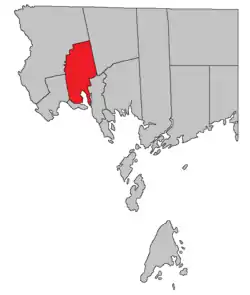 Location within Charlotte County. | |
| Country | |
| Province | |
| County | Charlotte County |
| Erected | 1786 |
| Area | |
| • Land | 190.66 km2 (73.61 sq mi) |
| Population (2016)[1] | |
| • Total | 1,529 |
| • Density | 8.0/km2 (21/sq mi) |
| • Pop 2011-2016 | |
| • Dwellings | 743 |
| Time zone | UTC-4 (AST) |
| • Summer (DST) | UTC-3 (ADT) |
The local service district (LSD) and Census subdivision of the same name have the same boundaries as the parish.[3]
The LSD is a member of the Southwest New Brunswick Service Commission (SNBSC).[4]
Origin of the name
Ganong believed the name suggested by other Saint names in the area.[5] Five of the original six mainland parishes of Charlotte County used names of major saints recognised by the Church of England: Andrew (Scotland), David (Wales), George (England), Patrick (Ireland), and Stephen.
History
Saint David was erected in 1786 as one of the original parishes of Charlotte County.[6] The block grant to the Cape Ann Association formed the bulk of the parish.
In 1881 southern end of the boundary with Saint Croix Parish was altered, transferring five grants to Saint David.[7]
Communities
|
|
|
Bodies of water and islands
This is a list of rivers, lakes, streams, creeks, marshes and Islands that are at least partially in this parish
- Foster Lake
- Oak Bay
- Spoon Island
Demographics
Population
| Canada census – Saint David Parish, New Brunswick community profile | |||
|---|---|---|---|
| 2016 | 2011 | 2006 | |
| Population: | 1,529 (-4.7% from 2011) | 1,605 (+7.1% from 2006) | 1,499 (-6.0% from 2001) |
| Land area: | 190.66 km2 (73.61 sq mi) | 189.93 km2 (73.33 sq mi) | 189.91 km2 (73.32 sq mi) |
| Population density: | 8.0/km2 (21/sq mi) | 8.5/km2 (22/sq mi) | 7.9/km2 (20/sq mi) |
| Median age: | 50.5 (M: 50.9, F: 50.0) | 47.8 (M: 47.9, F: 47.6) | 42.6 (M: 41.9, F: 43.1) |
| Total private dwellings: | 743 | 787 | 676 |
| Median household income: | $54,240 | $41,215 | |
| References: 2016[8] 2011[9] 2006[10] earlier[11] | |||
|
|
| |||||||||||||||||||||||||||
| [12][1] | |||||||||||||||||||||||||||||
Language
| Canada Census Mother Tongue - Saint David Parish, New Brunswick[12] | ||||||||||||||||||
|---|---|---|---|---|---|---|---|---|---|---|---|---|---|---|---|---|---|---|
| Census | Total | English |
French |
English & French |
Other | |||||||||||||
| Year | Responses | Count | Trend | Pop % | Count | Trend | Pop % | Count | Trend | Pop % | Count | Trend | Pop % | |||||
2011 |
1,590 |
1,530 | 96.23% | 40 | 2.52% | 5 | 0.31% | 15 | 0.94% | |||||||||
2006 |
1,495 |
1,440 | 96.32% | 25 | 1.67% | 10 | 0.67% | 20 | 1.34% | |||||||||
2001 |
1,585 |
1,555 | 98.11% | 30 | 1.89% | 0 | 0.00% | 0 | 0.00% | |||||||||
1996 |
1,630 |
1,580 | n/a | 96.93% | 40 | n/a | 2.45% | 0 | n/a | 0.00% | 10 | n/a | 0.61% | |||||
Access Routes
Highways and numbered routes that run through the parish, including external routes that start or finish at the parish limits:[13]
See also
References
- "Census Profile, 2016 Census: Saint David, Parish [Census subdivision], New Brunswick". Statistics Canada. Retrieved 30 August 2019.
- "Chapter T-3 Territorial Division Act". Government of New Brunswick. Retrieved 14 August 2020.
- "New Brunswick Regulation 84-168 under the Municipalities Act (O.C. 84-582)". Government of New Brunswick. Retrieved 14 August 2020.
- "Communities in each of the 12 Regional Service Commissions (RSC) / Les communautés dans chacune des 12 Commissions de services régionaux (CSR)" (PDF), Government of New Brunswick, July 2017, retrieved 1 February 2021
- Ganong, William F. (1896). A Monograph of the Place-Nomenclature of the Province of New Brunswick. Royal Society of Canada. p. 268.
- "26 Geo. III Chapter I. An Act for the better ascertaining and confirming the Boundaries of the several Counties within this Province, and for subdividing them into Towns or Parishes.". Acts of the General Assembly of His Majesty's Province of New-Brunswick, passed in the year 1786. Saint John, New Brunswick: Government of New Brunswick. 1786. pp. 3–12.
- "44 Vic. c. 31 An Act to alter the Boundary Lines of the Parish of Saint Croix, in the County of Charlotte.". Acts of the General Assembly of Her Majesty's Province of New Brunswick. Passed in the Month of March 1881. Fredericton: Government of New Brunswick. 1881. pp. 66–67.
- "2016 Community Profiles". 2016 Canadian Census. Statistics Canada. 21 February 2017. Retrieved 30 August 2019.
- "2011 Community Profiles". 2011 Canadian Census. Statistics Canada. 5 July 2013. Retrieved 17 March 2014.
- "2006 Community Profiles". 2006 Canadian Census. Statistics Canada. 30 March 2011. Retrieved 17 March 2014.
- "2001 Community Profiles". 2001 Canadian Census. Statistics Canada. 17 February 2012.
- Statistics Canada: 1996, 2001, 2006, 2011 census
- Atlantic Canada Back Road Atlas ISBN 978-1-55368-618-7 Pages 4, 12
Places adjacent to Saint David Parish, New Brunswick | ||||||||||
|---|---|---|---|---|---|---|---|---|---|---|
| ||||||||||
| Subdivisions | |
|---|---|
| Cities | |
| Counties | |
| |