Saint Croix Parish, New Brunswick
Saint Croix is a civil parish in Charlotte County, New Brunswick, Canada,[3] straddling Route 1 to the north of Saint Andrews, New Brunswick.
Saint Croix
St. Croix | |
|---|---|
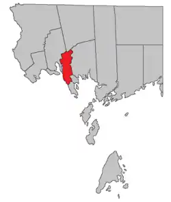 Location within Charlotte County. | |
| Country | |
| Province | |
| County | Charlotte County |
| Erected | 1874 |
| Named for | St. Croix River |
| Area | |
| • Land | 78.67 km2 (30.37 sq mi) |
| Population (2016)[1] | |
| • Total | 657 |
| • Density | 8.4/km2 (22/sq mi) |
| • Pop 2011-2016 | |
| • Dwellings | 368 |
| Time zone | UTC-4 (AST) |
| • Summer (DST) | UTC-3 (ADT) |
| Highways | Route 1 / Route 127 / Route 170 / Route 760[2] |
For governance purposes it is divided into two local service districts,[4] both of which are members of the Southwest New Brunswick Service Commission (SNBSC).[5]
The Census subdivision of the same name[1] includes the entire parish, while the LSD of Bayside is used as a Designated place.[6]
Origin of name
The parish's name comes from the St. Croix River,[7] which forms part of its western border.
History
Saint Croix was erected in 1874 from the northern part of Saint Andrews Parish[8] with smaller boundaries than it has today.
In 1881 the northern boundary was rewritten to run along grant lines,[9] taking parts of Dumbarton and Saint Patrick Parishes. Five grants on Saint Croix's western side were transferred to Saint David Parish.
In 1896 the eastern boundary was altered, exchanging small areas with Saint Patrick; Rickets Island was explicitly stated to be part of Saint Croix.[10] Saint Croix Island was included in the parish but the error was corrected in 1899.[11]
In 1958 the eastern boundary was altered to run completely along grant lines, once again exchanging small areas with Saint Patrick.[12]
Boundaries
External Boundaries
Saint Croix has the most irregular boundaries in Charlotte County, taking in an area based on land grants along and near Route 127, Cathcart Road, and Waweig Road to the north of Route 1 and along Frye Road and Chamcook and Little Chamcook Lakes to the south.
Internal Boundaries
- Bayside (LSD) comprises all of the mainland south of Route 1 and assesses for Community & Recreation Services[13] in addition to basic LSD services.[lower-alpha 1]
- the parish of Saint Croix (LSD) comprises the mainland north of Route 1 plus Rickets Island; it assesses only for basic services.
Census data
Population
| Canada census – Saint Croix Parish, New Brunswick community profile | |||
|---|---|---|---|
| 2016 | 2011 | 2006 | |
| Population: | 657 (+6.7% from 2011) | 616 (-8.1% from 2006) | 670 (+5.7% from 2001) |
| Land area: | 78.67 km2 (30.37 sq mi) | 78.77 km2 (30.41 sq mi) | 78.67 km2 (30.37 sq mi) |
| Population density: | 8.4/km2 (22/sq mi) | 7.8/km2 (20/sq mi) | 8.5/km2 (22/sq mi) |
| Median age: | 48.1 (M: 49.5, F: 46.3) | 45.2 (M: 45.8, F: 45.0) | 43.0 (M: 43.4, F: 41.5) |
| Total private dwellings: | 368 | 322 | 353 |
| Median household income: | $55,040 | $45,812 | $38,485 |
| References: 2016[14] 2011[15] 2006[16] earlier[17] | |||
|
|
| ||||||||||||||||||||||||||||||
(A) adjustment due to boundary change. [18][1] | ||||||||||||||||||||||||||||||||
Language
| Canada Census Mother Tongue - Saint Croix Parish, New Brunswick[18] | ||||||||||||||||||
|---|---|---|---|---|---|---|---|---|---|---|---|---|---|---|---|---|---|---|
| Census | Total | English |
French |
English & French |
Other | |||||||||||||
| Year | Responses | Count | Trend | Pop % | Count | Trend | Pop % | Count | Trend | Pop % | Count | Trend | Pop % | |||||
2011 |
610 |
590 | 96.72% | 10 | 1.64% | 0 | 0.00% | 10 | 1.64% | |||||||||
2006 |
665 |
655 | 98.50% | 0 | 0.00% | 0 | 0.00% | 10 | 1.50% | |||||||||
2001 |
635 |
620 | 97.64% | 15 | 2.36% | 0 | 0.00% | 0 | 0.00% | |||||||||
1996 |
660 |
650 | n/a | 98.48% | 10 | n/a | 1.52% | 0 | n/a | 0.00% | 0 | n/a | 0.00% | |||||
Communities
Communities within the parish;[19][20][21] italics indicate a deprecated name.[lower-alpha 2]
Bodies of water
Bodies of water at least partly in the parish;[19][20][21] italics indicates a deprecated name.[lower-alpha 2]
|
|
|
Islands
Islands in the parish.[19][20][21]
- Big Rock[lower-alpha 3] (in Chamcook Lake)
- Odell Island (in Chamcook Lake)
- Rickets Island (in Waweig River)
See also
Notes
- Firefighting, policing, zoning, EMO, and dog control, along with administrative costs.
- Categorised as Historical rather than Official by the Canadian Geographic Name Service; only those significantly different are noted.
- Classified as a shoal by CGNS but visible on cadastral map of the area.
References
- "Census Profile, 2016 Census Saint Croix, Parish [Census subdivision], New Brunswick". Statistics Canada. Retrieved 30 August 2019.
- Atlantic Canada Back Road Atlas ISBN 978-1-55368-618-7 Pages 4, 12
- "Chapter T-3 Territorial Division Act". Government of New Brunswick. Retrieved 26 July 2020.
- "New Brunswick Regulation 84-168 under the Municipalities Act (O.C. 84-582)". Government of New Brunswick. Retrieved 26 July 2020.
- "Communities in each of the 12 Regional Service Commissions (RSC) / Les communautés dans chacune des 12 Commissions de services régionaux (CSR)" (PDF), Government of New Brunswick, July 2017, retrieved 1 February 2021
- "Census Profile, 2016 Census". Statistics Canada. Retrieved 28 July 2020.
- Ganong, William F. (1896). A Monograph of the Place-Nomenclature of the Province of New Brunswick. Royal Society of Canada. p. 267.
- "37 Vic. c. 37 An Act to establish a new Parish in the County of Charlotte.". Acts of the General Assembly of Her Majesty's Province of New Brunswick. Passed in the Months of March & April 1874. Fredericton: Government of New Brunswick. 1874. pp. 109–111.
- "44 Vic. c. 31 An Act to alter the Boundary Lines of the Parish of Saint Croix, in the County of Charlotte.". Acts of the General Assembly of Her Majesty's Province of New Brunswick. Passed in the Month of March 1881. Fredericton: Government of New Brunswick. 1881. pp. 66–67.
- "59 Vic. c. 8 An Act to Revise and Codify an Act to Provide for the Division of the Province into Counties, Towns and Parishes.". Acts of the General Assembly of Her Majesty's Province of New Brunswick. Passed in the Month of March, 1896. Fredericton: Government of New Brunswick. 1896. pp. 86–123.
- "62 Vic. c. 33 An Act to amend an Act intituled 'An Act to revise and codify an Act to provide for the Division of the Province into Counties, Towns and Parishes,' and to better define the bounds of the Parish of Springfield and the Parish of Saint Croix.". Acts of the General Assembly of Her Majesty's Province of New Brunswick. Passed in the Months of March and April, 1899. Fredericton: Government of New Brunswick. 1899. pp. 163–164.
- "7 Elizabeth II, 1958, c. 56 An Act to Amend the Territorial Division Act". Acts of the Legislature of New Brunswick Passed During the Session of 1958. Fredericton: Government of New Brunswick. 1958. pp. 117–119.
- "2019 Local Government Statistics for New Brunswick" (PDF). Department of Environment and Local Government. p. 59. Retrieved 28 July 2020.
- "2016 Community Profiles". 2016 Canadian Census. Statistics Canada. 21 February 2017. Retrieved 30 August 2019.
- "2011 Community Profiles". 2011 Canadian Census. Statistics Canada. 5 July 2013. Retrieved 16 March 2014.
- "2006 Community Profiles". 2006 Canadian Census. Statistics Canada. 30 March 2011. Retrieved 16 March 2014.
- "2001 Community Profiles". 2001 Canadian Census. Statistics Canada. 17 February 2012.
- Statistics Canada: 1996, 2001, 2006, 2011 census
- "untitled spreadsheet of New Brunswick place names". Geographical names in Canada. Natural Resources Canada. Retrieved 20 July 2020.
- "No. 161". Provincial Archives of New Brunswick. Department of Natural Resources and Energy Development. Retrieved 1 October 2020.
- Official place names of New Brunswick checked against the cadastral map of the area.
Places adjacent to Saint Croix Parish, New Brunswick | |
|---|---|
| Subdivisions | |
|---|---|
| Cities | |
| Counties | |
| |