Ellsworth, New Hampshire
Ellsworth is a town in Grafton County, New Hampshire, United States. The population was 83 at the 2010 census.[1]
Ellsworth, New Hampshire | |
|---|---|
Town | |
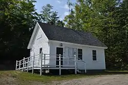 Town hall | |
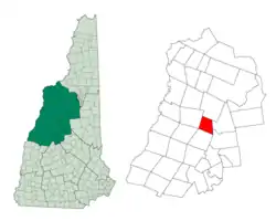 Location in Grafton County, New Hampshire | |
| Coordinates: 43°52′26″N 71°44′14″W | |
| Country | United States |
| State | New Hampshire |
| County | Grafton |
| Incorporated | 1769 |
| Area | |
| • Total | 21.5 sq mi (55.6 km2) |
| • Land | 21.4 sq mi (55.4 km2) |
| • Water | 0.1 sq mi (0.3 km2) 0.47% |
| Elevation | 1,174 ft (358 m) |
| Population (2010) | |
| • Total | 83 |
| • Density | 3.9/sq mi (1.5/km2) |
| Time zone | UTC-5 (Eastern) |
| • Summer (DST) | UTC-4 (Eastern) |
| ZIP code | 03223 |
| Area code(s) | 603 |
| FIPS code | 33-23860 |
| GNIS feature ID | 0873589 |
History
The town was originally known as "Trecothick", after Barlow Trecothick, a Bostonian who moved to London. He was an alderman, an MP, and a Lord Mayor of the City of London. He had a country estate at Addington, London, now called Addington Palace.
The name of the town was changed to "Ellsworth" in 1802, in honor of Chief Justice Oliver Ellsworth.
The first census of the town, in 1800, reported 47 residents.
Geography
According to the United States Census Bureau, the town has a total area of 21.5 square miles (55.7 km2), of which 21.4 sq mi (55.4 km2) is land and 0.1 sq mi (0.3 km2) is water, comprising 0.47% of the town. The highest point in Ellsworth is the summit of Mount Kineo, at 3,313 feet (1,010 m) above sea level. Ellsworth lies fully within the Merrimack River watershed.[3]
Demographics
| Historical population | |||
|---|---|---|---|
| Census | Pop. | %± | |
| 1800 | 47 | — | |
| 1810 | 142 | 202.1% | |
| 1820 | 213 | 50.0% | |
| 1830 | 234 | 9.9% | |
| 1840 | 300 | 28.2% | |
| 1850 | 320 | 6.7% | |
| 1860 | 302 | −5.6% | |
| 1870 | 193 | −36.1% | |
| 1880 | 209 | 8.3% | |
| 1890 | 150 | −28.2% | |
| 1900 | 107 | −28.7% | |
| 1910 | 46 | −57.0% | |
| 1920 | 30 | −34.8% | |
| 1930 | 28 | −6.7% | |
| 1940 | 26 | −7.1% | |
| 1950 | 24 | −7.7% | |
| 1960 | 3 | −87.5% | |
| 1970 | 13 | 333.3% | |
| 1980 | 53 | 307.7% | |
| 1990 | 74 | 39.6% | |
| 2000 | 87 | 17.6% | |
| 2010 | 83 | −4.6% | |
| 2017 (est.) | 86 | [4] | 3.6% |
| U.S. Decennial Census[5] | |||
At the 2000 census there were 87 people in 32 households, including 19 families, in the town. The population density was 4.1 people per square mile (1.6/km2). There were 72 housing units at an average density of 3.4 per square mile (1.3/km2). The racial makeup of the town was 96.55% White, and 3.45% Native American.[6] Of the 32 households 34.4% had children under the age of 18 living with them, 53.1% were married couples living together, none had a female householder with no husband present, and 40.6% were non-families. 18.8% of households were one person and 12.5% were one person aged 65 or older. The average household size was 2.72 and the average family size was 3.37.
The age distribution was 29.9% under the age of 18, 3.4% from 18 to 24, 23.0% from 25 to 44, 28.7% from 45 to 64, and 14.9% 65 or older. The median age was 41 years. For every 100 females, there were 102.3 males. For every 100 females age 18 and over, there were 110.3 males.
The median household income was $33,750 and the median family income was $34,750. Males had a median income of $26,500 versus $21,250 for females. The per capita income for the town was $22,705. None of the population and none of the families were below the poverty line.
References
| Wikimedia Commons has media related to Ellsworth, New Hampshire. |
- United States Census Bureau, American FactFinder, 2010 Census figures. Retrieved March 23, 2011.
- "Dry Towns" (PDF). NH Liquor Commission.
- Foster, Debra H.; Batorfalvy, Tatianna N.; Medalie, Laura (1995). Water Use in New Hampshire: An Activities Guide for Teachers. U.S. Department of the Interior and U.S. Geological Survey.
- "Annual Estimates of the Resident Population: April 1, 2010 to July 1, 2017 (PEPANNRES): Minor Civil Divisions – New Hampshire". Archived from the original on February 13, 2020. Retrieved November 14, 2018.
- "Census of Population and Housing". Census.gov. Retrieved June 4, 2016.
- "U.S. Census website". United States Census Bureau. Retrieved 2008-01-31.
External links
Places adjacent to Ellsworth, New Hampshire | |
|---|---|
Municipalities and communities of Grafton County, New Hampshire, United States | ||
|---|---|---|
| City | 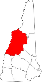 Map of New Hampshire highlighting Grafton County | |
| Towns |
| |
| Township | ||
| CDPs | ||
| Other villages | ||
| ||