Embden, Maine
Embden is a town in Somerset County, Maine, United States. The population was 939 at the 2010 census.
Embden, Maine | |
|---|---|
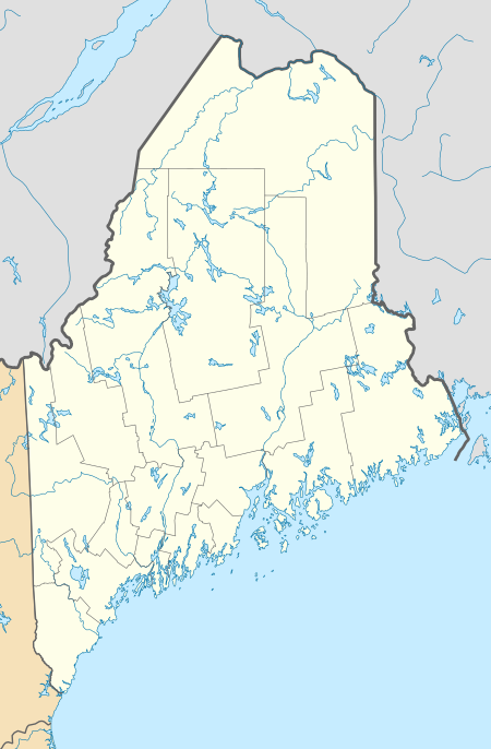 Embden, Maine Location within the state of Maine | |
| Coordinates: 44°56′13″N 69°56′42″W | |
| Country | United States |
| State | Maine |
| County | Somerset |
| Area | |
| • Total | 43.49 sq mi (112.64 km2) |
| • Land | 39.58 sq mi (102.51 km2) |
| • Water | 3.91 sq mi (10.13 km2) |
| Elevation | 420 ft (128 m) |
| Population | |
| • Total | 939 |
| • Estimate (2012[3]) | 949 |
| • Density | 23.7/sq mi (9.2/km2) |
| Time zone | UTC-5 (Eastern (EST)) |
| • Summer (DST) | UTC-4 (EDT) |
| ZIP code | 04958 |
| Area code(s) | 207 |
| FIPS code | 23-23410 |
| GNIS feature ID | 0582466 |
Geography
According to the United States Census Bureau, the town has a total area of 43.49 square miles (112.64 km2), of which 39.58 square miles (102.51 km2) is land and 3.91 square miles (10.13 km2) is water.[1] Included in the town is Embden Pond.
Embden Pond
| Embden Pond | |
|---|---|
 Along the shores of Embden Pond | |
 Embden Pond | |
| Location | Somerset County, Maine |
| Coordinates | 44°56′N 69°57′W[4] |
| Primary inflows | Hancock Stream[5] |
| Primary outflows | Mill Stream[5] |
| Basin countries | United States |
| Max. length | 3.5 mi (5.6 km)[6] |
| Max. width | 1 mi (1.6 km)[6] |
| Surface area | 1,542 acres (624 ha)[7] |
| Max. depth | 180 feet (55 m)[5] |
| Water volume | 91,627 acre⋅ft (113,020,000 m3)[7] |
| Surface elevation | 413 ft (126 m)[4] |
Embden Pond is a good habitat for smallmouth bass, lake trout, and land-locked Atlantic salmon. The pond shoreline is heavily developed with residences and seasonal camps. There is a public boat ramp at the south end of the pond near where Mill Stream overflows to the Carrabassett River, 4 miles (6.4 km) south of the pond and 1 mile (1.6 km) upstream of the Carrabassett's confluence with the Kennebec River.[5]
Demographics
| Historical population | |||
|---|---|---|---|
| Census | Pop. | %± | |
| 1810 | 351 | — | |
| 1820 | 664 | 89.2% | |
| 1830 | 894 | 34.6% | |
| 1840 | 983 | 10.0% | |
| 1850 | 971 | −1.2% | |
| 1860 | 1,041 | 7.2% | |
| 1870 | 803 | −22.9% | |
| 1880 | 674 | −16.1% | |
| 1890 | 579 | −14.1% | |
| 1900 | 567 | −2.1% | |
| 1910 | 529 | −6.7% | |
| 1920 | 475 | −10.2% | |
| 1930 | 393 | −17.3% | |
| 1940 | 319 | −18.8% | |
| 1950 | 303 | −5.0% | |
| 1960 | 321 | 5.9% | |
| 1970 | 418 | 30.2% | |
| 1980 | 536 | 28.2% | |
| 1990 | 659 | 22.9% | |
| 2000 | 881 | 33.7% | |
| 2010 | 939 | 6.6% | |
| 2014 (est.) | 937 | [8] | −0.2% |
| U.S. Decennial Census[9] | |||
2010 census
As of the census[2] of 2010, there were 939 people, 407 households, and 286 families living in the town. The population density was 23.7 inhabitants per square mile (9.2/km2). There were 950 housing units at an average density of 24.0 per square mile (9.3/km2). The racial makeup of the town was 97.6% White, 0.4% African American, 0.4% Native American, 0.2% Asian, 0.6% from other races, and 0.7% from two or more races. Hispanic or Latino of any race were 1.2% of the population.
There were 407 households, of which 23.6% had children under the age of 18 living with them, 60.9% were married couples living together, 5.2% had a female householder with no husband present, 4.2% had a male householder with no wife present, and 29.7% were non-families. 24.8% of all households were made up of individuals, and 11.3% had someone living alone who was 65 years of age or older. The average household size was 2.28 and the average family size was 2.66.
The median age in the town was 49.7 years. 17.9% of residents were under the age of 18; 5% were between the ages of 18 and 24; 20.1% were from 25 to 44; 36.6% were from 45 to 64; and 20.4% were 65 years of age or older. The gender makeup of the town was 52.3% male and 47.7% female.
2000 census
As of the census[10] of 2000, there were 881 people, 365 households, and 262 families living in the town. The population density was 22.0 people per square mile (8.5/km2). There were 893 housing units at an average density of 22.3 per square mile (8.6/km2). The racial makeup of the town was 98.86% White, 0.23% Native American, and 0.91% from two or more races. Hispanic or Latino of any race were 0.11% of the population.
There were 364 households, out of which 28.2% had children under the age of 18 living with them, 61.6% were married couples living together, 6.3% had a female householder with no husband present, and 28.2% were non-families. 22.2% of all households were made up of individuals, and 9.3% had someone living alone who was 65 years of age or older. The average household size was 2.38 and the average family size was 2.74.
In the town, the population was spread out, with 21.7% under the age of 18, 5.9% from 18 to 24, 28.7% from 25 to 44, 28.4% from 45 to 64, and 15.3% who were 65 years of age or older. The median age was 42 years. For every 100 females, there were 103.5 males. For every 100 females age 18 and over, there were 101.8 males.
The median income for a household in the town was $31,397, and the median income for a family was $35,833. Males had a median income of $28,281 versus $20,781 for females. The per capita income for the town was $14,588. About 10.2% of families and 15.4% of the population were below the poverty line, including 15.7% of those under age 18 and 13.8% of those age 65 or over.
Notable person
- John B. Pierce, founder of the company that became American Standard[11]
References
- "US Gazetteer files 2010". United States Census Bureau. Retrieved 2012-12-16.
- "U.S. Census website". United States Census Bureau. Retrieved 2012-12-16.
- "Population Estimates". United States Census Bureau. Archived from the original on 2013-06-11. Retrieved 2013-07-06.
- U.S. Geological Survey Geographic Names Information System: Embden Pond
- "Embden Pond" (PDF). Maine Department of Inland Fisheries and Wildlife. State of Maine. Archived from the original (PDF) on 20 October 2016. Retrieved 11 May 2016.
- The Maine Atlas and Gazetteer (Thirteenth ed.). Freeport, Maine: DeLorme Mapping Company. 1988. pp. 20&30. ISBN 0-89933-035-5.
- Maine Depts. of Environmental Protection and Inland Fisheries & Wildlife (2005-08-04). "Maine Lakes: Morphometry and Geographic Information". Senator George J. Mitchell Center for Environmental and Watershed Research, The University of Maine. Archived from the original on 2006-09-03. Retrieved 31 July 2008.
- "Annual Estimates of the Resident Population for Incorporated Places: April 1, 2010 to July 1, 2014". Archived from the original on May 23, 2015. Retrieved June 4, 2015.
- "Census of Population and Housing". Census.gov. Retrieved June 4, 2015.
- "U.S. Census website". United States Census Bureau. Retrieved 2008-01-31.
- John B. Pierce Archived 2013-03-08 at the Wayback Machine, John B. Pierce Laboratory website
Municipalities and communities of Somerset County, Maine, United States | ||
|---|---|---|
| Towns | 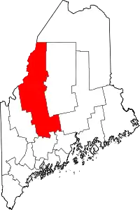 Somerset County map | |
| Plantations | ||
| Unorganized territories | ||
| CDPs | ||
| Other villages | ||
| ||