Kingfield, Maine
Kingfield is a town in Franklin County, Maine, United States. The population was 997 at the 2010 census. Kingfield is the principal gateway to Sugarloaf, a major ski resort, and is headquarters to Maine Huts and Trails.
Kingfield, Maine | |
|---|---|
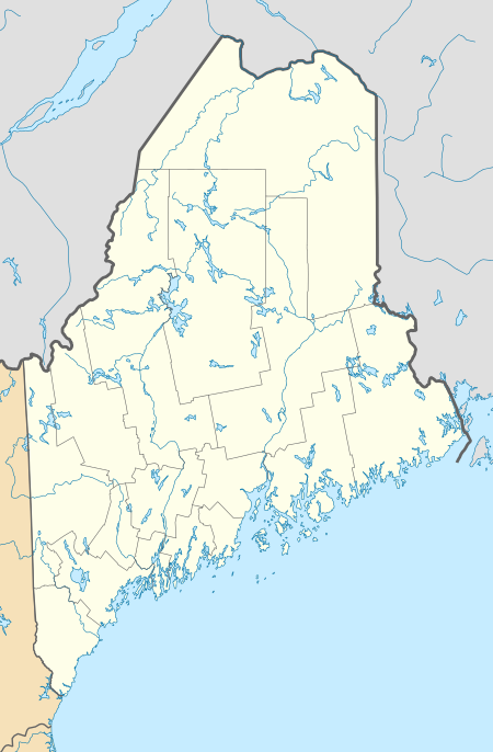
 Downtown in 2003 | |
 Kingfield Location within the state of Maine | |
| Coordinates: 44°58′26″N 70°10′3″W | |
| Country | United States |
| State | Maine |
| County | Franklin |
| Incorporated | January 24, 1816 |
| Area | |
| • Total | 43.28 sq mi (112.09 km2) |
| • Land | 43.12 sq mi (111.68 km2) |
| • Water | 0.16 sq mi (0.41 km2) |
| Elevation | 1,030 ft (314 m) |
| Population | |
| • Total | 997 |
| • Estimate (2012[3]) | 988 |
| • Density | 23.1/sq mi (8.9/km2) |
| Time zone | UTC-5 (Eastern (EST)) |
| • Summer (DST) | UTC-4 (EDT) |
| ZIP code | 04947 |
| Area code(s) | 207 |
| FIPS code | 23-37025 |
| GNIS feature ID | 0582541 |
| Website | www |
History
The first recorded European visitors were John W. Dutton and Nathaniel Kimball in 1805. They returned the following year with their families and began a settlement. In 1807, William King (later to be Maine's first Governor) purchased the township as part of the Bigham Plantation. In 1816 Kingfield was incorporated as the 210th town in the Maine District of the Commonwealth of Massachusetts.
Salomon Stanley was one of the earliest town settlers. His twin sons, Francis Edgar (F.E.) and Freelan Oscar (F.O.) became famous as manufacturers of Stanley Dry Plate, bought in 1903 by Eastman Kodak, and the Stanley Steamer automobile, manufactured from 1902 to 1924. Their sister, Chansonetta, became a photographer renowned for her portraits of local rural life. The Stanley Museum celebrates the family and its accomplishments.
Kingfield supported both agriculture and industry, drawing power from the Carrabassett River to power several sawmills, a clover mill, carding mill, flour mill, tannery, and a rake factory. All these mills are now closed. There was also a depot of a narrow-gauge railroad, which ceased to run in 1936.
In the early 1950s, local residents began developing Sugarloaf Mountain as a ski resort. Today Kingfield is known primarily as a gateway to Sugarloaf. In 2007 Nestlé opened a Poland Spring bottling plant in Kingfield. Kingfield is a Trail Town of the Appalachian Trail, being near Mount Abraham and the Bigelow Range.
Geography
According to the United States Census Bureau, the town has a total area of 43.28 square miles (112.09 km2), of which, 43.12 square miles (111.68 km2) of it is land and 0.16 square miles (0.41 km2) is water.[1] Situated in the Carrabassett River valley, Kingfield is drained by the Carrabassett River.
Climate
This climatic region is typified by large seasonal temperature differences, with warm to hot (and often humid) summers and cold (sometimes severely cold) winters. According to the Köppen Climate Classification system, Kingfield has a humid continental climate, abbreviated "Dfb" on climate maps.[4]
Demographics
| Historical population | |||
|---|---|---|---|
| Census | Pop. | %± | |
| 1820 | 464 | — | |
| 1830 | 554 | 19.4% | |
| 1840 | 671 | 21.1% | |
| 1850 | 662 | −1.3% | |
| 1860 | 670 | 1.2% | |
| 1870 | 560 | −16.4% | |
| 1880 | 454 | −18.9% | |
| 1890 | 601 | 32.4% | |
| 1900 | 693 | 15.3% | |
| 1910 | 927 | 33.8% | |
| 1920 | 975 | 5.2% | |
| 1930 | 1,024 | 5.0% | |
| 1940 | 860 | −16.0% | |
| 1950 | 963 | 12.0% | |
| 1960 | 864 | −10.3% | |
| 1970 | 877 | 1.5% | |
| 1980 | 1,083 | 23.5% | |
| 1990 | 1,114 | 2.9% | |
| 2000 | 1,103 | −1.0% | |
| 2010 | 997 | −9.6% | |
| 2014 (est.) | 970 | [5] | −2.7% |
| U.S. Decennial Census[6] | |||
2010 census
As of the census[2] of 2010, there were 997 people, 447 households, and 268 families living in the town. The population density was 23.1 inhabitants per square mile (8.9/km2). There were 695 housing units at an average density of 16.1 per square mile (6.2/km2). The racial makeup of the town was 97.5% White, 0.4% African American, 0.1% Native American, 0.9% Asian, 0.2% Pacific Islander, and 0.9% from two or more races. Hispanic or Latino of any race were 0.4% of the population.
There were 447 households, of which 25.1% had children under the age of 18 living with them, 47.9% were married couples living together, 6.9% had a female householder with no husband present, 5.1% had a male householder with no wife present, and 40.0% were non-families. 30.9% of all households were made up of individuals, and 12.3% had someone living alone who was 65 years of age or older. The average household size was 2.23 and the average family size was 2.78.
The median age in the town was 46.3 years. 20.8% of residents were under the age of 18; 4.4% were between the ages of 18 and 24; 21.7% were from 25 to 44; 34.3% were from 45 to 64; and 18.6% were 65 years of age or older. The gender makeup of the town was 49.8% male and 50.2% female.
2000 census
As of the census[7] of 2000, there were 1,103 people, 454 households, and 304 families living in the town. The population density was 25.4 people per square mile (9.8/km2). There were 659 housing units at an average density of 15.2 per square mile (5.9/km2). The racial makeup of the town was 98.37% White, 0.09% Native American, 0.18% Asian, 0.09% Pacific Islander, 0.27% from other races, and 1.00% from two or more races. Hispanic or Latino of any race were 0.18% of the population. 24.8% were of English, 18.0% American, 12.1% Irish, 8.0% French, 6.5% German, 5.3% French Canadian and 5.0% Finnish ancestry according to Census 2000.
There were 454 households, out of which 32.6% had children under the age of 18 living with them, 51.5% were married couples living together, 11.5% had a female householder with no husband present, and 33.0% were non-families. 24.9% of all households were made up of individuals, and 11.5% had someone living alone who was 65 years of age or older. The average household size was 2.43 and the average family size was 2.90.
In the town, the population was spread out, with 26.8% under the age of 18, 6.7% from 18 to 24, 29.5% from 25 to 44, 23.2% from 45 to 64, and 13.8% who were 65 years of age or older. The median age was 36 years. For every 100 females, there were 95.2 males. For every 100 females age 18 and over, there were 85.9 males.
The median income for a household in the town was $29,250, and the median income for a family was $37,614. Males had a median income of $27,059 versus $20,547 for females. The per capita income for the town was $15,954. About 5.1% of families and 9.5% of the population were below the poverty line, including 9.3% of those under age 18 and 14.9% of those age 65 or over.
Sites of interest
- Frank Hutchins House, listed on the National Register of Historic Places, and home of the Kingfield Historical Society Museum[8]
- Stanley Museum[9]
Education
Kingfield is part of Regional School Unit Number 58 and Maine School Administrative District Number 58.
Schools in the district include Kingfield Elementary School for students from Kindergarten to grade 8.[10]
Notable people
- Eugene Clark, Wisconsin state senator
- Edward L. Dexter, Maine state legislator
- William King, first governor of Maine
- Francis E. Stanley, inventor, businessman
- Freelan O. Stanley, inventor, businessman
- Chansonetta Stanley Emmons, photographer
References
- "US Gazetteer files 2010". United States Census Bureau. Archived from the original on 2012-12-20. Retrieved 2012-12-16.
- "U.S. Census website". United States Census Bureau. Retrieved 2012-12-16.
- "Population Estimates". United States Census Bureau. Archived from the original on 2013-06-11. Retrieved 2013-07-06.
- Climate Summary for Kingfield, Maine
- "Annual Estimates of the Resident Population for Incorporated Places: April 1, 2010 to July 1, 2014". Archived from the original on May 23, 2015. Retrieved June 4, 2015.
- "Census of Population and Housing". Census.gov. Retrieved June 4, 2015.
- "U.S. Census website". United States Census Bureau. Retrieved 2008-01-31.
- "National Register of Historic Places Inventory—Nomination Form | Frank Hutchins House". National Park Service. 1986. Retrieved 21 December 2019.
- Falkenstein, Michelle (25 January 2008). "The Simple Life, North of 'the Volvo Line'". The New York Times. Retrieved 21 December 2019.
- "Schools". Town of Kingfield Maine. Retrieved 2012-11-06.
External links
| Wikimedia Commons has media related to Kingfield, Maine. |
Municipalities and communities of Franklin County, Maine, United States | ||
|---|---|---|
| Towns | 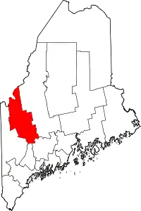 Franklin County map | |
| Plantations | ||
| Unorganized territories | ||
| CDPs | ||
| Other villages | ||
| Footnotes | ‡This populated place also has portions in an adjacent county | |
| ||