Erg Ferradj
Erg Ferradj (Arabic: ﻋﺮق ﻓﺮاج) is a town and commune in Abadla District, Béchar Province, in western Algeria. According to the 2008 census its population is 4,406,[2] down from 4,670 in 1998,[3] and an annual population growth rate of -0.6%, the second lowest in the province.[2] The commune covers an area of 6,410 square kilometres (2,470 sq mi).[1]
Erg Ferradj
ﻋﺮق ﻓﺮاج | |
|---|---|
Commune and town | |
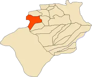 Location of Erg Ferradj commune within Béchar Province | |
 Erg Ferradj Location of Erg Ferradj within Algeria | |
| Coordinates: 31°2′5″N 2°47′29″W | |
| Country | |
| Province | Béchar Province |
| Area | |
| • Total | 6,410 km2 (2,470 sq mi) |
| Elevation | 589 m (1,932 ft) |
| Population (2008)[2] | |
| • Total | 4,406 |
| Time zone | UTC+1 (CET) |
Geography
Erg Ferradj lies at an elevation of 589 metres (1,932 ft) to the west of an extensive palm plantation covering 3000 hectares[4] lying along the western side of the Oued Guir. The rocky hills of the hamada are found on both sides of the river, but are more dramatic on the eastern side.
Climate
Erg Ferradj has a hot desert climate, with extremely hot summers and cool winters, and very little precipitation throughout the year.
Economy
Agriculture is the main industry in Erg Ferradj. The commune has a total of 2,560 hectares (6,300 acres) of arable land found mainly to the east of the town, of which 2,050 hectares (5,100 acres) is irrigated.[5] There are a total of 116,040 date palms planted in the commune.[6] As of 2009 there were 9,575 sheep, 6,050 goats, 714 camels, and 23 cattle. There were also 6,400 chickens in 6 buildings.[7]
There is no significant tourist industry in Erg Ferradj.
Infrastructure and housing
Basic services in the town are generally well provided for. 100% of Erg Ferradj's population is connected to drinking water,[8] 99% is connected to the sewerage system,[9] and 99% (including 756 buildings) have access to electricity.[10] There is no fuel service station in the town.[11]
Erg Ferradj has a total of 1,300 houses, of which 712 are occupied, giving an occupation rate of 6.2 inhabitants per occupied building.[12]
Transportation
Erg Ferradj is reached by a local road from the N6 highway just west of Abadla. It is 12 kilometres (7.5 mi) from Abadla and 101 kilometres (63 mi) from Béchar.[4]
There is a total length of 45 kilometres (28 mi) of roads in the commune.[13]
Education
There are 3 elementary schools, with 39 classrooms including 27 in use.[14] There are a total of 1,096 school students.[15]
2.8% of the population has a tertiary education, and another 14.9% has competed secondary education.[16] The overall literacy rate is 71.3%, and is 77.2% among males and 65.3% among females.[17]
Health
Erg Ferradj has 2 polyclinics and 2 room care facilities; residents must travel to Abadla or Méchraâ Houari Boumédienne for further medical treatment.[18]
References
- "Population, Area and Density per Commune" (in French). Official Website of the Wilaya of Bechar. Archived from the original on 22 February 2014. Retrieved 16 March 2013.
- "Population: Béchar Wilaya" (PDF) (in French). Office National des Statistiques Algérie. Archived from the original (PDF) on 16 May 2013. Retrieved 13 February 2013.
- "Algeria Communes". Statoids. Retrieved 9 March 2013.
- "Presentation" (in French). Site Officiel de la Wilaya de Béchar. Archived from the original on 16 February 2013. Retrieved 19 February 2013.
- "Distribution of Agricultural Land" (in French). Official Website of the Wilaya of Bechar. Archived from the original on 10 July 2014. Retrieved 9 March 2013.
- "Plant Productions" (in French). Official Website of the Wilaya of Bechar. Archived from the original on 20 August 2014. Retrieved 9 March 2013.
- "Animal Production" (in French). Official Website of the Wilaya of Bechar. Archived from the original on 20 August 2014. Retrieved 9 March 2013.
- "Drinking Water" (in French). Official Website of the Wilaya of Bechar. Archived from the original on 9 July 2014. Retrieved 9 March 2013.
- "Sewerage Networks" (in French). Official Website of the Wilaya of Bechar. Archived from the original on 10 July 2014. Retrieved 9 March 2013.
- "Electrification" (in French). Official Website of the Wilaya of Bechar. Archived from the original on 9 July 2014. Retrieved 9 March 2013.
- "Fuel Distribution" (in French). Official Website of the Wilaya of Bechar. Archived from the original on 10 July 2014. Retrieved 9 March 2013.
- "Housing" (in French). Official Website of the Wilaya of Bechar. Archived from the original on 4 March 2016. Retrieved 9 March 2013.
- "Density Kilometres" (in French). Official Website of the Wilaya of Bechar. Archived from the original on 29 April 2014. Retrieved 9 March 2013.
- "School Infrastructure" (in French). Official Website of the Wilaya of Bechar. Archived from the original on 29 April 2014. Retrieved 9 March 2013.
- "Number of Pupils" (in French). Official Website of the Wilaya of Bechar. Archived from the original on 4 March 2016. Retrieved 9 March 2013.
- "Structure relative de la population résidente des ménages ordinaires et collectifs âgée de 6 ans et plus selon le niveau d'instruction et la commune de résidence" (PDF) (in French). Office National des Statistiques Algérie. Archived from the original (PDF) on 17 May 2013. Retrieved 13 February 2013.
- "Taux d'analphabétisme et taux d'alphabétisation de la population âgée de 15 ans et plus, selon le sexe et la commune de résidence " (PDF) (in French). Office National des Statistiques Algérie. Archived from the original (PDF) on 16 May 2013. Retrieved 13 February 2013.
- "Health Facilities by Commune" (in French). Official Website of the Wilaya of Bechar. Archived from the original on 29 April 2014. Retrieved 9 March 2013.
- "Mosques and Koranic Rooms" (in French). Official Website of the Wilaya of Bechar. Archived from the original on 4 March 2016. Retrieved 9 March 2013.
- "Décret n° 84-365, fixant la composition, la consistance et les limites territoriale des communes. Wilaya d'El Oued" (PDF) (in French). Journal officiel de la République Algérienne. 19 December 1984. p. 1489. Archived from the original (PDF) on 2 March 2013 or before. Retrieved 2 March 2013. Check date values in:
|archive-date=(help)
Places adjacent to Erg Ferradj | |
|---|---|
Capital: Béchar | ||
| Béchar District | .svg.png.webp) | |
| Abadla District | ||
| Béni Abbès District | ||
| Béni Ounif District | ||
| El Ouata District | ||
| Igli District | ||
| Kénadsa District | ||
| Kerzaz District | ||
| Lahmar District | ||
| Ouled Khodeïr District | ||
| Tabelbala District | ||
| Taghit District | ||