Méridja
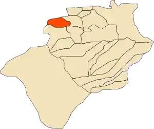
Méridja (Arabic: ﻣﺮﻳﺠﺔ, little swamp) is a town and commune in Kénadsa District, Béchar Province, in western Algeria. As of 2008 the population of the commune was 592,[2] up from 532 in 1998,[3] with an annual growth rate of 1.1%.[2] This makes it the smallest commune by population in Béchar Province. The commune covers an area of 2,270 square kilometres (880 sq mi).[1]
Méridja
ﻣﺮﻳﺠﺔ | |
|---|---|
Commune and town | |
 Location of Méridja commune within Béchar Province | |
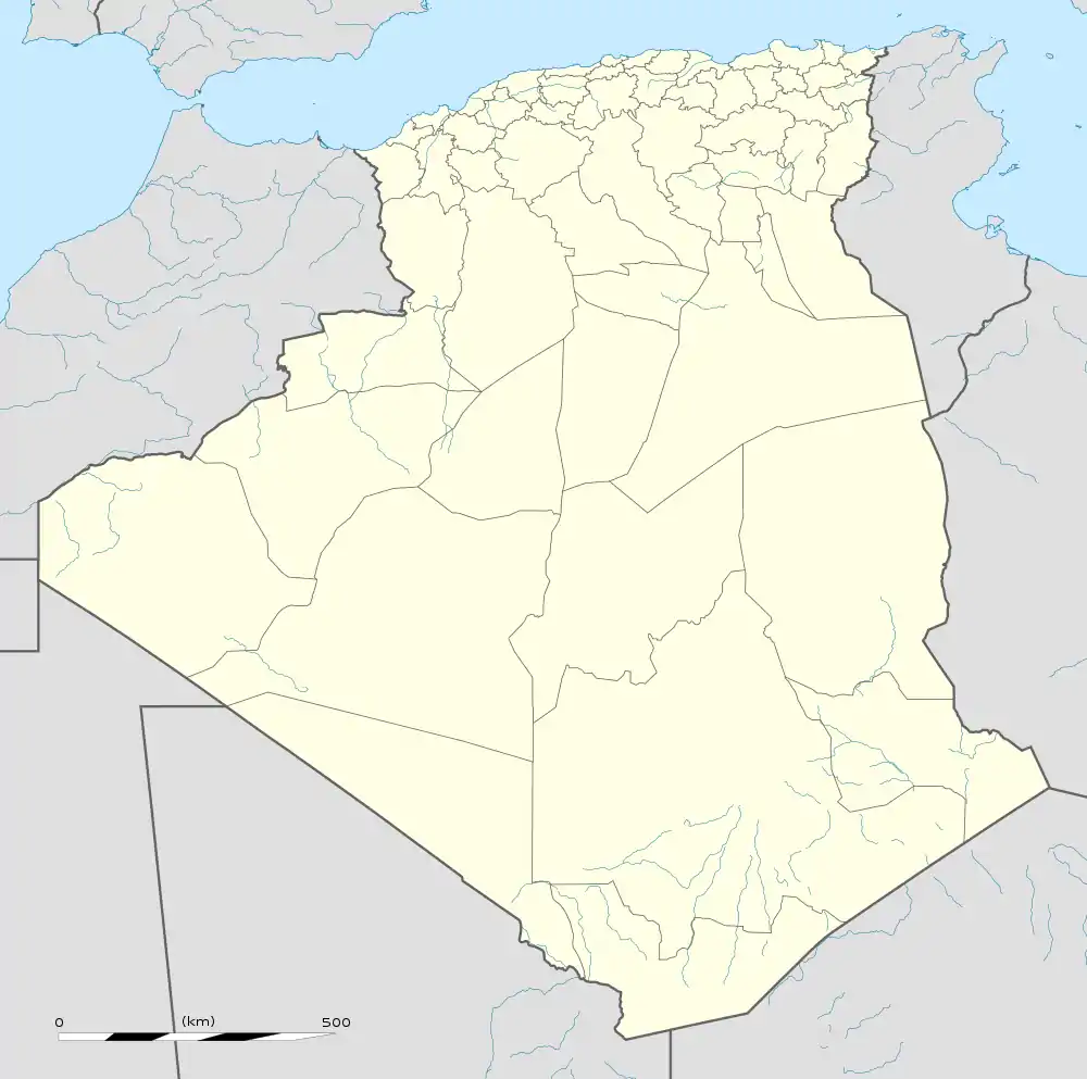
 Méridja Location of Méridja within Algeria | |
| Coordinates: 31°33′N 2°57′W | |
| Country | |
| Province | Béchar Province |
| District | Kénadsa District |
| Area | |
| • Total | 2,270 km2 (880 sq mi) |
| Elevation | 782 m (2,566 ft) |
| Population (2008)[2] | |
| • Total | 592 |
| • Density | 0.26/km2 (0.68/sq mi) |
| Time zone | UTC+1 (CET) |
Geography
Méridja is located at an elevation of 782 metres (2,566 ft) on the extensive hamada west of Béchar, about 15 kilometres (9.3 mi) west of the Djorf Torba dam on the Oued Guir. Some low, rocky hills rise both to the north and south of the town, but there are no significant mountains in the immediate vicinity of the town.
Climate
Méridja has a hot desert climate (Köppen climate classification BWh), with extremely hot summers and cool winters, and very little precipitation throughout the year.
| Climate data for Meridja Tahtania | |||||||||||||
|---|---|---|---|---|---|---|---|---|---|---|---|---|---|
| Month | Jan | Feb | Mar | Apr | May | Jun | Jul | Aug | Sep | Oct | Nov | Dec | Year |
| Record high °C (°F) | 23 (73) |
27 (81) |
31 (88) |
34 (93) |
38 (100) |
42 (108) |
45 (113) |
45 (113) |
41 (106) |
36 (97) |
29 (84) |
26 (79) |
45 (113) |
| Average high °C (°F) | 15 (59) |
18 (64) |
22 (72) |
26 (79) |
30 (86) |
35 (95) |
40 (104) |
38 (100) |
33 (91) |
27 (81) |
20 (68) |
16 (61) |
27 (80) |
| Daily mean °C (°F) | 8 (46) |
11 (52) |
15 (59) |
19 (66) |
23 (73) |
28 (82) |
32 (90) |
31 (88) |
26 (79) |
20 (68) |
13 (55) |
9 (48) |
20 (67) |
| Average low °C (°F) | 1 (34) |
4 (39) |
8 (46) |
12 (54) |
16 (61) |
21 (70) |
25 (77) |
25 (77) |
20 (68) |
13 (55) |
7 (45) |
2 (36) |
13 (55) |
| Record low °C (°F) | −4 (25) |
−3 (27) |
−1 (30) |
2 (36) |
7 (45) |
10 (50) |
17 (63) |
16 (61) |
9 (48) |
3 (37) |
0 (32) |
−6 (21) |
−6 (21) |
| Average precipitation mm (inches) | 8 (0.3) |
10 (0.4) |
13 (0.5) |
8 (0.3) |
3 (0.1) |
3 (0.1) |
0 (0) |
5 (0.2) |
8 (0.3) |
15 (0.6) |
13 (0.5) |
10 (0.4) |
96 (3.7) |
| Average relative humidity (%) | 54 | 44 | 37 | 33 | 29 | 23 | 17 | 21 | 29 | 40 | 49 | 56 | 36 |
| Source: Weatherbase[4] | |||||||||||||
Economy
Agriculture is an important industry in Méridja. The commune has a total of 240 hectares (590 acres) of arable land, of which 132 hectares (330 acres) is irrigated.[5] There are a total of 10,020 date palms planted in the commune.[6] Animal husbandry is particularly significant; as of 2009 there were 1,758 sheep, 2,182 goats, 2,033 camels, and 180 cattle. There were also 52,800 chickens in 6 buildings.[7]
Infrastructure and housing
100% of Méridja's population is connected to drinking water,[8] 100% is connected to the sewerage system,[9] but only 81% (including 135 buildings) have access to electricity, the equal lowest rate of electrification in the province with El Ouata.[10] There are no fuel service stations in the town; the nearest is in Kénadsa.[11]
Méridja has a total of 148 houses, of which 103 are occupied, giving an occupation rate of 5.7 inhabitants per occupied building.[12]
Transportation
A road leads west out of the town past the Djorf Torba dam to Kénadsa and the provincial capital Béchar, which is 80 kilometres (50 mi) away.[13]
There is a total length of 26.1 kilometres (16.2 mi) of roads in the commune.[14]
Education
There is 1 elementary school, with 6 classrooms, all of which are in use.[15] There are a total of 103 school students. Secondary students must travel to Kénadsa to study.[16]
2.6% of the population has a tertiary education (the second lowest in the province), and another 11.9% has competed secondary education.[17] The overall literacy rate is 76.6%, and is 83.3% among males and 68.0% among females.[18]
Sports
The town is home to association football club JS Saoura which currently plays in the Algerian Ligue Professionnelle 1.
References
- "Population, Area and Density per Commune" (in French). Official Website of the Wilaya of Bechar. Archived from the original on 22 February 2014. Retrieved 16 March 2013.
- "Population: Béchar Wilaya" (PDF) (in French). Office National des Statistiques Algérie. Retrieved 13 February 2013.
- "Algeria Communes". Statoids. Retrieved 9 March 2013.
- "Weatherbase: Historical Weather for Meridja Tahtania, Algeria". Weatherbase. Retrieved 14 February 2013.
- "Distribution of Agricultural Land" (in French). Official Website of the Wilaya of Bechar. Archived from the original on 10 July 2014. Retrieved 9 March 2013.
- "Plant Productions" (in French). Official Website of the Wilaya of Bechar. Archived from the original on 20 August 2014. Retrieved 9 March 2013.
- "Animal Production" (in French). Official Website of the Wilaya of Bechar. Archived from the original on 20 August 2014. Retrieved 9 March 2013.
- "Drinking Water" (in French). Official Website of the Wilaya of Bechar. Archived from the original on 9 July 2014. Retrieved 9 March 2013.
- "Sewerage Networks" (in French). Official Website of the Wilaya of Bechar. Archived from the original on 10 July 2014. Retrieved 9 March 2013.
- "Electrification" (in French). Official Website of the Wilaya of Bechar. Archived from the original on 9 July 2014. Retrieved 9 March 2013.
- "Fuel Distribution" (in French). Official Website of the Wilaya of Bechar. Archived from the original on 10 July 2014. Retrieved 9 March 2013.
- "Housing" (in French). Official Website of the Wilaya of Bechar. Archived from the original on 4 March 2016. Retrieved 9 March 2013.
- "Presentation" (in French). Site Officiel de la Wilaya de Béchar. Archived from the original on 16 February 2013. Retrieved 19 February 2013.
- "Density Kilometres" (in French). Official Website of the Wilaya of Bechar. Archived from the original on 29 April 2014. Retrieved 9 March 2013.
- "School Infrastructure" (in French). Official Website of the Wilaya of Bechar. Archived from the original on 29 April 2014. Retrieved 9 March 2013.
- "Number of Pupils" (in French). Official Website of the Wilaya of Bechar. Archived from the original on 4 March 2016. Retrieved 9 March 2013.
- "Structure relative de la population résidente des ménages ordinaires et collectifs âgée de 6 ans et plus selon le niveau d'instruction et la commune de résidence" (PDF) (in French). Office National des Statistiques Algérie. Retrieved 13 February 2013.
- "Taux d'analphabétisme et taux d'alphabétisation de la population âgée de 15 ans et plus, selon le sexe et la commune de résidence " (PDF) (in French). Office National des Statistiques Algérie. Retrieved 13 February 2013.
- "Health Facilities by Commune" (in French). Official Website of the Wilaya of Bechar. Archived from the original on 29 April 2014. Retrieved 9 March 2013.
- "Mosques and Koranic Rooms" (in French). Official Website of the Wilaya of Bechar. Archived from the original on 4 March 2016. Retrieved 9 March 2013.
- "Décret n° 84-365, fixant la composition, la consistance et les limites territoriale des communes. Wilaya d'El Oued" (PDF) (in French). Journal officiel de la République Algérienne. 19 December 1984. p. 1489. Archived from the original (PDF) on 12 January 2012. Retrieved 2 March 2013.
.svg.png.webp)