Béni Ikhlef
Béni Ikhlef (Arabic: ﺑﻨﻰ ﻳﺨﻠﻒ) is a town and commune in Kerzaz District, Béchar Province, in western Algeria. According to the 2008 census its population is 2,459,[2] up from 2,280 in 1998,[3] with an annual growth rate of 0.8%.[2] The commune covers an area of 2,617 square kilometres (1,010 sq mi).[1]
Beni Ikhlef
ﺑﻨﻰ ﻳﺨﻠﻒ | |
|---|---|
Commune and town | |
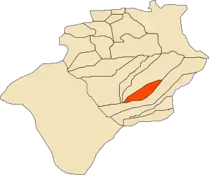 Location of Béni Ikhlef commune within Béchar Province | |
 Beni Ikhlef Location of Béni Ikhlef within Algeria | |
| Coordinates: 29°34′30″N 1°36′33″W | |
| Country | |
| Province | Béchar Province |
| District | Kerzaz District |
| Area | |
| • Total | 2,615 km2 (1,010 sq mi) |
| Elevation | 400 m (1,300 ft) |
| Population (2008)[2] | |
| • Total | 2,459 |
| • Density | 0.94/km2 (2.4/sq mi) |
| Time zone | UTC+1 (CET) |
Geography
Béni Ikhlef lies on the left (northeast) bank of the Oued Saoura in the Saoura valley. The Grand Erg Occidental, a large area of continuous sand dunes lies to the east, while the rocky ridges of the Ougarta Range rise to the west, running from northwest to southeast along the opposite side of the river from the town.
Climate
Béni Ikhlef has a hot desert climate, with extremely hot summers and warm winters, and very little precipitation throughout the year.
| Climate data for Béni Ikhlef | |||||||||||||
|---|---|---|---|---|---|---|---|---|---|---|---|---|---|
| Month | Jan | Feb | Mar | Apr | May | Jun | Jul | Aug | Sep | Oct | Nov | Dec | Year |
| Average high °C (°F) | 19.2 (66.6) |
22.3 (72.1) |
26.6 (79.9) |
31.3 (88.3) |
35.8 (96.4) |
42.2 (108.0) |
45.1 (113.2) |
44.6 (112.3) |
40.4 (104.7) |
33.6 (92.5) |
24.4 (75.9) |
18.9 (66.0) |
32.0 (89.7) |
| Daily mean °C (°F) | 11.6 (52.9) |
14.4 (57.9) |
18.7 (65.7) |
23.1 (73.6) |
27.6 (81.7) |
33.1 (91.6) |
36.5 (97.7) |
35.1 (95.2) |
31 (88) |
24.1 (75.4) |
17.5 (63.5) |
12.3 (54.1) |
23.8 (74.8) |
| Average low °C (°F) | 4 (39) |
6.6 (43.9) |
10.8 (51.4) |
15 (59) |
19.5 (67.1) |
24.7 (76.5) |
28 (82) |
27 (81) |
23.4 (74.1) |
16.8 (62.2) |
10.7 (51.3) |
5.7 (42.3) |
16.0 (60.8) |
| Average precipitation mm (inches) | 6 (0.2) |
5 (0.2) |
9 (0.4) |
4 (0.2) |
2 (0.1) |
1 (0.0) |
1 (0.0) |
1 (0.0) |
2 (0.1) |
6 (0.2) |
8 (0.3) |
7 (0.3) |
52 (2) |
| Source: climate-data.org[4] | |||||||||||||
Economy
Agriculture is the main industry in Béni Ikhlef. The commune has a total of 394 hectares (970 acres) of arable land, of which 314 hectares (780 acres) is irrigated.[5] There are a total of 36,420 date palms planted in the commune.[6] As of 2009 there were 614 sheep, 347 goats, 45 camels, and 13 cattle. There were also 6700 chickens.[7]
Tourist attractions include sand dunes, palm groves and an ancient fort.[8]
Infrastructure and housing
95% of Béni Ikhlef's population is connected to drinking water,[9] 95% is also connected to the sewerage system,[10] and 91% (including 560 buildings) have access to electricity.[11]
Béni Ikhlef has a total of 436 houses, of which 302 are occupied, giving an occupation rate of 8.1 inhabitants per occupied building.[12]
Transportation
Béni Ikhlef is on the N6 national highway between Béchar to the northwest and Adrar to the southeast. Towns accessible to the north via the N6 include El Ouata, Béni Abbès and Igli, while to the south the towns of Kerzaz, Timoudi and Ouled Khoudir can be accessed. Béni Ikhlef is 312 kilometres (194 mi) from the provincial capital, Béchar.[13]
There is a total length of 24 kilometres (15 mi) of roads in the commune.[14]
Education
There are 3 elementary schools, with 20 classrooms including 15 in use.[15] There are a total of 706 school students.[16]
9.1% of the population has a tertiary education (the second highest in the province), and another 21.9% has competed secondary education.[17] The overall literacy rate is 81.8%, and is 90.6% among males and 72.6% among females.[18]
Health
Béni Ikhlef has one room care facility. There are no hospitals, clinics, or pharmacies. The nearest clinics are in Kerzaz and El Ouata, and the nearest hospital is in Béni Abbès.[19]
Religion
Béni Ikhlef has 2 operational mosques, with another 1 under construction.[20]
Localities
The commune is composed of two localities:[21]
- Béni Ikhlef
- Guerzim
Guerzim also lies on the N6 highway, 10 kilometres (6.2 mi) northwest of the main town of Beni Ikhlef.[22]
References
- "Population, Area and Density per Commune" (in French). Official Website of the Wilaya of Bechar. Archived from the original on 22 February 2014. Retrieved 16 March 2013.
- "Population: Béchar Wilaya" (PDF) (in French). Office National des Statistiques Algérie. Archived from the original (PDF) on 16 May 2013. Retrieved 13 February 2013.
- "Algeria Communes". Statoids. Retrieved 9 March 2013.
- "Climate data for: Beni Ikhlef". climate-data.org. Retrieved 9 March 2013.
- "Distribution of Agricultural Land" (in French). Official Website of the Wilaya of Bechar. Archived from the original on 10 July 2014. Retrieved 9 March 2013.
- "Plant Productions" (in French). Official Website of the Wilaya of Bechar. Archived from the original on 20 August 2014. Retrieved 9 March 2013.
- "Animal Production" (in French). Official Website of the Wilaya of Bechar. Archived from the original on 20 August 2014. Retrieved 9 March 2013.
- "Tourism Sites and Monuments" (in French). Official Website of the Wilaya of Bechar. Archived from the original on 4 March 2016. Retrieved 9 March 2013.
- "Drinking Water" (in French). Official Website of the Wilaya of Bechar. Archived from the original on 9 July 2014. Retrieved 9 March 2013.
- "Sewerage Networks" (in French). Official Website of the Wilaya of Bechar. Archived from the original on 10 July 2014. Retrieved 9 March 2013.
- "Electrification" (in French). Official Website of the Wilaya of Bechar. Archived from the original on 9 July 2014. Retrieved 9 March 2013.
- "Housing" (in French). Official Website of the Wilaya of Bechar. Archived from the original on 4 March 2016. Retrieved 9 March 2013.
- "Presentation" (in French). Site Officiel de la Wilaya de Béchar. Archived from the original on 16 February 2013. Retrieved 19 February 2013.
- "Density Kilometres" (in French). Official Website of the Wilaya of Bechar. Archived from the original on 29 April 2014. Retrieved 9 March 2013.
- "School Infrastructure" (in French). Official Website of the Wilaya of Bechar. Archived from the original on 29 April 2014. Retrieved 9 March 2013.
- "Number of Pupils" (in French). Official Website of the Wilaya of Bechar. Archived from the original on 4 March 2016. Retrieved 9 March 2013.
- "Structure relative de la population résidente des ménages ordinaires et collectifs âgée de 6 ans et plus selon le niveau d'instruction et la commune de résidence" (PDF) (in French). Office National des Statistiques Algérie. Archived from the original (PDF) on 17 May 2013. Retrieved 13 February 2013.
- "Taux d'analphabétisme et taux d'alphabétisation de la population âgée de 15 ans et plus, selon le sexe et la commune de résidence " (PDF) (in French). Office National des Statistiques Algérie. Archived from the original (PDF) on 16 May 2013. Retrieved 13 February 2013.
- "Health Facilities by Commune" (in French). Official Website of the Wilaya of Bechar. Archived from the original on 29 April 2014. Retrieved 9 March 2013.
- "Mosques and Koranic Rooms" (in French). Official Website of the Wilaya of Bechar. Archived from the original on 4 March 2016. Retrieved 9 March 2013.
- "Décret n° 84–365, fixant la composition, la consistance et les limites territoriale des communes. Wilaya d'El Oued" (PDF) (in French). Journal officiel de la République Algérienne. 19 December 1984. p. 1489. Archived from the original (PDF) on 12 January 2012. Retrieved 2 March 2013.
- "Guerzim, Bechar, Algeria". Google Maps. Retrieved 10 March 2013.
Places adjacent to Béni Ikhlef | |
|---|---|
Capital: Béchar | ||
| Béchar District | .svg.png.webp) | |
| Abadla District | ||
| Béni Abbès District | ||
| Béni Ounif District | ||
| El Ouata District | ||
| Igli District | ||
| Kénadsa District | ||
| Kerzaz District | ||
| Lahmar District | ||
| Ouled Khodeïr District | ||
| Tabelbala District | ||
| Taghit District | ||