Fendi, Algeria
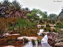
Fendi is a village in the commune of Béni Ounif,[1] in Béni Ounif District, Béchar Province, Algeria. The village is located next to a wadi at the end of a local road leading south from its intersection with the N6 highway west of Béni Ounif.[2] It is 75 kilometres (47 mi) east of Béchar and 32 kilometres (20 mi) southwest of Béni Ounif.
Fendi | |
|---|---|
Commune | |
 | |
 Fendi | |
| Coordinates: 31°50′26″N 1°28′40″W | |
| Country | |
| Province | Béchar Province |
| District | Béni Ounif District |
| Commune | Béni Ounif[1] |
| Elevation | 792 m (2,598 ft) |
| Time zone | UTC+1 (CET) |
References
- "Décret n° 84-365, fixant la composition, la consistance et les limites territoriale des communes. Wilaya d'El Oued" (PDF) (in French). Journal officiel de la République Algérienne. 19 December 1984. p. 1489. Archived from the original (PDF) on 2 March 2013 or before. Retrieved 2 March 2013. Check date values in:
|archivedate=(help) - "Fendi, Algeria". Google Maps. Retrieved 7 May 2013.
Neighbouring towns and cities
Places adjacent to Fendi, Algeria | |
|---|---|
Capital: Béchar | ||
| Béchar District | .svg.png.webp) | |
| Abadla District | ||
| Béni Abbès District | ||
| Béni Ounif District | ||
| El Ouata District | ||
| Igli District | ||
| Kénadsa District | ||
| Kerzaz District | ||
| Lahmar District | ||
| Ouled Khodeïr District | ||
| Tabelbala District | ||
| Taghit District | ||
This article is issued from Wikipedia. The text is licensed under Creative Commons - Attribution - Sharealike. Additional terms may apply for the media files.
