Ferndale, Oregon
Ferndale is an unincorporated community in Umatilla County, Oregon, United States.[1] It is near the Oregon–Washington border east of Oregon Route 339 and west of Oregon Route 11 about 4 miles (6 km) north of Milton-Freewater.[2]
Ferndale, Oregon | |
|---|---|
 Ferndale, Oregon Location within the state of Oregon | |
| Coordinates: 45°58′52″N 118°23′51″W | |
| Country | United States |
| State | Oregon |
| County | Umatilla |
| Elevation | 843 ft (257 m) |
| Time zone | UTC-8 (Pacific (PST)) |
| • Summer (DST) | UTC-7 (PDT) |
| Area code(s) | 458 and 541 |
| GNIS feature ID | 1136284[1] |
| Coordinates and elevation from Geographic Names Information System[1] | |
Ferndale was once a station on the Walla Walla Valley Railway, which served the local fruit orchards, and the site of a fruit-packing warehouse.[3][4] The next station south on the line was at Sunnyside.[3] Ferndale Elementary School is part of the Milton-Freewater Unified School District.[5]
References
- "Ferndale". Geographic Names Information System. United States Geological Survey. 1980-11-28. Retrieved 2016-09-06.
- Oregon Atlas & Gazetteer (7th ed.). Yarmouth, Maine: DeLorme. 2008. p. 74. ISBN 0-89933-347-8.
- "Virtual Tour Part 2". The Virtual Walla Walla Valley Railway. Archived from the original on 2004-11-20. Retrieved 2011-01-06.
- "WWV History, Part Two: 1931-1945: NP Control and the Growth of Freight Traffic". The Virtual Walla Walla Valley Railway. Retrieved 2011-03-25.
- "Ferndale Elementary: About Us". Milton-Freewater Unified School District. Archived from the original on 2011-08-16. Retrieved 2011-03-25.
External links
- Image of old fruit packing shed in Ferndale on former WWVR right-of-way
Municipalities and communities of Umatilla County, Oregon, United States | ||
|---|---|---|
| Cities | 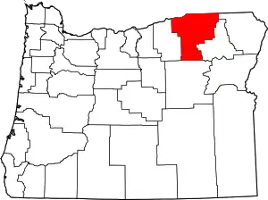 Umatilla County map | |
| CDPs | ||
| Other unincorporated communities | ||
| Indian reservation | ||
| Ghost towns | ||
| ||
This article is issued from Wikipedia. The text is licensed under Creative Commons - Attribution - Sharealike. Additional terms may apply for the media files.