Sunnyside, Umatilla County, Oregon
Sunnyside is an unincorporated community in Umatilla County, Oregon, United States.[1] It is about 3 miles (5 km) north of Milton-Freewater, at the intersection of Oregon Route 332, which is also known as the Sunnyside-Umapine Highway, and Oregon Route 339.[1][2] Sunnyside was once a station on the Walla Walla Valley Railway, which served the local fruit orchards, and the site of a Nebraska Bridge Supply and Lumber Co. planing mill from 1958 to 1963.[3] Inland Fir Company also had a sawmill.[3]
Sunnyside, Oregon | |
|---|---|
 Sunnyside, Oregon Location within the state of Oregon | |
| Coordinates: 45°57′44″N 118°24′08″W | |
| Country | United States |
| State | Oregon |
| County | Umatilla |
| Elevation | 912 ft (278 m) |
| Time zone | UTC-8 (Pacific (PST)) |
| • Summer (DST) | UTC-7 (PDT) |
| Area code(s) | 458 and 541 |
| GNIS feature ID | 1136801[1] |
| Coordinates and elevation from Geographic Names Information System | |
References
- "Sunnyside". Geographic Names Information System. United States Geological Survey. November 28, 1980. Retrieved January 6, 2011.
- Oregon Atlas & Gazetteer (7th ed.). Yarmouth, Maine: DeLorme. 2008. p. 74. ISBN 0-89933-347-8.
- "Virtual Tour Part 2". The Virtual Walla Walla Valley Railway. Archived from the original on November 20, 2004. Retrieved January 6, 2011.
Municipalities and communities of Umatilla County, Oregon, United States | ||
|---|---|---|
| Cities | 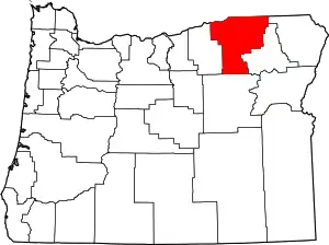 Umatilla County map | |
| CDPs | ||
| Other unincorporated communities | ||
| Indian reservation | ||
| Ghost towns | ||
| ||
This article is issued from Wikipedia. The text is licensed under Creative Commons - Attribution - Sharealike. Additional terms may apply for the media files.